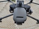
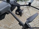
Bad start to using the drone for the first time. Just received a Mavic 2 Enterprise and took it for a flight in my back yard. The controller disconnected from the drone and now i cant find it. I went to the last known GPS location but cant find it can anyone help please! I have no clue how to pull flight logs from the controller
You are using an out of date browser. It may not display this or other websites correctly.
You should upgrade or use an alternative browser.
You should upgrade or use an alternative browser.
First flight lost drone :(
- Thread starter JRoffers
- Start date
DJI Flight Log Viewer | Phantom Help
Upload and view flight logs from your DJI drones
It shows it was last connected over my pond, The pond is frozen right now and there is no drone
Last edited:
Yorkshire_Pud
Well-Known Member
If it did disconnect from the controller and flew somewhere else then the logs can not track the movements of the drone since no data is recieved from the drone during the disconnection.
With regards to retrieving the log, have a look at the instructions lower down DJI Flight Log Viewer | Phantom Help
Currently your best bet would be to assume that the disconnection would trigger the failsafe RTH behaviour, page 19 of the drone's manual, where it will retrace the last 60 second of its flight path and then RTH to the home point.
The log should reveal if RTH was the failsafe behaviour, the RTH height and the location of the home point.
Ooops I guess I missed the log lol
Last edited:
The drone is not where signal was lost because when signal was lost, the drone was 70 feet up and flying southeast at 26 mph with no indication of a crash or collision in the data..DJI Flight Log Viewer | Phantom Help
Upload and view flight logs from your DJI droneswww.phantomhelp.com
It shows it was last connected over my pond, The pond is frozen right now and there is no drone
The Loss of Signal action was set to RTH, with RTH height at 98 ft.
The drone was 850 ft SSE of the home point.
Two seconds after losing signal, the drone would have initiated Failsafe RTH.
Here is an extract from the manual describing Failsafe RTH:
Failsafe RTH
The Forward Vision System allows the aircraft to create a real-time map of its flight route as it flies.
If the Home Point was successfully recorded and the compass is functioning normally, Failsafe RTH automatically activates after the remote control signal is lost for more than two seconds.
When Failsafe RTH is activated, the aircraft starts to retrace its original flight route home.
If the remote control signal is re-established within 60 seconds of Failsafe RTH being activated, the aircraft hovers at its present location for 10 seconds and waits for pilot commands.
The user may press the RTH button on the remote controller to cancel Failsafe RTH and retake control.
If no pilot command is given, the aircraft flies to the Home Point in a straight line.
If the remote control signal is still lost 60 seconds after activating Failsafe RTH, the aircraft stops retracing its original flight route and flies to Home Point in a straight line.
Unless there are any trees or other obstructions 100 feet high between the last location and the homepoint, the obvious place to look for the drone is the home point, which it would have been returning to.
Wind was from the south, so shouldn't have affected RTH.
If the trees around the pond where signal was lost are 70 ft or higher, the trees are another place to check.
The homepoint is exactly where the drone was launched from.For some reason I have a sneeking suspicion the home point might not be where you think it is but that is a totally "Outer limits" thought that just popped into my head.
There's no irregularity in the data regarding the homepoint.
Yorkshire_Pud
Well-Known Member
Yorkshire_Pud
Well-Known Member
Correct me if I am wrong but wouldn't a 60 sec retrace put the drone aproximately where the drone was at around flight time 10:04, around 67ft from the home point and possibly/hopefully at a height of 132ft?The homepoint is exactly where the drone was launched from.
There's no irregularity in the data regarding the homepoint.
If so wouldn't the RTH start from there?
Yorkshire_Pud
Well-Known Member
If the drone did not climb but executed the retrace at the loss-of-contact-height of 70ft there appears to be two trees enroute to 10:04 that might present problems at 70ft, they were over flown/bypass at 132ft & 88ft (10:45.5).Correct me if I am wrong but wouldn't a 60 sec retrace put the drone aproximately where the drone was at around flight time 10:04, around 67ft from the home point and possibly/hopefully at a height of 132ft?
If so wouldn't the RTH start from there?
Last edited:
IronSky1
Well-Known Member
- Joined
- Jan 16, 2019
- Messages
- 235
- Reactions
- 139
Thanks everyone for the help and advice. The drone did end up trying to make it back home. it was coming in for a landing and ended up in the tree by where it took off.. I did learn some very valuable information though...I will defiantly be getting a tracking device, and taking off in a more open spaces! Merry Christmas!
IronSky1
Well-Known Member
- Joined
- Jan 16, 2019
- Messages
- 235
- Reactions
- 139
KB9Radio
Well-Known Member
So to be clear, you did recover it? And if so, is it in ok condition?Thanks everyone for the help and advice. The drone did end up trying to make it back home. it was coming in for a landing and ended up in the tree by where it took off.. I did learn some very valuable information though...I will defiantly be getting a tracking device, and taking off in a more open spaces! Merry Christmas!
YVRGUY
Well-Known Member
Forget the tracking device…ensure, that you have set your safe RTH to a proper height wherever you fly. Scope it out.Thanks everyone for the help and advice. The drone did end up trying to make it back home. it was coming in for a landing and ended up in the tree by where it took off.. I did learn some very valuable information though...I will defiantly be getting a tracking device, and taking off in a more open spaces! Merry Christmas!
Merry Christmas
orionshooter
Well-Known Member
A big shout out to our daily heroes Meta4 and Yorkshire_Pud for coming to the rescue again!Good to hear (you were lucky). RTH altitude is critical however, Tracking device buys you time in the event of a loss. Your drone battery will run out quickly while the tracker will go for 1 to 2 days.
Similar threads
- Replies
- 59
- Views
- 5K
- Replies
- 35
- Views
- 3K
- Replies
- 28
- Views
- 2K
- Replies
- 22
- Views
- 2K
DJI Drone Deals
1. Mini 2
2. Mini 3 Pro
3. Mini 4 Pro
4. Air 2s
5. Air 3
6. Avata 2
7. Mavic 3 Pro
8. Mavic 3 Classic
2. Mini 3 Pro
3. Mini 4 Pro
4. Air 2s
5. Air 3
6. Avata 2
7. Mavic 3 Pro
8. Mavic 3 Classic
New Threads
-
-
Air 3 Full "Pink" Moon Rising Over Old Hickory Lake in Hendersonville, TN Tonight
- Started by rickmurray1989
- Replies: 0
-
-
Dji compliant checklist shows 2 areas to check for the RID is working?
- Started by Sterk
- Replies: 0
-


