DJI Mavic, Air and Mini Drones
Friendly, Helpful & Knowledgeable Community
Join Us Now

I lost my mavic pro, help me!

Marcelopr

New Member
Joined
Aug 19, 2019
Messages
3
Reactions
0
Age
31
Location
Brasil
I lost my mavic pro.

I took it 5000 meters away and spent only 29% of the battery.
He still had 71% but on the way back the wind was against him. I couldn't reach it even forcing the stick forward a lot.

Anyway, I should have landed somewhere before zeroing the battery, but I didn't think about that at the time.

My mavic cut all connections at 0% battery.
It was 45 meters high (from the starting point), but where the last location was sent, because it is a valley, I believe it is about 60 to 80 meters high.

I've been to the location of the last location sent by mavic but found nothing.
Tthe drone disconnected 367 meters from the starting point, that is, very close to arriving.

What bothers me most is not knowing if the drone has dropped vertically straight or kept falling forward.

At the time of disconnection he was at 39km / h.

Below is the .txt file for analysis if you can help me please.
 

Attachments

  • DJIFlightRecord_2019-08-11_[17-30-45].txt
    1.1 MB · Views: 104
Last edited:
I talked about how far I went so you can understand better.
But the drone disconnected 367 meters from the starting point, that is, very close to arriving.
 
Yes - that one shut down in mid-air when the cell voltages collapsed:

Battery.png

cells.png

Based on the last recorded position and velocity, the computed wind field, and the usual MP drag model, the descent track should have looked like this:

Results2.png

Displaying that on Google Earth, the descent is shown by the red trajectory:

1566262162866.jpeg
 
I will wait for the next day to do a new search based on this analysis.
Return with the result. God help you be positive.
Thank you so far!
 
I took it 5000 meters away and spent only 29% of the battery.
He still had 71% but on the way back the wind was against him. I couldn't reach it even forcing the stick forward a lot.
Here's what that flight data looks like: DJI Flight Log Viewer - PhantomHelp.com

The planning for this flight put the drone at risk from the start.
You took off and flew away with a significant tailwind, which always means the return trip will be fighting a headwind.
You burnt up more battery going high and continued burning battery at a fast rate by using Sport Mode.
At about 18 metres/sec it only took 7:25 to go 5.4 km where you turned around with the battery showing 70%.
But fighting the wind coming back (still in Sport Mode) you burned the next 30% in 3:25 but only made 2.2 km at 9-11 m/s.

Fighting a headwind on a long flight home is a losing strategy and best avoided.
Sport Mode burns battery quickly, the extra speed does not compensate for the faster burn rate.
 
Yes - that one shut down in mid-air when the cell voltages collapsed:

View attachment 79995

View attachment 79996

Based on the last recorded position and velocity, the computed wind field, and the usual MP drag model, the descent track should have looked like this:

View attachment 79997

Displaying that on Google Earth, the descent is shown by the red trajectory:

View attachment 79998
I was under the impression that both the Mavic 2s will automatically land when battery level goes critically low. Did the OP have to force that to occur?
 
  • Like
Reactions: Swampwalker
I was under the impression that both the Mavic 2s will automatically land when battery level goes critically low. Did the OP have to force that to occur?
The Mavic commenced autolanding at 13:42 when the battery was showing 13% and it was still 375 feet up.
The Mavic had calculated it could not reach home and tried to land to protect itself from crashing when battery power ran out.
The OP kept driving it hard forwards as well as pushing the left stick full forward to fight the autolanding
This used up battery power needed for the autodescent from 375 feet, drained the battery quickly and it hit 5% at 14:33.6
At 15:08.3 the battery cells were all below 3.3 volts (critical low voltage), the drone was still 233 feet up and still being pushed hard with left and right sticks.
Last data record was at 15:37.1 with both sticks pushed hard forward, 147 feet up, battery reading 0% and the 3 cells showing 1.8, 2.3 and 1.5 volts.
The battery had died and the show was over.
Gravity took over from there.
 
Last edited:
I was under the impression that both the Mavic 2s will automatically land when battery level goes critically low. Did the OP have to force that to occur?

This was a Mavic Pro but the same principle applies. As @Meta4 described, if you fight it hard enough you can prevent it from landing before it runs out of juice.
 
The Mavic commenced autolanding at 13:42 when the battery was showing 13% and it was still 375 feet up.
The Mavic had calculated it could not reach home and tried to land to protect itself from crashing when battery power ran out.
The OP kept driving it hard forwards as well as pushing the left stick full forward to fight the autolanding
This used up battery power needed for the autodescent from 375 feet, drained the battery quickly and it hit 5% at 14:33.6
At 15:08.3 the battery cells were all below 3.3 volts (critical low voltage), the drone was still 233 feet up and still being pushed hard with left and right sticks.
Last data record was at 15:37.1 with both sticks pushed hard forward, 147 feet up, battery reading 0% and the 3 cells showing 1.8, 2.3 and 1.5 volts.
The battery had died and the show was over.
Gravity took over from there.
So, what one should do in this situation is look for a safe area for it to land? Would be awesome if the Mavics could recognize a safe spot for easy retrieval...
 
So, what one should do in this situation is look for a safe area for it to land? Would be awesome if the Mavics could recognize a safe spot for easy retrieval...
By the time it gets to that stage, you might not have a lot of options.
It's a lot better to learn from examples like this and plan your flights to avoid getting into that situation.
 
So, what one should do in this situation is look for a safe area for it to land? Would be awesome if the Mavics could recognize a safe spot for easy retrieval...

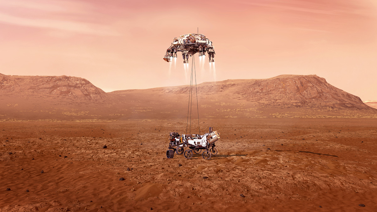
Yeah, too bad it doesn’t have a EDL system like this!


Provided it is not over a hazard to others or itself (people or water) I’d stop all forward motion and get a good GPS fix, and then descend as straight down as possible while recording the video on my controller and trying to record as much of the surrounding landscape as possible for a good position fix.
 
Last edited:
@sar104 & Meta4
I am truly amazed a your willingness to help and ability to decipher all of the info. I look at the charts and I'm still scratching my head ?
 
@sar104 & Meta4
I am truly amazed a your willingness to help and ability to decipher all of the info. I look at the charts and I'm still scratching my head ?

Without some kind of data-driven analysis these discussions have nowhere to go, and tend to descend into the realm of speculation and guessing. Plus many of these events are interesting and instructive cases. Since I have enough knowledge and tools to help, it seems like a small price to pay to help the community and repay at least in part for all the stuff I've learned here.
 
@sar104 , which app did you use to create those charts? Then again, even those are not of much help without your expertise in turning that info - along with the drag coefficient from who-knows-where! - into a trajectory estimate. If you ever wanted to teach a webinar on that, the attendance would be enough to crash the forum's servers.
 
  • Like
Reactions: SoCalSteve
So, what one should do in this situation is look for a safe area for it to land? Would be awesome if the Mavics could recognize a safe spot for easy retrieval...

Avoiding this kind of situation in the first place would be a good start.
1. Fly In Line of Sight (LOS)
2. Avoid flying in high winds.
3. Make sure batteries are fully charged before flight.
4. Fly into the wind and return with the wind.
5. Be especially careful with these issues when flying over water as you will have less margin for error.
6. When caught in higher than anticipated wind, bring your drone lower to the ground/water if possible. Wind speeds are generally lower closer to the ground.
7. If not able to return to home, attempt to find a safe and flat place to land for retrieval. If flying in LOS, or shouldn’t take too long to retrieve your drone.
 
@sar104 , which app did you use to create those charts? Then again, even those are not of much help without your expertise in turning that info - along with the drag coefficient from who-knows-where! - into a trajectory estimate. If you ever wanted to teach a webinar on that, the attendance would be enough to crash the forum's servers.

I use one of the common scientific data analysis applications, Wavemetrics Igor Pro. I estimated the drag coefficients by comparing freefall data with standard geometric drag models. It's highly simplified in its assumption of isotropic behavior, but it seems to be close enough to predict trajectories with a somewhat useful level of fidelity. Even with the simplest drag model included there is no analytic solution to the resulting differential equations of motion, and so those are solved with a first order numerical finite difference method. Unfortunately such methods require a reasonable level of comfort with at least college level physics and mathematics as well as somewhat costly software, and so I suspect that the audience for such a thing would be very small indeed.
 
Fighting a headwind on a long flight home is a losing strategy and best avoided.
Yes, but...
Sport Mode burns battery quickly, the extra speed does not compensate for the faster burn rate.
Not if it's a stiff headwind.

Here's a thought experiment to demonstrate.

I have a Mavic Air. For simplicity, let's say it flies 30kmh in P mode, and 60kmh in sport.

I get a low battery warning, and start flying home.

If the headwind is 30kmh, I can never make it in P mode. My only chance is sport mode.

I don't have the data to calculate what the headwind threshold is for when sport mode would be better, but it should be obvious that a good wind of maybe just 15kmh or so may well be enough to make faster better.

I'll make 15kmh over the ground in P mode, versus 45kmh in sport mode. Unless sport mode consumes triple the rate of battery power, I'm winning.
 
  • Like
Reactions: Rodkat
Yes, but...

Not if it's a stiff headwind.

Here's a thought experiment to demonstrate.

I have a Mavic Air. For simplicity, let's say it flies 30kmh in P mode, and 60kmh in sport.

I get a low battery warning, and start flying home.

If the headwind is 30kmh, I can never make it in P mode. My only chance is sport mode.

I don't have the data to calculate what the headwind threshold is for when sport mode would be better, but it should be obvious that a good wind of maybe just 15kmh or so may well be enough to make faster better.

I'll make 15kmh over the ground in P mode, versus 45kmh in sport mode. Unless sport mode consumes triple the rate of battery power, I'm winning.

Just to clarify, Sport Mode simply enables a larger maximum tilt. Flying in Sport Mode is only different to flying in regular P mode if you go faster than the maximum P-mode tilt - below that the only difference is stick sensitivity. The optimal airspeed (minimizing energy per unit ground distance) is a function of wind speed but, even in still air, appears to be at least 30 mph for the Mavic series. As the headwind increases the optimal airspeed goes up, and so Sport Mode is going to be required to maximize battery use into almost any significant headwind.
 
Lycus Tech Mavic Air 3 Case

DJI Drone Deals

New Threads

Forum statistics

Threads
130,978
Messages
1,558,530
Members
159,967
Latest member
rapidair