

Oh my….litchi on iOS now supports Mavic Air 2! Thoughts anyone? Does anyone currently use litchi and is it worth the $23? Thanks in advance

You are using an out of date browser. It may not display this or other websites correctly.
You should upgrade or use an alternative browser.
You should upgrade or use an alternative browser.
Litchi now supports Mavic Air 2!
- Thread starter Jamm1975
- Start date
I currently use Litchi on Android with a Gen 1 mavic (MPP). For me, the ability to pre-plan waypoint missions makes it worth the money.Oh my….litchi on iOS now supports Mavic Air 2! Thoughts anyone? Does anyone currently use litchi and is it worth the $23? Thanks in advance
I am also curious and interested in Litchi. On the App Store DroneDeploy Flight App gets slightly better ratings.Oh my….litchi on iOS now supports Mavic Air 2! Thoughts anyone? Does anyone currently use litchi and is it worth the $23? Thanks in advance
Does the Litchi App have the RTH feature?I use it for waypoints as well. Newest release is pretty solid and the cost is minimal.
YesDoes the Litchi App have the RTH feature?
Wow! I just tried out the Litchi App. It is amazing. Besides way points I like that it gives the signal strengths of upload and download in percentages. The learning curve is fairly quick. I', on my 4th battery. Aircraft is the MA2
Wildcatgary
Active Member
Oh my….litchi on iOS now supports Mavic Air 2! Thoughts anyone? Does anyone currently use litchi and is it worth the $23? Thanks in advance
Wildcatgary
Active Member
So after reading a bunch of stuff on the litchi website it seems that dji hasn't released the sdk for mini 2, but its supposed to happen by the end of the year and litchi will very quickly support it they say
Korrd
Well-Known Member
- Joined
- May 16, 2020
- Messages
- 331
- Reactions
- 440
- Age
- 41
- Location
- Punta del Este, Uruguay
- Site
- www.youtube.com
Just got it to automate some tasks with my MA2.
Are waypoints implemented via virtual commands? It seems that when signal is low, it flies jerky
Are waypoints implemented via virtual commands? It seems that when signal is low, it flies jerky
Last edited:
Thatguy13
Active Member
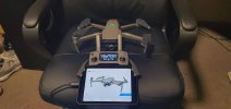
i saw a video on youtube last week where a guy was having trouble with his mavic pro 2 using an ipad 4 mini in where the cpu was struggling to cache the video feed or something.i immediately sold my ipad 4 mini and grabbed this ipad 6 mini which has only just released.it has an a15 bionic processor.the liquid retina display is awesome,and it fits no problem at all
Attachments
Just got it to automate some tasks with my MA2.
Are waypoints implemented via virtual commands? It seems that when signal is low, it flies jerky
ANY application that controls an MA2 must use virtual stick control. DJI has made it so that the MA2 cannot accept autonomous control commands. If the signal goes away the MA2 will execute whatever failsafe routine you have programmed it to do ... i.e., return to home, land, or hover in place. It will not continue the mission.
Mavic-Master88
Well-Known Member
- Joined
- Jun 1, 2019
- Messages
- 130
- Reactions
- 102
You might want to look at the Maven app instead.
I have a Mavic 2 Zoom and have used both Litchi and Maven apps. Litchi is a nice app but the major limitation I didn't like is that it will not execute gimbal pitch angles on a waypoint mission once your drone loses signal with the controller, however the Maven app WILL still execute camera pitch angles at waypoints even if no longer connected to the controller. Some people work around this limitation by setting the gimbal pitch at like -18 degrees at takeoff and the gimbal will hold that angle for the entire flight, but this doesn't fit all circumstances.
The other major limitation with both Litchi and Maven is there is no way to cancel the Smart RTH feature once the drone loses contact with the controller. What that means is that if you have a long waypoint mission, the Smart RTH will automatically kick in once a certain battery threshold is met and the drone will abandon the remaining waypoints on the mission path and fly home on an RTH straight line and altitude. On a calm day and without a lot of ascending, this usually happens around 3 miles from the launch point.
The only thing I really love about Litchi over all other apps is the Mission Hub where I can plan out waypoint missions on my laptop and then save the mission to be transferred to my iPad that I use to fly my M2Z. Plus, you can also export Litchi missions to CSV file and these can be opened by the Maven app, but still needs some minor tweaking after opening the files.
You might want to look at the Maven app instead.
I have a Mavic 2 Zoom and have used both Litchi and Maven apps. Litchi is a nice app but the major limitation I didn't like is that it will not execute gimbal pitch angles on a waypoint mission once your drone loses signal with the controller, however the Maven app WILL still execute camera pitch angles at waypoints even if no longer connected to the controller. Some people work around this limitation by setting the gimbal pitch at like -18 degrees at takeoff and the gimbal will hold that angle for the entire flight, but this doesn't fit all circumstances.
The other major limitation with both Litchi and Maven is there is no way to cancel the Smart RTH feature once the drone loses contact with the controller. What that means is that if you have a long waypoint mission, the Smart RTH will automatically kick in once a certain battery threshold is met and the drone will abandon the remaining waypoints on the mission path and fly home on an RTH straight line and altitude. On a calm day and without a lot of ascending, this usually happens around 3 miles from the launch point.
The only thing I really love about Litchi over all other apps is the Mission Hub where I can plan out waypoint missions on my laptop and then save the mission to be transferred to my iPad that I use to fly my M2Z. Plus, you can also export Litchi missions to CSV file and these can be opened by the Maven app, but still needs some minor tweaking after opening the files.
One thing I didn't expect to like about Maven is the ability to manually fly to your waypoints and log them into the mission, which gives fairly precise control over the actual location of the waypoints. You can then edit each waylpoint to specify height, radius of curvature, direction of the camera, etc. I don't know if Litchi offers that or not, but where I fly the terrain and vegetation changes dramatically over very short distances (canyons and hillsides), and the terrain data in either Litchi or Maven cannot be trusted for precision positioning. The Elevation.api used by Google Earth, for instance (which is one of the terrain data sources for these apps) is almost 40 feet off in elevation just crossing a large ravine that runs across my own property. Flying to a waypoint and actually knowing your position from the video feed is a huge plus for accuracy and safety. If I remember correctly, Maven allows up to 99 different waypoints to be locked in this way.
Unfortunately, there is no Android version of Maven yet. A search of mavenpilots.com found this:
A:Currently the Android version is not available, we assure you that we want an Android version more than anyone else but unfortunately there is no shortcut to bring an app from iOS to Android, every little part has to be totally rewritten and tested. To date, unfortunately, we still don’t have an expected date.
It sounds interesting and I'd like to try it but don't have access to any iOS devices.
Mavic-Master88
Well-Known Member
- Joined
- Jun 1, 2019
- Messages
- 130
- Reactions
- 102
One thing I didn't expect to like about Maven is the ability to manually fly to your waypoints and log them into the mission, which gives fairly precise control over the actual location of the waypoints. You can then edit each waylpoint to specify height, radius of curvature, direction of the camera, etc. I don't know if Litchi offers that or not, but where I fly the terrain and vegetation changes dramatically over very short distances (canyons and hillsides), and the terrain data in either Litchi or Maven cannot be trusted for precision positioning. The Elevation.api used by Google Earth, for instance (which is one of the terrain data sources for these apps) is almost 40 feet off in elevation just crossing a large ravine that runs across my own property. Flying to a waypoint and actually knowing your position from the video feed is a huge plus for accuracy and safety. If I remember correctly, Maven allows up to 99 different waypoints to be locked in this way.
Yes, the "waypoints by flying" is a nice feature in Maven, even though I never used it yet. But like you said, elevation data can't be 100% reliable regardless of the source --- the best way to be safe is to fly the entire route manually.
I just wish there was a way to disable the Smart RTH feature for waypoint missions. There are some long-range missions I'd like to run with my M2Z and it's frustrating when RTH kicks in and I can't stop it once it's out of signal range. I've also noticed that Maven won't follow time intervals at waypoints. I would love to use this feature as well.
Mavic-Master88
Well-Known Member
- Joined
- Jun 1, 2019
- Messages
- 130
- Reactions
- 102
Unfortunately, there is no Android version of Maven yet. A search of mavenpilots.com found this:
A:Currently the Android version is not available, we assure you that we want an Android version more than anyone else but unfortunately there is no shortcut to bring an app from iOS to Android, every little part has to be totally rewritten and tested. To date, unfortunately, we still don’t have an expected date.
It sounds interesting and I'd like to try it but don't have access to any iOS devices.
You could always try an iOS emulator on the Android device so you can try Maven. However, I have no experience with this so I can't tell you if it works or is reliable. Plus, I think you have to sideload the emulator since the Google Play store doesn't offer iOS emulators for download.
I've also noticed that Maven won't follow time intervals at waypoints. I would love to use this feature as well.
What if you add additional waypoints and manually edit the aircraft speed for the additional intermediate waypoints? For example, turn one waypoint into five waypoints and make the speed for the four new waypoints different than the original waypoint. Wouldn't that have the same effect?
Similar threads
- Replies
- 22
- Views
- 3K
- Replies
- 13
- Views
- 2K
- Replies
- 5
- Views
- 1K
- Replies
- 8
- Views
- 1K


DJI Drone Deals
1. Mini 2
2. Mini 3 Pro
3. Mini 4 Pro
4. Air 2s
5. Air 3
6. Avata 2
7. Mavic 3 Pro
8. Mavic 3 Classic
2. Mini 3 Pro
3. Mini 4 Pro
4. Air 2s
5. Air 3
6. Avata 2
7. Mavic 3 Pro
8. Mavic 3 Classic
New Threads
-

-
 Mini 2 Beautiful Ordu City View From Boztepe Hill
- Started by Cotyoran52
- Replies: 0
-
 Mini 3 Yesnaby Castle, Orkney - to be featured on UK National TV this weekend...
- Started by AlbionDrones
- Replies: 4
-

-

Forum statistics
