You are using an out of date browser. It may not display this or other websites correctly.
You should upgrade or use an alternative browser.
You should upgrade or use an alternative browser.
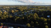
Mini 2 Altitude data after shooting incorrect.
- Thread starter MiniP2
- Start date
Possibly .... can you post an original jpg and I'll see what's going on with the metadata for you.Any ideas?
There are two altitude numbers in the image metadata.Thanks Meta4. Here it is.
Relative Altutude = 62 metres
Absolute Altitude = 217.51 metres
Realtive altitude is what you see on your screen while flying and is relative to Launch Point = zero.
Absolute Altitude (sometimes labelled as GPS altitude) = Height above sea level, but because of the way this is calculated, it can be quite wrong as it is here.
The actual height above sea level would have been approx 126 metres
Last edited:
Thanks Meta4.
Well done. Where did you get that from? After your reply I just found this in RAW Data in Bridge.
<drone-dji:AbsoluteAltitude>+217.51</drone-dji:AbsoluteAltitude>
<drone-dji:RelativeAltitude>+62.00</drone-dji:RelativeAltitude>
Just for interest, where do you get 126m?
(Thank you for taking the time to reply.)
Maybe in Lightroom there is a decimal dot I can't see making it 2175m
I added the relative height to the altitude I found in Google Earth for the location where the pic was taken.Just for interest, where do you get 126m?
Similar threads
- Replies
- 2
- Views
- 1K
DJI Drone Deals
1. Mini 2
2. Mini 3 Pro
3. Mini 4 Pro
4. Air 2s
5. Air 3
6. Avata 2
7. Mavic 3 Pro
8. Mavic 3 Classic
2. Mini 3 Pro
3. Mini 4 Pro
4. Air 2s
5. Air 3
6. Avata 2
7. Mavic 3 Pro
8. Mavic 3 Classic
New Threads
-
Is it better to almost exhaust your battery or leave 20 to 30% on it.
- Started by Terry Coleman
- Replies: 1
-
-
-
-
Mini 3 Awakening Woodland, Sunshine and Spring Flowers , Top Lodge Woods, Kelsall
- Started by AlbionDrones
- Replies: 0


