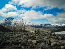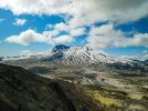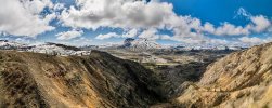


Got some great shots of Mt. St. Helens and found this out after the fact...

Gifford Pinchot National Forest - Other Activities
Gifford Pinchot National Forest - Other Activities
www.fs.usda.gov
Last edited:


If "within" their land / airspace - I'd think you would have gotten some warnings from DJI / drone.View attachment 128523View attachment 128524View attachment 128525
Got some great shots of Mt. St. Helens and found this out after the fact...
I thought I thoroughly researched the restrictions before flying but there’s always something hidden somewhere on a website...
Gifford Pinchot National Forest - Other Activities
Gifford Pinchot National Forest - Other Activitieswww.fs.usda.gov
Many "wilderness" designated areas all around. For me to fly in my local "wilderness" areas, i'd be flying a good 150-200 ft minimum due to vast ree cover - yet we do tend to have A LOT of raptors in our area and they don't seem to like drones.Mark, thank you very much for the incredible photos and more for the info on Wilderness areas. I knew that NP were NFZ and I new the National Forests were mostly legal to fly in but I did not know about Wilderness areas. Great Link and Thank you again.
It’s Ben, and thanks!Mark, thank you very much for the incredible photos and more for the info on Wilderness areas. I knew that NP were NFZ and I new the National Forests were mostly legal to fly in but I did not know about Wilderness areas. Great Link and Thank you again.
I notified the admin at AIRMAP and wilderness.net since they work together to identify restricted wilderness areas on the AIRMAP app. Hopefully they will update the map to include the Mt. St. Helens area sometime soon. AIRMAP has a very good representation of the restricted wilderness area boundaries...If "within" their land / airspace - I'd think you would have gotten some warnings from DJI / drone.
I have flown outside of NP's and not gotten any warnings - even though many maps like om KittyHawk and others seem to cover that specific area. I have also flown near some NP's and got very distinct warnings when "entering" that airspace - specifically at St. Louis Arch. Where I took off across the street along the Mississippi River - no problem at all. As soon as I got up in air and went across the street - "Betty" started screaming I was entering restricted airspace. As I was flying my Mini at the time and winds were whipping above 50 ft - I brought it home and went on my way. Would loved to have gotten some nice out of park aerials of the Gateway Arch, but maybe next time I'm in St. Louis with my Air2.
Curious, and seeing how wide-spread closure areas 1 & 2 are, where was your take-off location? I plan on going up there with visiting family in late June, early July. I'm in Gresham, OR and am pretty familiar with the territory.View attachment 128523View attachment 128524View attachment 128525
Got some great shots of Mt. St. Helens and found this out after the fact...
I thought I thoroughly researched the restrictions before flying but there’s always something hidden somewhere on a website...
Gifford Pinchot National Forest - Other Activities
Gifford Pinchot National Forest - Other Activitieswww.fs.usda.gov
Off of the boundary trailCurious, and seeing how wide-spread closure areas 1 & 2 are, where was your take-off location? I plan on going up there with visiting family in late June, early July. I'm in Gresham, OR and am pretty familiar with the territory.


