DJI Mavic, Air and Mini Drones
Friendly, Helpful & Knowledgeable Community
Join Us Now

New-ish with Mavic Air 2 - Blindsided by Reality - taking deep breaths and assessing the situation. Any info/help greatly appreciated.

Status
Not open for further replies.

NoBuzzKill

New Member
Premium Pilot
Joined
Jul 27, 2020
Messages
3
Reactions
16
Age
52
Location
Cazadero, California, USA
Please excuse if I'm in the wrong forum, but I think this might be a good place to start.

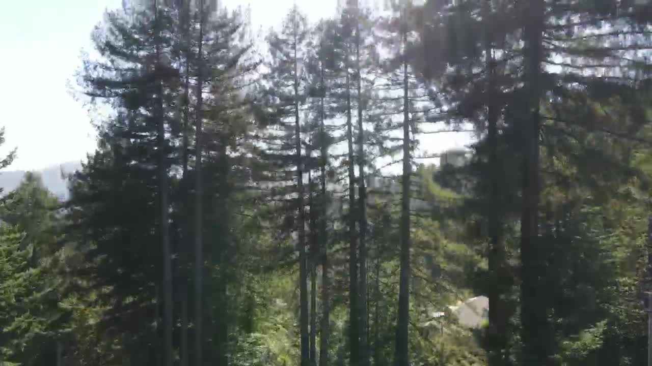
Mavic Air 2, my first drone, purchased a couple of weeks ago for fun and to take pics of the beautiful surrounding coastal redwoods here in Northern California. So far my flights have been short and always in eye shot, my training wheels still on.

We are currently experiencing what have become the annual wildfire season. I didn't realize what an indespensible tool the drone would become. Being able to zoom straight up, do a 360 and scan the area for signs of fire has been unbelievably comforting and frankly essential to assessing my safety. Are flames near? Do I need to pack up the dogs and evacuate or am I all good?

So today, fires raging around, I got my rude awakening. Grounded by the DJI app. It's now a restricted area.
WTF. I'm livid.

Had I have known DJI participates in police state crap like this, I would have thought twice before purchasing.

I just applied for a license, but don't expect to get it.

Now it's dawning on me that this thing is tethered to cell service to facilitate flight no matter what. So no cell service, no decent flight.

I realize I have some research to do, but due to the urgent utility, I need a Cliffs Notes version.
Am I correct in guessing there might be work-arounds? Yes, No? Positives and negatives of doing so? And realistically, how complicated is it to implement? Can it be done quickly and with little effort? Reverseable? Reliable? I'd really like to get back in the air today, realistic?

Any info greatly appreciated,
J
Cazadero, Sonoma County, California.
Sample video clip:
 
Had I have known DJI participates in police state crap like this, I would have thought twice before purchasing.
Had you known that FAA imposed no-fly zones apply to you, you would have thought twice before purchasing?
Now it's dawning on me that this thing is tethered to cell service to facilitate flight no matter what. So no cell service, no decent flight.
You can fly in the middle of the Pacific Ocean or the Sahara Desert.
Your drone doesn't need any cell phone connectivity.
 
I don't know what you expect. There is temporary flight restriction in the Napa-Sonoma area due to the wildfires. This is to prevent interference with fire fighting airplanes and helicopters. Any responsible drone pilot should know this! Here is the link:

knowbeforefly.jpg
 
I'd be livid too. Unintended consequences I suppose but that's no comfort.

There should be some exemption mechanism built into the workflow for rural property owners in danger needing to get above treetop height to check for fires heading their way. The system is clearly too simplistic to support that in its current form and needs revising, period.

I'd make some 'structured noise' about it if I were you. I will be on board, having lived in south Austin during the Bastrop fires, watching the smoke coming our way, I know exactly how you feel right now. Jeesh! What a bummer. And I wish you all the best.
 
Last edited:
I wish you the best in combating what can be a dangerous situation. We all get hamstrung from time to time, and it's sad that DJI has to use geo-fencing because too many drone owners don't know to check the airspace before flying and create a problem for everyone else. But aside from that, I agree that DJI has to make it easier to make exceptions under certain restricted conditions- and make it easy to do so.
 
Yeah it's hardly "a police state" the airspace closures are designed to keep firefighting ground and air support safe. Just like when they close roads for similar reasons. Unfortunately, too many "lookie-Lou's" in cars, planes, drones, etc. represent a serious safety threat to firefighters and other first responders. The fact that you're actively seeking a workaround because you feel like you should be able to do whatever you want--whenever you want is precisely why there are so many restrictions. Get a battery powered radio and/or police scanner. Firefighting aircraft and ground support are well aware of when flames are getting close to buildings and they either send people to issue evacuation orders in person, and/or announce it on local media. And a lot of state and local governments now also offer text-alert systems that you can sign up for to get up-to-the-minute alerts about emergencies in your area. Good luck.
 
Stay Safe
 
I would say "a big thanks" to all the irresponsible pilots that because of their own benefit endangered rescue and fireservice personel so authorities where forced to get a TFR.
 
are you kidding? It’s because of irresponsible people like you that more and more restrictive laws will be made against drones. How about turning on the tv and watching the news for updates on the fire instead of putting emergency personnel who are trying to help you in danger. Sell your drone and please, never fly again.
 
I'd be livid too. Unintended consequences I suppose but that's no comfort.

There should be some exemption mechanism built into the workflow for rural property owners in danger needing to get above treetop height to check for fires heading their way. The system is clearly too simplistic to support that in its current form and needs revising, period.

I'd make some 'structured noise' about it if I were you. I will be on board, having lived in south Austin during the Bastrop fires, watching the smoke coming our way, I know exactly how you feel right now. Jeesh! What a bummer. And I wish you all the best.
People living in areas subject to wildfires should be granted authority to fly their drones for the purpose of advance safety warnings as long as the flights are logged into a recognised system, so that other pilots know what is happening. And there should be comms links available - mobiles, landlines and email. It should be easy to report fire fighting plane and heli flights on to a GIS mapping system that can be readily accessed online by the drone flying community. And by the time such flights are occurring, the drone is unlikely to be used for early warning purposes, anyway, as detailed in the original posting. Residents’ drones should also be integrated into the early warning system, as they can provide excellent information to the coordinators, to enable better utilisation of resources, on the ground and in the air. They could also identify hot spots and jumps in the fire front. The blanket no-fly restriction takes no advantage of what could potentially be additional life saving “eyes in the sky”. And before anyone slings off here, this comment is intended to advance safety during wildfires, not detract from it. There can be a stronger team approach with the inclusion of drones, if properly managed.
 
Last edited:
Fire TFR's are be pretty restrictive. With most aircraft you can overfly or circumvent them but even that is not always possible. You're flying an aircraft and using airspace so you have to obey the rules. Tanker pilots see one drone and they're out of there. Maybe they seem like they're being primadonna's..but put yourself in their position. You wouldn't want to deal with a dangerous target and a drone.
The best thing you can do while flying a drone is ..if you see a smoke plume in a wilderness area, report it and give it's location as best as you can.
Thats always been appreciated in my experience..even when they say..yes we're aware of that one..it's been burning for five years..
I can sure understand you're concern for the safety of you, your family and that of your animals, but I think the protection you get from the tankers is worth not being able to fly your drone.
 
People living in areas subject to wildfires should be granted authority to fly their drones for the purpose of advance safety warnings as long as the flights are logged into a recognised system, so that other pilots know what is happening. And there should be comms links available - mobiles, landlines and email. It should be easy to report fire fighting plane and heli flights on to a GIS mapping system that can be readily accessed online by the drone flying community. And by the time such flights are occurring, the drone is unlikely to be used for early warning purposes, anyway, as detailed in the original posting. Residents’ drones should also be integrated into the early warning system, as they can provide excellent information to the coordinators, to enable better utilisation of resources, on the ground and in the air. They could also identify hot spots and jumps in the fire front. The blanket no-fly restriction takes no advantage of what could potentially be additional life saving “eyes in the sky”. And before anyone slings off here, this comment is intended to advance safety during wildfires, not detract from it. There can be a stronger team approach with the inclusion of drones, if properly managed.


Seriously? You want LIFE SAVING equipment to be on the lookout for a drone? They are already operating on the cutting edge of their technology (Low, Slow, Heavy, Task Burdened) and you want them to also have to watch out the window for a drone taking pictures? NO NO NO! The area is CLEARED for a VERY good reason (about a million of them) and no one needs to be flying within the TFR unless they are a Coordinated part of the Incident. NO NO NO!

If it's YOUR house on fire and the fire suppression equipment is grounded because someone in the next area over wants to get a "Quick Look" to see what they can you'd have a VERY different outlook.

It's the responsibility of EVERY UAS operator to know HOW to look, WHERE to look, and HOW to interpret the DATA so that you're no flying inside of an ACTIVE TFR. Anything less is gross negligence.

To @NoBuzzKill even if you had figured a way around the DJI GeoFencing you would have been violating a FEDERAL Regulation flying within the TFR. You don't need a work-around you just need to abide by the rules already at play and not look for a loop-hole as that only adds fuel to the debate AGAINST our industry.
 
Here's some good reading.

 
People living in areas subject to wildfires should be granted authority to fly their drones for the purpose of advance safety warnings as long as the flights are logged into a recognised system, so that other pilots know what is happening. And there should be comms links available - mobiles, landlines and email. It should be easy to report fire fighting plane and heli flights on to a GIS mapping system that can be readily accessed online by the drone flying community.

Yeah, MAYBE something like that could work, but just last weekend I was flying my drone on the beach in Oregon for sunset and a plane and an ultralight came out of nowhere to buzz the beach at about 150-200' altitude. Because of the high dunes and wind, I had ZERO warning that they were near. So maybe if the fire was in Kansas that could work, but hard to see how it could possibly work in mountainous terrain like N. Cal.
 
The blanket no-fly restriction takes no advantage of what could potentially be additional life saving “eyes in the sky”. And before anyone slings off here, this comment is intended to advance safety during wildfires, not detract from it. There can be a stronger team approach with the inclusion of drones, if properly managed.

The amount of coordination and extra effort that would be required to try to do this safely would be huge and would just be a terrible waste of already stretched resources. The real aircraft involved have a strict set of rules and regulations that they must follow whilst many drone flyers seem to view the laws applying to drones as something optional at the best of times. It would be a recipe for an even worse disaster than that caused by the fires!
 
The amount of coordination and extra effort that would be required to try to do this safely would be huge and would just be a terrible waste of already stretched resources. The real aircraft involved have a strict set of rules and regulations that they must follow whilst many drone flyers seem to view the laws applying to drones as something optional at the best of times. It would be a recipe for an even worse disaster than that caused by the fires!


BINGO!! Well said!!

Resources are already stretched dangerously thin and now we need to add a Public UAS Operations Coordinator to the mix. Not gonna happen :)
 
are you kidding? It’s because of irresponsible people like you that more and more restrictive laws will be made against drones. How about turning on the tv and watching the news for updates on the fire instead of putting emergency personnel who are trying to help you in danger. Sell your drone and please, never fly again.

Wow, perhaps less coffee in the AM would be helpful?!?!
 
Wow. What a discussion and lots of interesting things to consider which many a would be drone pilot may not think about.

I live near (Blue Mountains Australia) where there were terrible bushfires (wildfires?) last summer and saw the altitude of some water dumping aircraft (fixed wing and helicopters) and they fly extremely low in smoke laden air and would not want to 'injest' an unseen drone. Very dangerous flying by those very skilled pilots. A fixed wing aircraft on loan from USA with a USA crew crashed and was completely lost due to need to fly in smoke and undulating terrain. These fire flighting aircraft don't just fly over the fires they have to get there and back from where they load with water.

On the other hand those wanting to 'spot fires' using drones could be an asset but how do you differentiate between areas 'outside' the area where the fires are and where the firefighting aircraft might be. Lots of 'grey' areas in between and the fires can move so very quickly from one area to another in high winds.
 
Man if I were sitting on the ground surrounded by trees, all power out, not enough water, smelling smoke, winds changing, sparks flying, no sign of any aircraft or firefighters on the ground, and not enough information coming my way, I'd be pissed-off too if I couldn't launch. I've experienced a mild form of it once and I hope to never again but it could happen here tomorrow the way the weather has been. The OP just needs to know when to get out of there and in which direction; he's not trying to get footage to put on youtube! :rolleyes: I hope everything's OK

Some of the responses on here kind of indicates you guys have never experienced a bad fire, and how quickly the wind can change direction and speed. "Like a freight train" is a common description from survivors. At that point, unless you're extremely lucky, you're on your own. And that goes for everyone in its path. Please think about how that feels.

We're not talking about climbing to max alt and beyond; just the ability to survey 360 degrees above the canopy. I don't have any pat solutions but I do believe we are capable of building-in limited license extensions for those who need it most. In the USA that's the domain of the FAA, probably in coordination with the NTSB

Nobody here wants to jeopardize safety in the air. Given the characteristic rapidity of changing conditions, particularly wind, on the ground there has to be a way for people, including ground firefighters, to further protect themselves without reducing safety in the air. The status of the problem is this: It is getting worse every year. Just my $.02
 
Last edited:
  • Like
Reactions: DavidT_ NZ
[Edited by ADMIN] all ye know it alls and passive aggressive let me correct you forum folks. I quite CLEARLY stated that I am just learning all this and CLEARLY this is an unusual situation.

Personal opinions can be retained where the sun don't shine. I posted a request for information so I can assess the viability of utilizing the drone I have for a specific task. The very same task I have been using it for the past week until it was locked down. I'm merely trying to utilize the tools currently at my disposal quickly and efficiently. FAA rules blah, blah blah. I'm talking about flying straight up. doing a 360 and straight back down. 180 seconds. Not cruising around bird watching or creating my next earth shattering scenic panning masterpiece set to the Game of Thrones soundtrack or Enya.

Obviously, I have no intention of interfering with air traffic and wouldn't send it up when manned aircraft were around. I'm located on a hill crest with decent views and can hear any approaching aircraft from quite far off. It's even quieter than usual given the evacuation. Don't bother going into a diatribe about some new silent skimmer plane I don't know about. I'm smart enough to assess the safety situation with confidence. That is why I am here in the first place.

What I have to go with here is my specific situation: the drone I have here functioned just fine until yesterday. Now I can't even get it to take off. And I currently am not interested in investing the time to research the subject from one side of the www to another.

This post is/was a simple, straight forward request for information, not an invitation to school me on whatever hot button topic some hypersensitive drone enthusiast has stuck in their craw.

No matter where anyones opinion falls on the subject of police state or corporate control, what I take umbrage with is the fact that it is not clearly stated prior to purchasing that complete function of this item is not at the purchasers disposal at all times and is subject to multiple factors. The how and why are entirely different subjects and debatable. Start your own thread if you wanna go there.


Regards,
J


And yes, a minimum of cell service (network connection) could be required to utilize the hardware to it's full capability. The hardware I have requires a cell phone with the DJI app installed. If the capabilities can be restricted remotely, it could require a network connection (cell service) to restore. As opposed to a unit that could not be accessed remotely (hacking aside) and is simply the drone and companion controller, other than for firmware updates, zero network connection.

For those interested, my two dogs and I are doing fine. The activity around my location has settled down. At one point it was a bit unnerving as fires were popping up all around from the insane lightning we experienced. During that storm, I wanted to get a couple of photos because the sight was unbelievable, but being on a hillside, I wasn't about to step outside. There were simultaneous strikes all around. Thus, little fires everywhere. And clear, consistent information was not available. Different websites, differing and conflicting info. Some sites listed reported fires as fires, others only one or two fires total. So time to put on ones big boy pants and do what needed to be done.

The incredible part of this is that because of where we are located, the air has been amazingly good. We are situated in a way, close enough to the coast, that what little breeze we feel is pushing the smoke away inland. That's one reason I'm stying put as long as possible. Looting is another. And as long as I can keep spraying down the plants surrounding my place and feel safe and aware of whats going on around, I'll stay here and do so. If it gets hairy, the cars already packed and we'll head out. I'm fortunate enough not to need to utilize a shelter, particularly during this pandemic.
And on a related note. (Mod Removed Political Comments and Language )
 
Last edited by a moderator:
Status
Not open for further replies.
Lycus Tech Mavic Air 3 Case

DJI Drone Deals

Members online

Forum statistics

Threads
131,089
Messages
1,559,730
Members
160,073
Latest member
testtest