DJI Mavic, Air and Mini Drones
Friendly, Helpful & Knowledgeable Community
Join Us Now

Tips for managing your height when ground level changes significantly

jweaver

Well-Known Member
Joined
Feb 24, 2021
Messages
64
Reactions
26
Age
54
Location
South Wales (But English)
One thing about the new regulations that I am not entirly clear on is the 120m height rule.... Whilst I am a reasonably competant quad flyer, I have only taken my Mini2 out once in the garden to check it out...

I havn't flown my quads for a fair while, certainly before the new regulations came in so I am starting again.

As I understanding it, I can fly 120m off the ground? So if I fly over a hill, I can increase my height as I go over the hill, as long as I stay 120m from the ground...

But how do you know? If you don't know the heigh of the hill, how can you ensure you are still flying within 120m?

My standand flying site is at 0ft above sea level as its a large level area by a river.. But the ground sharply rises all round.. I would guess by 20-30m... So if I go over this hill, I can increase my height to 140-150m.. How how can I tell exactly how high I can go?

I guess its just a case of finding out the height of the hill and then manually monitoring my height, but I just wanted to check if there were any tips? There is nothing in the app that helps here is there? Based on the Google map data?
 
  • Like
Reactions: w00dy67
You will not find anything in the app that will assist you with a measurement of height above ground beneath the AC up on 120m. All heights shown will be relative the HP. Some models can display the VPS sensor height (distance to ground beneath) but only up to roughly 10m ( ...my Mavic Air 1 with the GO4 app can).

So it's up to your pre-planning & there finding out the height of those hills you will fly over.
 
  • Like
Reactions: tlswift58
You will not find anything in the app that will assist you with a measurement of height above ground beneath the AC up on 120m. All heights shown will be relative the HP. Some models can display the VPS sensor height (distance to ground beneath) but only up to roughly 10m ( ...my Mavic Air 1 with the GO4 app can).

So it's up to your pre-planning & there finding out the height of those hills you will fly over.
Thanks.. I assumed so, but it was worth asking.
 
  • Like
Reactions: slup
This is a difficult one as I also fly off cliffs etc. for filming. DJI should address this for the purposes of legal remit.
 
DJI should address this for the purposes of legal remit.
How?
Do a little searching to see what a radar altimeter costs and how much it weighs.
Most of the pilots of real light aircraft have to calculate/estimate their agl heights too you know.
It's really not that hard when you already know your height above the launch point for reference.
 
So my thoughts on this, as I asked the question, is that they could offer an approximate height over land value, based on Google/Map data.
That's not going to work.
If it was so easy, DJI would have done it long ago.
 
@jweaver ,hi fellow flyer,
i too live in South Wales, and most of the spots where i fly contain very changeable topography
my way of getting a reasonable approximation of my height is to use an ordnance Survey map that has elevation readings on it , that way you can check your height relative to the map where you are flying ,and if you were flying out over a valley compare the height you are at with that of the area you intend to fly over, so then as you fly out over the valley, and reduce altitude with the drone, it will show a negative reading as you descend ,so you get a reasonable AGL reading, because you know your height at take off ,and then the height of the valley floor below you,you can use the same method if you start off low down and intend to climb up ,a little tip with regards RTH height when you are high up and intend to fly out over a valley, just set your RTH height to reflect your take off area ,which would normally be near the edge of the drop so you can keep LOS between the RC and drone once you descend, i will set mine to 20ft , so when it gets close i know its not going to hit anything near the home point, and not waste battery trying to climb to my usual RTH height of 120ft ,you could of course just cancel the RTH as well as it nears home, but you will still have gone up to 120ft above your home point so it would have needed more battery to attain that height ,and with regards to that ,dont forget to factor in the climb back to the home point when you are in a valley several hundred ft below ,it takes more battery to ascend than to descend ,so come home with more battery left than you normally would
 
The issue with using Google Earth data are 2 fold.

1. It takes a lot of calculation power to make these calculations in real time - at least 100x per second. More power required by this computation leads to less flying time.

2. The results are subject to inaccuracies due to variation in the barometric altimeter, and variations in the Google Earth datums. This exposes DJI to significant legal risk when something goes wrong when relying on that information.
 
  • Like
Reactions: Meta4
One way to take automatically into account ground elevation while flying your drone is to use the LITCHI application instead of DJI Go 4.0. Litchi permits to plan your mission in advance using waypoints which will take into consideration ground elevation above your HP. The application uses the DME (Digital Elevation Model) of the Google satellite imagery of the area you are flying in. The only drawback is the availability of a Litchi version for Mini 2. It will come. I use an old Mavic Air for my flying. Good luck and happy flying with preflight estimations from USGS Topo maps.
 
  • Like
Reactions: DroneToJoy
Thanks.. I assumed so, but it was worth asking.

A good topo map will help you immensely. Google Maps is okay, but not all inclusive. We have GAIA here in the US which is very detailed with elevations. Maybe it has a UK / Euro version as well.
 
This is a difficult one as I also fly off cliffs etc. for filming. DJI should address this for the purposes of legal remit.
The only way to address this (probably) are sensors that can work up to/over 120m. I would expect either those sensors don't exist or are too large or too costly, ground sensing radar would be good!
 
  • Like
Reactions: DroneToJoy
The only way to address this (probably) are sensors that can work up to/over 120m. I would expect either those sensors don't exist or are too large or too costly, ground sensing radar would be good!
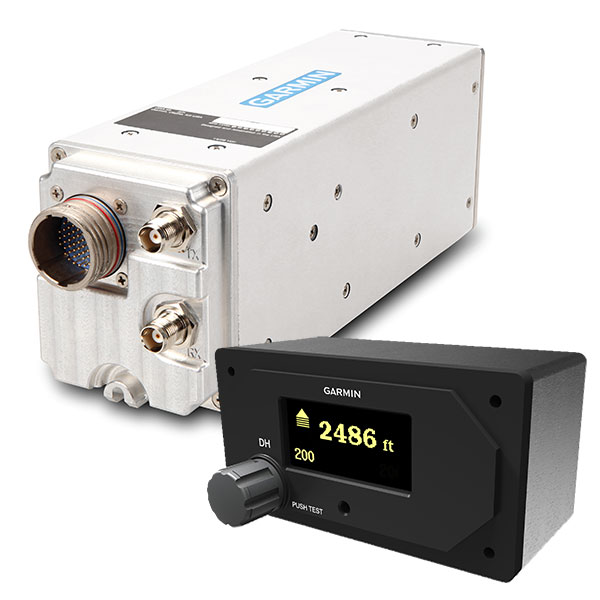
This is what a small, cost-effective radar altimeter costs:
And your drone would have to be able to deal with the 3.5 lbs weight.
 
  • Like
Reactions: Rich QR
Without some kind of lidar or something much more accurate to see the ground below, it'd be hard. It does have a visual sensor on the bottom, but I think that's only good for up to 30 feet, so it couldn't really tell you how far off the ground in that area you were if it can't see it from 40+ feet up.

I remember filming at the dunes off Lake Michigan, and the viewing platform is about 100 feet above the coast/beach line, flying down course will show negative height. But knowing how high I already am at take off I get a pretty good estimate of how far it is off the coast. Plus should be flying within visual line of sight here in the US anyways.

Just curious if anyone is going to go after you just for avoiding flying into the ground or a hill...
 
Something to keep in mind is that most small airplanes carrying people have no good way to determine their height AGL, either. A few more expensive planes may have a radar altimeter, but many of the small planes tooling around in uncontrolled airspace just have a barometric altimeter that indicates altitude above sea level.

While they may be well aware of their own altitude above sea level, they may not always be aware of the precise altitude of the terrain below them, particularly when flying fast over steep terrain.

That's why you're always required to see and avoid other traffic, even traffic that happens to be lower than it's supposed to be and comes quickly at you from behind, or from the other side of a ridge that your drone is flying over.
 
Oh come on!

I've just bought a hand-held laser rangefinder, 1000 metres range, accurate to ~1m , 150AUD, not optimised for flight, 250g.

As a built-in, you'd look at no extra battery or casing or glass lenses or wrist loop, no extra inventory cost, <20g, <20AUD.

And as per someone above, I've used Litchi with Google Earth. GE is pretty accurate, when compared with a digital topo with 2m contours. For better accuracy I've made a DEM with ArcMap using the same digital topo.

The biggest problem with such accuracy is big trees that aren't shown on the map. Fly at 30m through a 35m tree, probably an issue.
 
I agree with garrytre. Apart from using Litchi with GE, you have to take into account the height of trees or other artificial artefacts such as antenna or buildings, GE showing the topography of the ground, not the height of added object above the terrain. So add up a safe 30 or 40 m to your calculations with Litchi and Google Earth. Fly safe!
 
I monitor my visual cues very carefully when flying hills and mountain parts. My approach is to carefully assess heights around me visually at take off. I have a pretty good idea of when I'm too close to tree tops or cliff sides. Have been doing this a while and tend to err on the safe side.
 
One thing about the new regulations that I am not entirly clear on is the 120m height rule.... Whilst I am a reasonably competant quad flyer, I have only taken my Mini2 out once in the garden to check it out...

I havn't flown my quads for a fair while, certainly before the new regulations came in so I am starting again.

As I understanding it, I can fly 120m off the ground? So if I fly over a hill, I can increase my height as I go over the hill, as long as I stay 120m from the ground...

But how do you know? If you don't know the heigh of the hill, how can you ensure you are still flying within 120m?

My standand flying site is at 0ft above sea level as its a large level area by a river.. But the ground sharply rises all round.. I would guess by 20-30m... So if I go over this hill, I can increase my height to 140-150m.. How how can I tell exactly how high I can go?

I guess its just a case of finding out the height of the hill and then manually monitoring my height, but I just wanted to check if there were any tips? There is nothing in the app that helps here is there? Based on the Google map data?
I recommend you take a look at pre-flight planning apps such as DroneLink. You can use it for free for recreational use or pay a nominal annual fee for added functionality. Business use requires an annual fee, still very reasonably priced.
 

DJI Drone Deals

New Threads

Members online

Forum statistics

Threads
130,983
Messages
1,558,545
Members
159,972
Latest member
valter123