DJI Mavic, Air and Mini Drones
Friendly, Helpful & Knowledgeable Community
Join Us Now

What is the point of LAANC as it is currently deployed?

chakalakasp

Well-Known Member
Joined
Jan 9, 2021
Messages
63
Reactions
38
Age
44
Location
United States
Let's talk about LAANC.

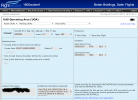
As LAANC is currently deployed, there exists a national system through which UAS pilots input their flight missions when flying in controlled airspace, await approval, and then fly within the contraints they input. They indicate a geographical area they will operate in and a maximum altitude they plan to operate at, and set a mission time limit after which the area can be considered no longer in use by the UAS.

The system then... does nothing useful with this information. Does ATC see this information? No, they do not. Do pilots see this information? No, they do not. The information lives in a government database and is otherwise not made visible to any of the relevant parties that it might be useful to. The only exception is approvals that are made non-automatically (for missions that exceed typical scope -- altitude above airspace limits, missions that are very close to the airport (in areas where you'd see "0" as the auto approved altitude), etc.

Why does it exist? Why ask UAS operators to input information that would be useful to other parties and then not make that information accessible to them? Are there plans in the future to make that information visible to the relevant parties? To build UAS information into the ATC datastream so that ATC can see UAS LAANC approvals? To allow pilots to see UAS operations areas in their data stream? Is LAANC in its current form just a "placeholder" of sorts -- much like you build out the power lines in a power grid before you actually flip the switch and send electricity down the lines?
 
  • Like
Reactions: dawgpilot
Flying drones boils down to responsibility. ATC and ATO worked together to come up with the area around each airport where each ATC Manager said basically, "Drones can fly here without further coordination". However, that doesn't mean w/o any responsibility.

The fact of information not going to ATC or GA/CA aircraft the entire point. They don't need to be bothered.

However, you still technically need permission to fly in controlled airspace. 14 CFR Part 107 specifically says you need permission to fly in controlled airspace, so LAANC & 107.41 COAs exist. But you need to prove it to someone who needs to know. Therefore, LAANC (& COAs) are proof you have permission to fly there.

Also, if something goes wrong with a flight, ATC can look at the records of LAANC approvals and rule out pilots who follow the rules.

Once RID is required, this will be even more critical.
 
  • Like
Reactions: tlswift58 and B52-D
So basically the reason it exists is for the furtherance of administrative paperwork? I mean it’s not even a tax, like registering your car. It’s just filing for permission from something that automagically grants it and said permission is immediately thrown into a dark hole where nobody ever looks at it again. If you don’t do it and something goes wrong they fine you for not doing it, even though having done it would have made no functional difference to the situation. If you do file for it and something goes wrong they fine you for not abiding by the conditions of the approval, which again, has no real function other than to serve as some kind of legal instrument to fulfill some law that probably was never meant to be applied to flying objects that fit in your pocket.

I guess I’m just disappointed that LAANC seems to have no real function other than to fulfill some legal rubber stamp requirement. If ATC and pilots don’t want / need this info then functionally there is no reason for it to exist. (Unless there is some expectation that in the future such a need will exist, as UAS operations flourish and the space becomes more crowded).
 
  • Haha
Reactions: tlswift58
So basically the reason it exists is for the furtherance of administrative paperwork? I mean it’s not even a tax, like registering your car. It’s just filing for permission from something that automagically grants it and said permission is immediately thrown into a dark hole where nobody ever looks at it again. If you don’t do it and something goes wrong they fine you for not doing it, even though having done it would have made no functional difference to the situation. If you do file for it and something goes wrong they fine you for not abiding by the conditions of the approval, which again, has no real function other than to serve as some kind of legal instrument to fulfill some law that probably was never meant to be applied to flying objects that fit in your pocket.

I guess I’m just disappointed that LAANC seems to have no real function other than to fulfill some legal rubber stamp requirement. If ATC and pilots don’t want / need this info then functionally there is no reason for it to exist. (Unless there is some expectation that in the future such a need will exist, as UAS operations flourish and the space becomes more crowded).
We are legally required to obtain prior permission to fly in controlled airspace. This is the automated system to obtain that permission. The only other option is to call ATC (we're not allowed) or continue to use the 107.41 COA system on Drone Zone. And the COA system was a logistical headache.

The LAANC system has a very real function. And it's more than just a rubber stamp requirement. And the law was meant EXACTLY for "flying objects that fit in your pocket" as well as larger drones.

You're obviously new to drones and controlled airspace, or you wouldn't be so uninformed on why LAANC exists.
 
All pilots need permission to enter and fly in controlled airspace, it has been that way for decades and includes drone pilots. In the bad old days before LAANC it would take days, weeks and even months to get approval. The FAA realized that the manual method did not work well, and the system backed up to the point of stalling, thus LAANC was born. See below.

"After the Part 107 rule was published, the FAA had only a manual method to process authorization requests. This manual process was not scalable and while the number of sUAS was much smaller in 2016 than it is in 2020, a backlog of tens of thousands of authorization requests developed. Part 107 operators faced waits that averaged 104 days to receive an authorization to fly."

Actually, ATC does know you are in the controlled airspace and if a situation arises they will contact you. See below:

"LAANC plays an essential role in the authorization process. Automated transfer of information from the USSs to the FAA allows sUAS operators to quickly receive authorization to fly in controlled airspace. LAANC also provides situation awareness to Air Traffic of all planned sUAS flight operations in their controlled airspace. LAANC also enables Air Traffic to quickly communicate with sUAS operators when required. "

In my view LAANC is so much better than the manual method, the FAA, ATC and most drone pilots would agree that LAANC works well.

All bold quotes are from the FAA paper about LAANC: Here's the link:

Hope this helps
Cheers!
 
Last edited:
We are legally required to obtain prior permission to fly in controlled airspace. This is the automated system to obtain that permission. The only other option is to call ATC (we're not allowed) or continue to use the 107.41 COA system on Drone Zone. And the COA system was a logistical headache.

The LAANC system has a very real function. And it's more than just a rubber stamp requirement. And the law was meant EXACTLY for "flying objects that fit in your pocket" as well as larger drones.

You're obviously new to drones and controlled airspace, or you wouldn't be so uninformed on why LAANC exists.You're obviously new to drones and controlled airspace, or you wouldn't be so uninformed on why LAANC exists.

I understand the concept of controlled airspace. The control has a purpose: to ensure the safe and efficient functioning of a shared public resource. The regulations ostensibly exist for that purpose. ATC doesn’t chat with you to fill the awkward silences as you slide through the clouds, they do it to keep you from giving another aircraft a surprise party in the sky.

LAANC seems to exist primarily to fill a bureaucratic hole. A regulation exists that did not take current generation UAS into account and they needed to change it to accommodate these UAS. The solution was LAANC. But that’s literally all it does — it dots an i and crosses a t in the federal register, but the solution itself does nothing to functionally improve the administration of the airspace. (That I can see - maybe I’m missing something).
 
  • Wow
Reactions: tlswift58
All pilots need permission to enter and fly in controlled airspace, it has been that way for decades and includes drone pilots. In the bad old days before LAANC it would take days, weeks and even months to get approval. The FAA realized that the manual method did not work well, and the system backed up to the point of stalling, thus LAANC was born. See below.

"After the Part 107 rule was published, the FAA had only a manual method to process authorization requests. This manual process was not scalable and while the number of sUAS was much smaller in 2016 than it is in 2020, a backlog of tens of thousands of authorization requests developed. Part 107 operators faced waits that averaged 104 days to receive an authorization to fly."

Actually, ATC does know you are in the controlled airspace and if a situation arises they will contact you. See below:

"LAANC plays an essential role in the authorization process. Automated transfer of information from the USSs to the FAA allows sUAS operators to quickly receive authorization to fly in controlled airspace. LAANC also provides situation awareness to Air Traffic of all planned sUAS flight operations in their controlled airspace. LAANC also enables Air Traffic to quickly communicate with sUAS operators when required. "

In my view LAANC is so much better than the manual method, the FAA, ATC and most drone pilots would agree that LAANC works well.

All bold quotes are from the FAA paper about LAANC: Here's the link:

Hope this helps
Cheers!
From the recent Reddit thread in which actual controllers comment on LAANC:

“LAANC is invisible to ATC. It was made to be that way. The union and management collaborate on altitudes that can be pre approved in quadrants around the airport to make it easy for you all to fly UAS there when we really don’t care. In the case you need say 600 feet in a 400 foot pre approval, further FAA approval is needed and then we will be briefed for that specific operation. We don’t have as atc an all seeing drone radar.”

Another controller being asked about LAANC:

“Been an FAA controller for 13yrs and work at a level 12 Tracon and have no idea what you are talking about or what any of those acronyms mean.

As in, some airplane reports a drone, and we just report it for 30min and tell the sup, like everything else and don't care or give a second thought to what any of the rules or regulations are.

the visibility and practical use are pretty much null as far as ATC goes. This is more of an upper management problem and we wouldn't need to know anything about it.”
 
I understand the concept of controlled airspace. The control has a purpose: to ensure the safe and efficient functioning of a shared public resource. The regulations ostensibly exist for that purpose. ATC doesn’t chat with you to fill the awkward silences as you slide through the clouds, they do it to keep you from giving another aircraft a surprise party in the sky.

LAANC seems to exist primarily to fill a bureaucratic hole. A regulation exists that did not take current generation UAS into account and they needed to change it to accommodate these UAS. The solution was LAANC. But that’s literally all it does — it dots an i and crosses a t in the federal register, but the solution itself does nothing to functionally improve the administration of the airspace. (That I can see - maybe I’m missing something).
At the bare minimum, LAANC does 3 things,

A) It makes the drone pilot aware that they are flying in controlled airspace.

And,

B) ATC will be aware that a drone is in the controlled airspace at a given location and time.

Finally,

C) If a situation arises, ATC can contact you as needed.

Cheers!
 
Last edited:
At the bare minimum it does 3 things,

A) It makes the drone pilot aware that they are flying in controlled airspace.

And,

B) ATC will be aware that a drone is in the controlled airspace at a given location and time.

Finally,

C) If a situation arises, ATC can contact you as needed.

Cheers!
Point A and C are true (though they could probably be accomplished much more reliably using software solutions like geo locking and remote ID). But is B true? People who actually work as ATC say it isn’t. They never see anything to do with LAANC unless it exceeds the auto approval norms.
 
  • Like
Reactions: Dave Maine
Point A and C are true (though they could probably be accomplished much more reliably using software solutions like geo locking and remote ID). But is B true? People who actually work as ATC say it isn’t. They never see anything to do with LAANC unless it exceeds the auto approval norms.
Whether they see it or not I can't say, but all LAANC authorizations go to the controlled airspace ATC. Geofencing is currently problematic and to aggressive on DJI products currently. DJI has extended their Geofencing beyond what is actual controlled airspace... Especially airport approaches, watch this video:

DJI Authorization Zones vs FAA Airspace Approval

You can get LAANC approval but DJI will still aggressively block an area from drone flights... Go figure.

Cheers!
Yeah, I’d agree on DJI’s aggressiveness. Ran into that tonight near a state Capitol that was in an airport approach. Filed for LAANC at 400 ft, got it, but it wouldn’t let me get near the approach zone without dropping under 200. I mean, it’s their hardware and they can limit it however they want, but if the FAA thinks 400 is OK then you’d think it’d be reasonable the drone would agree.
 
  • Like
Reactions: db4476
The system then... does nothing useful with this information. Does ATC see this information? No, they do not. Do pilots see this information? No, they do not. The information lives in a government database and is otherwise not made visible to any of the relevant parties that it might be useful to.
I believe the main usefulness of this information occurs before a LAANC request is approved. If there are special circumstances, a temporary no fly zone, for instance, the system will not approve a LAANC application.
 
OMG, why is this even a topic? LAANC is ONLY there to make getting approval in controlled airspace more convenient to the UAS pilot and prevent unnecessary burden on ATC's. It is and never was meant to be a "data collection tool". Why is this such a hard concept to understand? Why would anyone give two cents of thought to something like this? Normally, people would be happy that the government is not sharing our information with everyone. Jeesh. I do agree that DJI's GEO fencing is a PITA and they need to make it easier to coordinate LAANC approvals with it.
 
I understand the concept of controlled airspace. The control has a purpose: to ensure the safe and efficient functioning of a shared public resource. The regulations ostensibly exist for that purpose. ATC doesn’t chat with you to fill the awkward silences as you slide through the clouds, they do it to keep you from giving another aircraft a surprise party in the sky.

LAANC seems to exist primarily to fill a bureaucratic hole. A regulation exists that did not take current generation UAS into account and they needed to change it to accommodate these UAS. The solution was LAANC. But that’s literally all it does — it dots an i and crosses a t in the federal register, but the solution itself does nothing to functionally improve the administration of the airspace. (That I can see - maybe I’m missing something).
Your beating a dead horse and not getting WHY LAANC exists. If it's better than the old system and does not take days, weeks, or months to get authorization to fly - then that is a GOOD THING.

As stated a few times - it's there WHEN something happens and they have a record of who was allowed in that airspace - a UAV type. Without it - then no record exists and if a UAV is involved in a mishap of some type - think of all the manhours people will expend (great cost no less) investigating the mishap.

Much of what the government does is "bureaucratic" to all of us - yet if they have a simple system to get you approval to fly in restricted areas quicker; then does not that bureaucracy benefit you if you need / want to fly there?
 
  • Like
Reactions: Mr. G and Wade L.
Ok controlled air space. I get it. Trying to learn but...I have an airport in the next town, Andrews, N.C. and the code is RHP. If I go to "before you fly" it shows that there are no restrictions at the airport!!! Why is this? If you are interested in looking at this airport on an actual air map, go to the extreme west of N.C. and heading east you will see Murphy and then Andrews.
 
Ok controlled air space. I get it. Trying to learn but...I have an airport in the next town, Andrews, N.C. and the code is RHP. If I go to "before you fly" it shows that there are no restrictions at the airport!!! Why is this? If you are interested in looking at this airport on an actual air map, go to the extreme west of N.C. and heading east you will see Murphy and then Andrews.
Most local airports are not under restrictions due to no local tower and mostly small civilian aircraft. Most small airports in wNC are not under that advisory. A couple are in North GA around Clayton for some reason - but a pretty small area.

I do have an "advisory" show up due to Medivac Choppers at Angels Hospital in Franklin, NC - yet no restrictions to fly. Now, get around Asheville Airport - due to many large commercial aircraft - and you've got a big boundary of restrictions.
 
Ok controlled air space. I get it. Trying to learn but...I have an airport in the next town, Andrews, N.C. and the code is RHP. If I go to "before you fly" it shows that there are no restrictions at the airport!!! Why is this? If you are interested in looking at this airport on an actual air map, go to the extreme west of N.C. and heading east you will see Murphy and then Andrews.
I welcome fact checking from others but it appears that RHP is in Class E airspace which does not require authorization (controlled airspace begins at 700' which is well above the 400' max for drones). Of course that doesn't mean you can fly recklessly, especially since it overlaps part of the Snowbird Military Operations Area (MOA). Be aware of what is going on around you and immediately yield to any fixed wing aircraft. And be careful out there...

From Aloft...

A big point of confusion comes from the fact that there are multiple types of Class E airspace, only one of which (Class E2) requires authorization in order to operate there. Part 107.41 makes clear that no person may operate a small UAS “within the lateral boundaries of the surface area of Class E airspace designated for an airport unless that person has prior authorization from ATC.” This somewhat complicated language refers specifically to Class E2 airspace, which generally means a Class E airport (with controlled airspace that extends to the surface), and not extensions to other classes of airspace.

The remaining types of Class E airspace are still considered controlled airspace, but do not require prior authorization in order to operate (since the controlled airspace starts at 700 ft. AGL) – so you don’t need a LAANC authorization there. One of the best official explanations of this area of confusion is available through the FAA, who did a webinar on this very topic in June 2019.

1629398437027.png
 
I welcome fact checking from others but it appears that RHP is in Class E airspace which does not require authorization (controlled airspace begins at 700' which is well above the 400' max for drones). Of course that doesn't mean you can fly recklessly, especially since it overlaps part of the Snowbird Military Operations Area (MOA). Be aware of what is going on around you and immediately yield to any fixed wing aircraft. And be careful out there...

From Aloft...

A big point of confusion comes from the fact that there are multiple types of Class E airspace, only one of which (Class E2) requires authorization in order to operate there. Part 107.41 makes clear that no person may operate a small UAS “within the lateral boundaries of the surface area of Class E airspace designated for an airport unless that person has prior authorization from ATC.” This somewhat complicated language refers specifically to Class E2 airspace, which generally means a Class E airport (with controlled airspace that extends to the surface), and not extensions to other classes of airspace.

The remaining types of Class E airspace are still considered controlled airspace, but do not require prior authorization in order to operate (since the controlled airspace starts at 700 ft. AGL) – so you don’t need a LAANC authorization there. One of the best official explanations of this area of confusion is available through the FAA, who did a webinar on this very topic in June 2019.

View attachment 133654
When Snowbird MOA operates - they typically shut down most of Western NC, N Georgia, and Upstate SC to any drone activity for 3-4 days.

Some of those guys fly really low level over my house in the cargo types and it is loud. Even at night.
 
Ok controlled air space. I get it. Trying to learn but...I have an airport in the next town, Andrews, N.C. and the code is RHP. If I go to "before you fly" it shows that there are no restrictions at the airport!!! Why is this? If you are interested in looking at this airport on an actual air map, go to the extreme west of N.C. and heading east you will see Murphy and then Andrews.

That's because RHP isn't in CONTROLLED airspace (unless you jump up to 700' AGL). I've flown around that very airport and in several areas adjacent to it. On some weekends that strip is a live with pilots doing touch-n-goes for hours on end. It's a neat airport and we do a lot of UAS work up in that area especially over in the Marble area.

For anyone questioning or doubting LAANC . . . What people don't understand is that LAANC is basically what we have used for decades in the R/C Hobby Industry but with a modern spin. If we wanted to operate an R/C Plane/Heli and our "Flying Field" was within Controller Airspace the field owner/operator (or flying club authority) would reach out to the FAA and have to create a Letter of Agreement (LoA) with the airport. This LoA was a pain to get initially. It often took months of paperwork and meetings back and forth to get the details ironed out so everyone was happy and able to safely co-exist. Even though it was a pain to get, it served a very needed purpose. It gave those in charge the ability to find out where we are if an INCIDENT arises. Technically it defined our allowed flying AREA, Max Altitude, and in some cases Time of Operation. Do these criteria sound familiar to anyone?

LAANC was created to take the burden OFF of ATC so expecting then to watch/monitor our UAS flights is literally taking time/resources away from the people helping to keep Manned Aviation safe. It serves a GREAT purpose and does exactly what it's designed for.
 
When Snowbird MOA operates - they typically shut down most of Western NC, N Georgia, and Upstate SC to any drone activity for 3-4 days.

Are you sure about that? A large portion of my every day work is within Snowbird MOA. Our training area is within Snowbird MOA and in 2019 we had a national Drone Search n Rescue training event with Snowbird "Hot" with, IIRC 27 aircraft flying. All they required was me to file a NOTAM and not deviate from the specs unless I called Flight Services prior (1-800-WXBRIEF).

Here are the documents from that NOTAM:


And here is where our training field is located on the sectional chart (red circle in the top right corner of the MOA:
 

Attachments

  • DSAR_NOTAM_9_29_2019REDACTED.png
    DSAR_NOTAM_9_29_2019REDACTED.png
    116.6 KB · Views: 8
  • DSAR_NOTAM_Graphic_9_29_2019.png
    DSAR_NOTAM_Graphic_9_29_2019.png
    1.4 MB · Views: 8
  • SnowBirdMOA_KAVL.jpg
    SnowBirdMOA_KAVL.jpg
    622.1 KB · Views: 8
Lycus Tech Mavic Air 3 Case

DJI Drone Deals

New Threads

Forum statistics

Threads
131,081
Messages
1,559,640
Members
160,065
Latest member
mlaut