DJI Mavic, Air and Mini Drones
Friendly, Helpful & Knowledgeable Community
Join Us Now

Will I be able to fly at my house? Unsure of implications of airport zones

TMaster87

New Member
Joined
Jan 17, 2019
Messages
3
Reactions
0
Location
California
Hey everyone,

I'm hoping to purchase a mavic shortly, but would like to know if I'll be able to fly it at / around my house (for fun, not commercial). Unfortunately I'm located pretty close to an airport, so I'm in some zones associated with it but not others. I've looked at the location on both airmaps and the DJI geo-map, but I'm unsure of what the implications of the various zones are.
Can I fly just with height restrictions? Can I use self-unlock and be fine? Or is the authorization required going to be impossible to get and I won't be able to fly at all?
Please see attached images from AirMaps and DJI Geo-maps for details. (The mouse pointer is placed at my location on the overview map shots)

Thanks for the help.
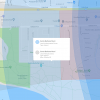
2019-01-30 12_02-DJI - Detailed.png2019-01-30 12_01-DJI - Overview.png2019-01-30 11_59-AirMap - Overview.png2019-01-30 11_59-AirMap - Detailed.png
 
I don't know what the current version of G0 4 will allow, but you are only 2 miles from the airport and in the direct flight path of the main runway so it does not look good. Even if you were able to unlock or get permission you will be relying on everything working correctly to keep out of controlled airspace.

Go ahead with the purchase, the Mavics are amazing, just get further away from the airport to fly it.
 
  • Like
Reactions: TMaster87
I am at the edge of a regional airport zone. when I fly at home I stay over my property and below 150 feet. if you fly in the beginner mode at your home you'll be limited to about 100 feet vertical and same horizontal. In this mode, which you should use to learn the aircraft, you should be fine, but without permission and knowledge of the airport controller admins I would do no more at your home.
 
  • Like
Reactions: Jerry and TMaster87
Um, no way would I fly there. Your house is in a really bad spot. Not only are you in Class C airspace, but you are also in direct line with runway 7/25. Checking the sectional chart shows that the inner ring is Class C from Surface to 4000 and then an outer ring from 1500 to 4000 AGL. You also have glider operations in the area.

Personally I would not take the risk even if I were able to get tower clearance. It's much safer and prudent to just go fly in a different area.
 
  • Like
Reactions: dawgpilot
Here is the FAA UAS Facility map for your area. This map can be accessed here: UAS Facility Maps
This is from the notes on this page and the FAQs.
UAS Facility Maps show the maximum altitudes around airports where the FAA may authorize part 107 UAS operations without additional safety analysis. The maps should be used to inform requests for part 107 airspace authorizations and waivers in controlled airspace. NOTE: These maps DO NOT authorize operations in these areas at the depicted altitudes – they are for informational purposes ONLY. Operators must still apply to operate in controlled airspace (Class B, C, D, or surface area E) by completing a Part 107 Airspace Authorization or Waiver Application in the FAA DroneZone.

Since you plan on flying recreationally, not Part 107, this is from the FAQ
Does the 5-mile notification requirement still apply for recreational UAS operators who want to fly near airports?
Yes. Hobbyists and recreational operators are still required to notify airport operators and the air traffic control facility (if present) prior to operating within 5 miles of an airport.
After notification, hobbyists may want to operate at or below the altitudes displayed on the UASFMs to ensure they stay well clear of manned aircraft
.

I would take ignore the "may" in the last sentence and always operate below the altitude shown, 200 feet in your case

goleta_FAA_grid.PNG
 
Um, no way would I fly there. Your house is in a really bad spot. Not only are you in Class C airspace, but you are also in direct line with runway 7/25. Checking the sectional chart shows that the inner ring is Class C from Surface to 4000 and then an outer ring from 1500 to 4000 AGL. You also have glider operations in the area.

Personally I would not take the risk even if I were able to get tower clearance. It's much safer and prudent to just go fly in a different area.

@PhantomFandom Thanks for the info. When you say "checking the sectional chart", what do you mean? Is there a different view on one of the maps that I can get to to get more detailed info?
Also, I didn't really give this context in the original post, but all I was hoping to be able to do at this location was short, low elevation flights to learn the drone. A lot more convenient to learn if you don't have to physically go somewhere else every time you want to do some practice.
Thanks again for the info.
 
Here is the FAA UAS Facility map for your area. This map can be accessed here: UAS Facility Maps
This is from the notes on this page and the FAQs.
UAS Facility Maps show the maximum altitudes around airports where the FAA may authorize part 107 UAS operations without additional safety analysis. The maps should be used to inform requests for part 107 airspace authorizations and waivers in controlled airspace. NOTE: These maps DO NOT authorize operations in these areas at the depicted altitudes – they are for informational purposes ONLY. Operators must still apply to operate in controlled airspace (Class B, C, D, or surface area E) by completing a Part 107 Airspace Authorization or Waiver Application in the FAA DroneZone.

Since you plan on flying recreationally, not Part 107, this is from the FAQ
Does the 5-mile notification requirement still apply for recreational UAS operators who want to fly near airports?
Yes. Hobbyists and recreational operators are still required to notify airport operators and the air traffic control facility (if present) prior to operating within 5 miles of an airport.
After notification, hobbyists may want to operate at or below the altitudes displayed on the UASFMs to ensure they stay well clear of manned aircraft
.

I would take ignore the "may" in the last sentence and always operate below the altitude shown, 200 feet in your case

@kadras Thanks for the link and detailed info, appreciate it.
Per UAS Data Exchange (LAANC) , am I correct in assuming that the notification requirement is conducted through self-unlock via the DJI app (or AirMap app)? And I don't need to additionally contact the airport in a different manner. (SBA airport does participate in LAANC)
Thanks
 
The VFR Sectional Chart is what pilots (under visual flight rules) use to navigate and check airspace restrictions. Pilots are required to carry them when flying. You can view the charts online in many places, but one good source is vfrmap.com.

I understand that you want to stay low and just learn but:
  • Surface to 4,000 AGL means just that...restricted from the SURFACE
  • What happens if (especially as a novice) you make a mistake, get disoriented, lose control of the drone, or any one of a thousand other scenarios occur that causes the Mavic to drift into the flight path of an airplane or glider?
  • In any case you will need to advise the tower every time you fly, and always stay below 200 feet as mentioned by @kadras
  • When you are learning, you are likely at your most vulnerable and dangerous. Mistakes happen. Losing a drone is sad but you can survive that. Causing an incident/collision with an airplane or glider is tragic.
Just my $.02
 
I agree and would like to say it is nice to see an honest, factual reply answering a question! Nice post!

The VFR Sectional Chart is what pilots (under visual flight rules) use to navigate and check airspace restrictions. Pilots are required to carry them when flying. You can view the charts online in many places, but one good source is vfrmap.com.

I understand that you want to stay low and just learn but:
  • Surface to 4,000 AGL means just that...restricted from the SURFACE
  • What happens if (especially as a novice) you make a mistake, get disoriented, lose control of the drone, or any one of a thousand other scenarios occur that causes the Mavic to drift into the flight path of an airplane or glider?
  • In any case you will need to advise the tower every time you fly, and always stay below 200 feet as mentioned by @kadras
  • When you are learning, you are likely at your most vulnerable and dangerous. Mistakes happen. Losing a drone is sad but you can survive that. Causing an incident/collision with an airplane or glider is tragic.
Just my $.02
 
  • Like
Reactions: PhantomFandom
@PhantomFandom Thanks for the info. When you say "checking the sectional chart", what do you mean? Is there a different view on one of the maps that I can get to to get more detailed info?
Also, I didn't really give this context in the original post, but all I was hoping to be able to do at this location was short, low elevation flights to learn the drone. A lot more convenient to learn if you don't have to physically go somewhere else every time you want to do some practice.
Thanks again for the info.
The VFR Sectional Chart is THE chart that should be consulted to determine what airspace you will be flying in or near, and what air traffic you could expect to encounter. It is to your benefit to learn how to interpret these. FYI, the LAANC system is not designed for hobbyists. It is for Part 107 certified individuals who which to fly commercially in controlled airspace near an airport. As stated above by PhantomFandom, the airspace immediately surrounding the airport starts at ground level, so as soon as you lift off you are actually flying directly in controlled airspace. All of that aside, if you are in a DJI "authorization zone", you can unlock it and fly, but you still need to notify the airport of your flight. Unlocking through DJI does NOT notify the airport.

capture_001_30012019_192335.jpg
 
Hey everyone,

I'm hoping to purchase a mavic shortly, but would like to know if I'll be able to fly it at / around my house (for fun, not commercial). Unfortunately I'm located pretty close to an airport, so I'm in some zones associated with it but not others. I've looked at the location on both airmaps and the DJI geo-map, but I'm unsure of what the implications of the various zones are.
Can I fly just with height restrictions? Can I use self-unlock and be fine? Or is the authorization required going to be impossible to get and I won't be able to fly at all?
Please see attached images from AirMaps and DJI Geo-maps for details. (The mouse pointer is placed at my location on the overview map shots)

Thanks for the help.

View attachment 61099View attachment 61100View attachment 61101View attachment 61102

You can download a program called "airmap". That will be easier for you to read as compared to the FAA Sectionals which take some understanding. You should still learn to read the sectionals and that's important. However, airmap is an excellent free program to stay clear of important airport areas and their 5-mile radius. In those airport zones the restrictions go to the surface and you should not fly in them.
 
You can download a program called "airmap". That will be easier for you to read as compared to the FAA Sectionals which take some understanding. You should still learn to read the sectionals and that's important. However, airmap is an excellent free program to stay clear of important airport areas and their 5-mile radius. In those airport zones the restrictions go to the surface and you should not fly in them.
He is already using AirMap. The last picture in his post is directly from AirMap.
 
He is already using AirMap. The last picture in his post is directly from AirMap.

Thank, I did not see the images and was just reading the text. Thank you for the clarification. That's all he needs along with got app. I just don't see the need for flying in airport areas.
 
Where Can I Fly?

https://www.faa.gov/uas/recreational_fliers/where_can_i_fly/airspace_restrictions/

Flying Near Airports

Flying Near Airports

Generally, drone operators should avoid flying near airports because of other air traffic. It is very difficult for other aircraft to see and avoid a drone while flying, and drone operators are responsible for any safety hazard their drone creates in an airport environment.

Option 1: If you have a Remote Pilot Certificate and are following part 107 rules, you must get permission from air traffic control to fly in controlled airspace. The FAA can grant permission two different ways – LAANC or DroneZone.

Option 2: If you are flying with a model aeroclub organization following the Special Rule for Model Aircraft, you must notify the airport operator and air traffic control tower to fly within 5 miles of an airport.

Option 3: If you are a public entity (law enforcement or government agency), the FAA may issue you special permission to fly in a designated location near an airport. For more information about the requirements for law enforcement and government drone operations here.


You do the reading!!

You live in a very busy area!

If you choose to fly, I would recommend max AGL of 50 feet
 
Nope, if you live in a NFZ you will be grounded. Unless you want go through the rigor moral of supplying all of your personal info to the FAA and the airport so you can then ask permission to fly after you submit your flight plan, even if you’d like to test your UAV in your living room in your house on your property.
I own lots of guns. I’ve bought every one of them legally, in the state with the most strict gun laws in the nation.....California. The process to purchase every gun, getting background checked by the DOJ, fingerprinted, tested and then tested again , was much easier than this ridiculous rules/process is to fly my toy. Guns can easily kill people, DJI’s UAV’s do not. What a joke
 
  • Like
Reactions: Dril
Lycus Tech Mavic Air 3 Case

DJI Drone Deals

New Threads

Forum statistics

Threads
131,076
Messages
1,559,582
Members
160,057
Latest member
Rui S