Hi,
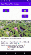
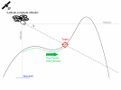
It's a great weekend to get out and fly, so accordingly we've released some more free updates for you all for OpenAthena. The app allows you to locate anything within any single drone image, turning what's usually a complex mapping task into a simple, quick action:

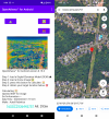
Our latest update for iOS and Android adds support for the DJI Mini 4 Pro. It also features significant accuracy improvements, bugfixes, and even enhanced support for various thermal camera models:

We can't wait to see what you can do with this software! The possibilities are limitless.
Link for OpenAthena iOS:
OpenAthena
Link for OpenAthena for Android:
OpenAthena for Android - Apps on Google Play
As a free and open source software project, we're interested in the community's thoughts and feedback, both to improve the product and ensure good compatibility with a wide range of devices. This forum, or our email at [email protected] are great ways to reach out to us. We also take user reports and Pull Requests on our GitHub page:
Theta Limited
While we aim to support as many devices as possible, images from the following drone models do not work with our software:
It's a great weekend to get out and fly, so accordingly we've released some more free updates for you all for OpenAthena. The app allows you to locate anything within any single drone image, turning what's usually a complex mapping task into a simple, quick action:

Our latest update for iOS and Android adds support for the DJI Mini 4 Pro. It also features significant accuracy improvements, bugfixes, and even enhanced support for various thermal camera models:

We can't wait to see what you can do with this software! The possibilities are limitless.
Link for OpenAthena iOS:
OpenAthena
Link for OpenAthena for Android:
OpenAthena for Android - Apps on Google Play
As a free and open source software project, we're interested in the community's thoughts and feedback, both to improve the product and ensure good compatibility with a wide range of devices. This forum, or our email at [email protected] are great ways to reach out to us. We also take user reports and Pull Requests on our GitHub page:
Theta Limited
While we aim to support as many devices as possible, images from the following drone models do not work with our software:
- DJI Phantom 4 (not inc. Pro or Advanced versions, FC330 only)
- DJI Mini 2
- DJI Mini 3 (not inc. Pro version)
- DJI Air 2 S


