DJI Mavic, Air and Mini Drones
Friendly, Helpful & Knowledgeable Community
Join Us Now

Suggestion to DJI.. Min Alt Setting..

vandemonian

Active Member
Joined
Oct 24, 2021
Messages
36
Reactions
53
Location
Hobart, Tas, AUST
I made a suggestion during a recent DJI survey request after a Care Refresh replacement and wanted to canvas folks here with my idea..

I suggested a firmware addition in settings for the pilot to set an alert if you tried to fly lower than a pre-set minimum altitude.. much the same as the Max Alt / Max Dist setting...

It would also offer an override option where you could acknowledge the limit and fly lower or land but you would receive an audible or haptic feedback prior to allowing the drone to descend.. this would prevent an unwanted descent while trying to fly visual where distance might cause some loss of height perspective and the possibility of a crash or loss. (this is not about (downward) obstacle avoidance etc because there are times OA doesn't work like over water and uniform surfaces).

In my own case; I was flying a (long distant but visual) "C" shaped course and had just lost clear vision so started my turn to return to HP but during the turn back I was also unwittingly decreasing throttle but without looking at the screen to see the reducing Alt or the approaching water I was set for disaster.. if there was an alert to "Check Alt" or "Minimum Alt Reached" (the same as Max dist / Alt alert) I would have been pre-warned and averted the crash (splash).. Sure - I could have pressed RTH and waited until the drone appeared in sight but that's not why I fly a drone..

Any thoughts?

Chris
 
  • Wow
Reactions: LoudThunder
@vandemonian ,although your idea sounds wonderful, unfortunately our drones do not contain an altimeter ,once airborne they only know their height above the take off point ,not the actual height above the ground where they happen to be during flight,
 
I think it's not a bad idea but it would need to
a) be possible to switch it on and off and
b) complete control over the height that could be set or at least it should permit setting heights in the signal digit ft range, it would need to
c) include negative heights yet exclude the landing protection range 0 to 0.5m. (VPS detected height only.)

What sensed height should it use, barometric or VPS or the lower of both etc. and what happens when flying over undulating terrain?
 
Last edited:
It sounds like a good idea. Even an alert that warns about going below the take off point would be at least somewhat useful. Of course the negative altitude is shown but it’s easily overlooked.
 
With Maven, a 3rd party app for iOS, one of its many features is a Virtual Polygonal Geofence (VPG). You can set up a customizable flying area and also minimum and maximum flying altitudes alone with max climb/descend and speed rates.
Check out Maven and all its other features like waypoints, cablecam HERE
Wouldn’t that require an SDK for recent drones to be in effect?
 
  • Like
Reactions: LoudThunder
I fly lots from high log landings which are higher than the homepoint so I’ve learn to watch my negate hight on my screen as well as my screen. I always keep my camera pointed down seversl degrees so I dont hit the treetops or ground. i also fly over water lots. Keeping my camera pointed down helps. It might look like I’m to close to the water or whatever I’m actually several feet above it.
Just the way I fly. Over water it might in video look like I’m inches but actually several feet. guess it just takes lots of flying to get used to it.
 
Wouldn’t that require an SDK for recent drones to be in effect?
Yes an SDK is required for 3rd party apps. The OP didn't mention what he was flying. Check the above link to Maven for the DJI drones it supports. It's a great app with lots of features. It took my Mini 1 to a whole new level that still surpasses many features in my Mini 3 Pro.
 
  • Like
Reactions: LoudThunder
I think I've flown a little below take off point and it doesn't try to land unless I hold it down, but the sensor doesn't quite keep up or read as accurately as you think. It doesn't look like it is as high as it says it is. Typically not a good idea to fly too much below takeoff point as it implies that it is probably flying behind terrain.
 
  • Like
Reactions: LoudThunder
Bull ,I flown way below my home point. And it don’t matter.
Edit. … I’ll try ad go out in the morning if I can and shoot yo a screen shot.
 
Last edited:
You people talk with out knowing what your talking about kill me. 🙄
 
I’ve flown well below my takeoff with my Mav3 and FPV but don’t think I’ve done so with my Mini 3Pro or new Avata so we’ll see when the time comes.
 
  • Like
Reactions: LoudThunder
As long as it maintains some sort of rc link you should be okay. Not sure I'd go droning in the grand canyon (there maybe restrictions against doing that already), just in case the signal bounces around all over the place.
 
Thanks for the replies and generally positive feedback.. for the interested I fly an Air 2S.

My idea is mostly about flying at a height that you don't want to descend any lower because there is a risk beneath that level. We're all supposed to be VLOS so can't be glued to an alti. and at long distance that you can still see the drone and avoid people etc but height is difficult to assess especially if you're at a higher elevation than the aircraft.

In my case I took off from a small raised outcrop and descended to about 3M above the water and 2.5M below T.O.P.

I flew a bit of back and forth / side to side positioning and height adjustment to get the frame correct and got ready for the video run down the bay. I still had good visual at 400M but looking at the screen the water looked really close and I did add some elevation but a little while later I unconsciously descended too close and next thing I was underwater. Yes it was pilot error and I wrote along story about retrieving it some weeks ago..

But: If I could have set the "Do Not Descend Lower" Alarm to the level I had determined in my "framing" and had got the alarm during the flight and subsequent return that I had reduced height I would have still had safety margin for the stick input error that caused my crash (splash).

The alert level would have to be relative to T.O.P e.g.: TOP -3M = Alarm, or TOP +3M = Alarm. and the confirmation required "Do you want to descend lower than this previously set point?" Like cancelling the collision avoidance - when you do that, its all on you. It would just be an aid to flying especially while trying to shoot smooth video.

Anyway, blue skies, folks.

Chris.
 
  • Wow
Reactions: LoudThunder
Bull ,I flown way below my home point. And it don’t matter.
Edit. … I’ll try ad go out in the morning if I can and shoot yo a screen shot.
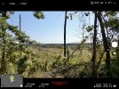
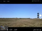
Sorry for late response but been bad windy. They had gated of the log landing so just found a opening on road and went from there and took a couple of screen shots
.0852FB89-953B-45D4-AE30-6F1034225740.jpegB5834B03-70FD-4388-9407-A5D50551B0CA.jpeg
 
My idea is mostly about flying at a height that you don't want to descend any lower because there is a risk beneath that level. We're all supposed to be VLOS so can't be glued to an alti. and at long distance that you can still see the drone and avoid people etc but height is difficult to assess especially if you're at a higher elevation than the aircraft.

Chris.

The first response in post #2 by @old man mavic says it all.

These drones do not have the capability to do anything like what you envision nor will they ever. As with all of the safety features such as vision sensors, sonar, cameras and whatever else - these are not capable of keeping your drone 100% safe in leu of a pilot being keenly aware of their drones' surroundings.

Not to turn this thread into a VLOS discussion (there are 100s already), but VLOS does not require you to stare at the drone constantly. In your case, a quick look around with the camera could/should have been performed to make the determination that your drone was close to the ground.

I do real estate photography and many times, to get the shot we have to place our cameras (drone), in places like between branches under trees, between powerlines or next to other structures and more just to get the framing right - without seeing the obstruction we are flying next to. There is simply no tech I would trust to do this currently on any commercial drone, indeed the current tech would prohibit and limit my access - so for this reason we never use any OA other than what our owns eyes can see directly or through the camera, and sometimes both.

Eye.jpg
 
The downward vision sensors also don't like seeing water. They become fatally attracted to it. So you have turn off downward sensors when flying over water during times when the vision sensors are engaged (30 feet or below).
 
took a couple of screen shots
My Mini2 with the DJI Fly App does not give such a warning. In your signature, it says you are now flying a DJI Mini 3. Did that RED Warning, "Downward 6.5 ft" come from the Mini 3's Fly App, some additional software you may be using (like Litchi), or did you edit your photo to show the distance?
 
  • Like
Reactions: dirkclod
My Mini2 with the DJI Fly App does not give such a warning. In your signature, it says you are now flying a DJI Mini 3. Did that RED Warning, "Downward 6.5 ft" come from the Mini 3's Fly App, some additional software you may be using (like Litchi), or did you edit your photo to show the distance?
The Mini 2 doesn't give such reports. Its downward-facing sensors are much more limited. With the Mini 3 Pro yes that will be being displayed by DJI Fly.
 
Lycus Tech Mavic Air 3 Case

DJI Drone Deals

New Threads

Forum statistics

Threads
131,647
Messages
1,564,900
Members
160,515
Latest member
Arm1