AMann's latest activity
-
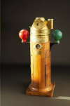
 AMann replied to the thread EMI canceling / shielded landing pad?.Good info, thanks for posting it! I also have a flux gate compass (magnetometer) on my boat and calibrating it (to the boat) is fun - you have to steer in a S-shaped course to do it. Remember when ship compasses had these for calibration?
 -
 AMann replied to the thread Air 3 Scotland's abandoned shopping village.I just looked up “shale bings” and had no idea the 5 Sisters were man-made. They look pretty natural with trees at their base and a lot of grass and other vegetation on them, guess Mother Nature comes back pretty fast as they are over 100 years...
 -
 AMann reacted to Coconut Island Drones's post in the thread Air 3 Scotland's abandoned shopping village with
 Like.
Thank you. The cone shaped hills are known as 'the 5 sisters'. They are shale bings. I was going to fly around them today but didn't have enough battery left so I'll get back to them soon.
 -
 AMann replied to the thread Air 3 Scotland's abandoned shopping village.Interesting, good flying too. What I’m also really interested in are those cone-shaped hills at the 0:55 mark. Can you do a movie of flying over and around those? They look fascinating!
 -
 AMann reacted to anotherlab's post in the thread Anyone ever try using a government bid site for drones? with
 Like.
I don't think that is always the case, but it can be a requirement for a specific agency. The Federal requirements are defined by NIST SP 800-88, and one option is to overwrite the data to eliminate recovery. That allows the media to be reused.


