


Recent content by tiltedviewsbykyle
-

Mavic 2 Pro Rid Module
We all know that the DJI geozones are not entirely accurate. I've flown mapping projects where their geozone intrudes just a tiny sliver into of the back of the properties. This creates a MAJOR issue when trying to complete a portion of the last leg of the mission. I could either use my parrot...- tiltedviewsbykyle
- Post #5
- Forum: Mavic 2 Pro
-
Mavic 2 Pro Rid Module
I'm using Dronehacks on my M2P and have had no issues since upgrading to recent firmware.- tiltedviewsbykyle
- Post #3
- Forum: Mavic 2 Pro
-
Hello from Virginia
Welcome from Va. Beach. I fly plenty around here...haven't flown in Suffolk.- tiltedviewsbykyle
- Post #17
- Forum: Pilot Check In
-
Lack of GPS in tight spaces can ruin a gig
You're not going to have much luck in "urban canyons" obtaining enough GPS SVs. Proper satellite geometry is crucial and the buildings block that.- tiltedviewsbykyle
- Post #3
- Forum: Firmware & Software
-
How to reset remote Mavic 2
Try this.... how to bind controller- tiltedviewsbykyle
- Post #15
- Forum: Mavic 2
-
Sat Lock App?
The number of SVs (satellites) does not necessarily mean accuracy. The DOPs (Dilution Of Precision) are the other main items to evaluate. There may be plenty of SVs, but the geometry is weak. There's usually once a day where the DOP values are high therefore the accuracy is low. The GPS apps...- tiltedviewsbykyle
- Post #11
- Forum: Control Apps - DJI, Litchi, Autopilot, etc...
-
Best time of day for strongest GPS Signals?
Here is a link to planning your mission around the GNSS availability. Trimble GNSS Planning Tool. I recommend setting your elevation mask to 15° as anything below that can cause some discrepancies due to poor geometry and atmospheric refraction. Water and other reflective surfaces can cause...- tiltedviewsbykyle
- Post #14
- Forum: General Discussions
-
Hello from Virginia Beach
Welcome to the forum from a fellow VaBeach drone enthusiast. Great Chic's Beach video!- tiltedviewsbykyle
- Post #10
- Forum: Pilot Check In
-
Newbie from Virginia
The area is just outside a warning/restricted zone from the aviation museum and I never have problems except on some weekends. The planes sometimes fly below 400ft even with high visibility. I fly out past Pungo Ferry bridge towards Moyock. Mt Trashmore is okay but not much scenery and sometimes...- tiltedviewsbykyle
- Post #18
- Forum: Pilot Check In
-
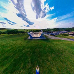
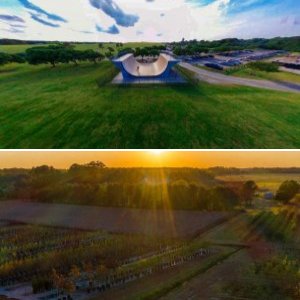
Mt Trashmore skate session.jpg
- tiltedviewsbykyle
- Media item
- Comments: 0
- Album: Virginia Beach, VA
-
-
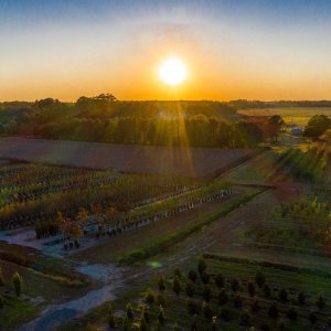
Sunset over tree farm.jpg
- tiltedviewsbykyle
- Media item
- Comments: 0
- Album: Virginia Beach, VA
-
Newbie from Virginia
I have a place out in Creeds in Va Beach that has several wide-open acres that I go to for distance flights.- tiltedviewsbykyle
- Post #16
- Forum: Pilot Check In
-
Newbie from Virginia
I have found a few spots in the area. Using Airmap and B4UFLY apps help. Chicks Beach, Mt. Trashmore, Sandbridge, sometimes the oceanfront and out past Creeds towards Moyock are a few places. There are minor gaps that allow flying here and there. I live right outside of Oceana so I know the...- tiltedviewsbykyle
- Post #13
- Forum: Pilot Check In
-
Newbie from Virginia
Virginia Beach area myself. Hit me up if in this area.- tiltedviewsbykyle
- Post #11
- Forum: Pilot Check In