You are using an out of date browser. It may not display this or other websites correctly.
You should upgrade or use an alternative browser.
You should upgrade or use an alternative browser.
Above the 400' threshold
- Thread starter hedbonker
- Start date
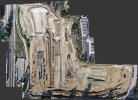
There are more ways to skin a cat.I have a construction site that is too large for me to get a complete overhead shot of it at 400'. Need to get up higher for the shot...
Here's a 33 acre site shot from 320 feet.

brett8883
Well-Known Member
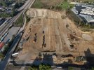
No, you cannot use LAANC to receive authorization to fly over 400’. You’d need a waiver which you can apply for in the Drone Zone portal on the FAA website. It is a long process with no guarantee it will be accepted.Is it possible to get an LAANC to get permission to fly above 400'? I have a construction site that is too large for me to get a complete overhead shot of it at 400'. Need to get up higher for the shot... This image is at 400'View attachment 168557
With an Air 3, what I would do is try to do a manual mapping flight. You’d fly in a grid pattern and take multiple overlapping photos so that they can be stitched together on your computer or using a mapping service. Kinda like a panorama but with the camera pointed straight down. I use PTGui for a lot of this stuff if it’s just the photo I’m interested in but you could use a service like Maps Made Easy which lets you pay as you go instead of buying the software or paying a monthly fee.
Thanks Brett. Maps Made Easy looks like the perfect solution.No, you cannot use LAANC to receive authorization to fly over 400’. You’d need a waiver which you can apply for in the Drone Zone portal on the FAA website. It is a long process with no guarantee it will be accepted.
With an Air 3, what I would do is try to do a manual mapping flight. You’d fly in a grid pattern and take multiple overlapping photos so that they can be stitched together on your computer or using a mapping service. Kinda like a panorama but with the camera pointed straight down. I use PTGui for a lot of this stuff if it’s just the photo I’m interested in but you could use a service like Maps Made Easy which lets you pay as you go instead of buying the software or paying a monthly fee.
Ok, how'd you do that?There are more ways to skin a cat.
Here's a 33 acre site shot from 320 feet.

I created an orthophoto mosaic from 300 images shot with large overlaps, using a drone mapping app.Ok, how'd you do that?
The full image is huge and has great detail.
Here's a much simpler implementation of the same principle.
The ship is 1150 feet long.
I couldn't fly high enough to capture its full length, so I captured four images as I flew over the subject, ensuring a good overlap for stitching.
Then stitched them using a planar projection.

Click on the bottom image to see a larger version.

Last edited:
What tool did you use to stitch the images? What is a planar projection?I created an orthophoto mosaic from 300 images shot with large overlaps, using a drone mapping app.
The full image is huge and has great detail.
Here's a much simpler implementation of the same principle.
The ship is 1150 feet long.
I couldn't fly high enough to capture its full length, so I captured four images as I flew over the subject, ensuring a good overlap for stitching.
Then stitched them using a planar projection.

Click on the bottom image to see a larger version.

The construction site was stitched in Metashape, the ship was done with Autopano Giga.What tool did you use to stitch the images? What is a planar projection?
There are several different projections that can be used in image stitching.
Planar projection is the one to use where the camera/drone moves along the plane of the image, capturing images from different locations on that plane.
Going to try this with Hugin tomorrow after I shoot some orthographic images to work with.

Thanks Meta4The construction site was stitched in Metashape, the ship was done with Autopano Giga.
There are several different projections that can be used in image stitching.
Planar projection is the one to use where the camera/drone moves along the plane of the image, capturing images from different locations on that plane.
MavicShooter
Member
Another option too is to do a pano with the gimbal tilted all the way down. Only works with vertical-panos and “wide angle(9-shot)” panos
Nice stuff, thanks!I created an orthophoto mosaic from 300 images shot with large overlaps, using a drone mapping app.
The full image is huge and has great detail.
Here's a much simpler implementation of the same principle.
The ship is 1150 feet long.
I couldn't fly high enough to capture its full length, so I captured four images as I flew over the subject, ensuring a good overlap for stitching.
Then stitched them using a planar projection.

Click on the bottom image to see a larger version.

I returned to the site and canvased it from 380'. It's about 18 acres and I ended up taking about 25 images. I used my Air 3 to do it otherwise I would have used Maps Made Easy's app.The construction site was stitched in Metashape, the ship was done with Autopano Giga.
There are several different projections that can be used in image stitching.
Planar projection is the one to use where the camera/drone moves along the plane of the image, capturing images from different locations on that plane.
I took that into Photoshop and had it do a merge on the image set and it actually created a pretty decent final output. It took it a long time to do it which did not surprise me to be honest. But I wanted to try AutoPano Giga. For anyone else interested in it, the company that made it is out of business now but you can still download it and they give away a free full license to use it so that's nice. You can get it here:
AutoPano Giga is Now Free - HDRMAPS™
So I downloaded AutoPano Giga and installed it on my Win10 system but it would crash as soon as I imported any photos. So I installed it on my Windows 7 system and it worked like a charm. Thanks for cluing me in to this app - It does a decent job and is MUCH faster than Photoshop. Here is the image it produced:

brett8883
Well-Known Member
Nice! Just for the record you could have uploaded the images to maps made easy even if you don’t take the images with the app. Doing it that way it uses the embedded GPS data to arrange the images so it’s more sure fire to get a good stitch rather than just relying on matching up the pixels like in photoshop or other pano apps. Looks like you got a good stitch anyway on this one but just fyi in the future if other methods don’t work as wellI returned to the site and canvased it from 380'. It's about 18 acres and I ended up taking about 25 images. I used my Air 3 to do it otherwise I would have used Maps Made Easy's app.
I took that into Photoshop and had it do a merge on the image set and it actually created a pretty decent final output. It took it a long time to do it which did not surprise me to be honest. But I wanted to try AutoPano Giga. For anyone else interested in it, the company that made it is out of business now but you can still download it and they give away a free full license to use it so that's nice. You can get it here:
AutoPano Giga is Now Free - HDRMAPS™
So I downloaded AutoPano Giga and installed it on my Win10 system but it would crash as soon as I imported any photos. So I installed it on my Windows 7 system and it worked like a charm. Thanks for cluing me in to this app - It does a decent job and is MUCH faster than Photoshop. Here is the image it produced:
View attachment 168911
Thanks Brett. I plan to go back and re-shoot it with my Phantom using the Map Pilot Pro application and then use Maps Made Easy to generate a GeoTIFF. It's 245 images in the mission that I plotted so it actually falls JUST under their threshold where they will want points and a subsequent fee to process it. Once I have the GeoTIFF I will load that into Google Earth Pro to test it all out.Nice! Just for the record you could have uploaded the images to maps made easy even if you don’t take the images with the app. Doing it that way it uses the embedded GPS data to arrange the images so it’s more sure fire to get a good stitch rather than just relying on matching up the pixels like in photoshop or other pano apps. Looks like you got a good stitch anyway on this one but just fyi in the future if other methods don’t work as well
Please post back here and let us know how it all goesThanks Brett. I plan to go back and re-shoot it with my Phantom using the Map Pilot Pro application and then use Maps Made Easy to generate a GeoTIFF. It's 245 images in the mission that I plotted so it actually falls JUST under their threshold where they will want points and a subsequent fee to process it. Once I have the GeoTIFF I will load that into Google Earth Pro to test it all out.
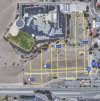
Just a tipYou bet. Just as a point of interest, this is. the sloppy path I flew for that image:
View attachment 168913
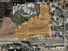
This is the path that the app will fly:
View attachment 168914
If you want sharp imagery to the edge of your site, you will need the grid to go past the site boundaries to make sure that the edges of your site appear in at least two images, not just one.
Not sure what's going on there.So I downloaded AutoPano Giga and installed it on my Win10 system but it would crash as soon as I imported any photos.
I've been using it on Windows 10 for years without any problems.
Thank you sir!Just a tip
If you want sharp imagery to the edge of your site, you will need the grid to go past the site boundaries to make sure that the edges of your site appear in at least two images, not just one.
Similar threads
- Replies
- 6
- Views
- 1K
- Replies
- 7
- Views
- 918
- Replies
- 3
- Views
- 355
DJI Drone Deals
New Threads
-
Air 3 Stirling Castle on a cold & slightly misty night
- Started by Coconut Island Drones
- Replies: 0
-
Air 3 Kite Surfing Fuerteventura / Luna Landscape New Version
- Started by Pacefast
- Replies: 0
-
-
-


