Hi,
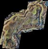
I need to create high resolution aerial photo of my piece of land. It is some 250x250 meters. I have Mavic Mini, what I want - send it along some route, take shots every 10 meters and then glue them into one image by cutting overlapping parts to decrease distortion. Is there some software that can help to automate the process? I believe it is nightmare to process 625 photos in Photoshop barehanded...
I need to create high resolution aerial photo of my piece of land. It is some 250x250 meters. I have Mavic Mini, what I want - send it along some route, take shots every 10 meters and then glue them into one image by cutting overlapping parts to decrease distortion. Is there some software that can help to automate the process? I believe it is nightmare to process 625 photos in Photoshop barehanded...