DJI Mavic, Air and Mini Drones
Friendly, Helpful & Knowledgeable Community
Join Us Now

DJI fly spots and recommended zone

Moving Zen

Well-Known Member
Joined
Feb 20, 2018
Messages
66
Reactions
37
I live in Charleston Sc and do a lot of fishing in the area. I usually take my drone with me for the occasions I want to check out an area I can't get to because of depth concerns. Anyway, I was in the harbor and wanted to take some pictures of Ft. Sumter. I knew it to be a national monument so I checked both fly spots and recommended zone for issues and neither showed any sort of restrictions. I kept a set back and took my picture, brought the drone back down and continued on my way. easy peasy. Now here I am a month or so later and I'm using b4ufly on my computer because I don't have my phone with me to check out another spot in the harbor I want to fly. Bam, I notice a huge red box around Ft. Sumter and here I am with a picture that I might have taken in a no fly zone. I can't really say that I did because I don't know exactly where the box ends or exactly where I had the drone when I took the picture. How am I supposed to deal with that? I know I can't trust the DJI app anymore that's for sure. I'm just kinda surprised that an FAA no fly zone isn't even marked in either of those maps. What are you guys using for your fly maps? Is the b4ufly app the be all end all when it comes to marking restricted areas? I seriously don't want to run into this issue again.
 
If it was really in a no-fly zone, I'm sure the Fly-Safe database wouldn't have allowed you inside. Perhaps it's a temporary no-fly zone for an event or you didn't get close enough to the box. If it's a National Park, you just aren't allowed to take off from inside the boundaries but there's nothing to keep you from overflying it. I would use Aloft before flight to ensure you're not violating any airspace restrictions.
 
If it was really in a no-fly zone, I'm sure the Fly-Safe database wouldn't have allowed you inside. Perhaps it's a temporary no-fly zone for an event or you didn't get close enough to the box. If it's a National Park, you just aren't allowed to take off from inside the boundaries but there's nothing to keep you from overflying it. I would use Aloft before flight to ensure you're not violating any airspace restrictions.
As stated above - Ft Sumter "IS" a National Park and taking off or landing would be prohibited and FlyApp would tell you so. Been there, done that - not at Ft Sumter, but at Gateway Arch. I have flown in Charleston with no issues before as well.

If you were out on a boat in the harbor and flew "to" Ft Sumter - there is no issue and you probably should have gotten a warning if you flew directly in the "airspace" that surrounds it. Doesn't mean you can't fly over it - the warnings are just there to alert you should you have to land in that zone.

Seriously doubt the FAA / NPS is going to come after you for taking a pic of Ft Sumter esp if outside the "zone" that is it's official space.

Using Apps is great and help you know where they are prior to taking off for any restricted or No Fly Zone. I live near both the Great smoky Mtns and Blue Ridge Parkway and have flown over the Parkway with no issues. I have flown on the outer edges of what the maps show at the Smoky Mtns taking shots of Gatlinburg, but was not officially on park property; so no foul there. Even the FlyApp did not register an issue based on GPS of where I was located. The maps in some Apps seem to go outside the official lines of what may be NPS or restricted areas.
 
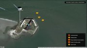
Here's where the drone was when I took the pictures.

Sumter locations.jpg

I didn't fly over the fort because from the view finder I could see people all over the place but from where I was I couldn't see into the fort so I stayed back. The drone wasn't directly over my boat but it was pretty close. Looking at the b4ufly app and the above, it looks like I was actually in a no fly zone. I'm not happy about that at all. I'm pretty surprised neither of the DJI flight tools has any sort of zone there. It really sucks to think you're doing due diligence only to be very wrong. So I wont be relying on the DJI flight tools anymore and will use b4ufly from here on out. But, is the b4ufly app considered the bible or is there another app that's more comprehensive? I don't even care if it's a paid app, I do not want to run into this issue ever again.
 
Here's where the drone was when I took the pictures.

View attachment 131359

I didn't fly over the fort because from the view finder I could see people all over the place but from where I was I couldn't see into the fort so I stayed back. The drone wasn't directly over my boat but it was pretty close. Looking at the b4ufly app and the above, it looks like I was actually in a no fly zone. I'm not happy about that at all. I'm pretty surprised neither of the DJI flight tools has any sort of zone there. It really sucks to think you're doing due diligence only to be very wrong. So I wont be relying on the DJI flight tools anymore and will use b4ufly from here on out. But, is the b4ufly app considered the bible or is there another app that's more comprehensive? I don't even care if it's a paid app, I do not want to run into this issue ever again.
I look at ALOFT - used to be KittyHawk or AirMap.

Typically DJI is far more sensitive than any of the other apps - as many people have issues with DJI's Geo-Fencing and requiring access when maybe it is not necessary.

I looked on AirMap and it shows a pretty big rectangle of space - more to the west / northwest of the actual fort as a "restricted" area. Your spots were right on the fringe of that "restricted" area. No idea why there would be so much space out over open water in Charleston Harbor.

Totally up to you whether you "trust" DJI and it letting you know if you're in a "restricted area" or not. I personally have never had an issue with the FlyApp on either my Mini or Air2 when flying close to or in "zones" that may require authorization prior to take-off or totally not letting me take off at all. I tried to fly my Mini near the St. Louis Gateway Arch. I was not on actual arch proper, but across the street. FlyApp let me take off fine. As I approached the sidewalk of what would be considered "arch space" - the app let me know I WAS entering the NPS restricted zone. Again, as everyone here will tell you - since I DID take off and land outside of that NPS restricted zone - I was not in committing an infraction of the rules. NPS owns the ground, while the FAA owns the airspace, which governs us drone pilots.

So, again - it's YOUR CALL on whether you trust DJI using the FlyApp to warn / notify you of going into restricted airspace or not. The apps like Aloft, AirMap, or B4ufly are fine as well. You have to find what is comfortable / works for you.
I probably will start looking at all of them to be as safe as I can. I agree the size of the restricted rectangle is pretty large and covers water it doesn't seem like it should. Weirdness that I'm still learning. I guess it's lucky for me I learned this way instead of a much harder way. I don't want to be that guy who has an illegal picture on google maps with 130k views. Thanks for the advice fellas!
 
Lycus Tech Mavic Air 3 Case

DJI Drone Deals

Forum statistics

Threads
130,998
Messages
1,558,737
Members
159,984
Latest member
jack_0851