

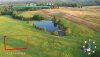
When using the Mavic 2 Pro with DJI GO4 is there a way to include the flight path and compass as they relate to the drones position in the images/videos that are captured by the drone (please see attached image as an example). If this is not possible in DJI GO4 are there other apps that can accommodate this requirement? Thank you.
Flight path & compass in aerial photographs with M2P
- Thread starter FlyingBliss
- Start date
Similar threads


DJI Drone Deals
New Threads
-
 Mini 4 Pro Istanbul where the East meets West - Bosphorus Straits Cruise
- Started by MPone
- Replies: 0
-

-
 DJI MINI 5 PRO QUICK RELEASE 360° PROPELLER GUARD Anybody Tried a set yet
- Started by Dogpilot
- Replies: 4
-

-
