


You are using an out of date browser. It may not display this or other websites correctly.
You should upgrade or use an alternative browser.
You should upgrade or use an alternative browser.
Mav 3 mapping
- Thread starter NobleDrone
- Start date

I was trying to avoid buying a second drone, but may have to.Nothing official yet but could be awhile. I’d recommend a different drone for mapping to be honest.
Me too. I have 6I was trying to avoid buying a second drone, but may have to.

RocketBrew
Well-Known Member
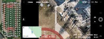
I tried a manual flight to capture map images on a small scale. Processed in Pix4D Cloud (Skyward.io)


Camera Model Name(s) L2D-20c_24.0mmf/2.8_12.3_5272x3948 (RGB)
Average Ground Sampling Distance (GSD) 0.75 cm / 0.30 in
Area Covered 0.010 km2 / 0.9562 ha / 0.00 sq. mi. / 2.3641 acres
Camera Model Name(s) L2D-20c_24.0mmf/2.8_12.3_5272x3948 (RGB)
Average Ground Sampling Distance (GSD) 0.75 cm / 0.30 in
Area Covered 0.010 km2 / 0.9562 ha / 0.00 sq. mi. / 2.3641 acres
Dougcjohn
Well-Known Member
- Joined
- Nov 18, 2017
- Messages
- 969
- Reactions
- 530
- Age
- 67
When you hear the SDK has been released, add a minimum of 2 months before 3rd Party can begin to offer ability for mapping missions. I doubt you'll see the FLY App offer mapping missions for the Mavic3.Has anyone heard when the mapping capabilities will be available for the mavic 3? Need it for my start up business
I'm also looking forward to trying the M3 MFT camera, personally I think it'll provide excellent results... but that's to be determined. From what I've seen in some manual tests, the results should be great!
Other great options would be the P4Pv2, I2 with X4S both for the mechanical shutter. The M2P would provide same autonomous mission capabilities but camera may not be as ideal. The FLY App crafts use the 3rd Party tools a bit different receiving "virtual stick" commands to fly the mission within the app vs Go4app Crafts uploading & processing the mission on-board craft.
Both Go4App and FLY App provide same outcome... a collection of images. Although the smoothness of the mission & waypoints with on-board processing and able to continue mission if disconnected from Radio may be benefits of Go4App crafts.
I personally prefer the I2 X4S or P4Pv2, although I've used my M2P a few times with good results, I haven't tried my Air2S yet; recently added to a few 3rd Party tools with the SDK release.
Another possible, the Autel Crafts: EVO 2 & Lite +, my understanding is their App includes Mapping capabilities. Not sure if fully supported, but I believe they are gaining support by some of the 3rd Party tools too. The reviews are indicating the lower priced Lite+ may even have a better camera payload than the EVO 2 for image quality.
Dougcjohn
Well-Known Member
- Joined
- Nov 18, 2017
- Messages
- 969
- Reactions
- 530
- Age
- 67
That's actually pretty good. You manually triggered while on the move or stopped & shot?I tried a manual flight to capture map images on a small scale. Processed in Pix4D Cloud (Skyward.io)
View attachment 144381 View attachment 144382
Camera Model Name(s) L2D-20c_24.0mmf/2.8_12.3_5272x3948 (RGB)
Average Ground Sampling Distance (GSD) 0.75 cm / 0.30 in
Area Covered 0.010 km2 / 0.9562 ha / 0.00 sq. mi. / 2.3641 acres
How do you feel the detail was... or compared?
Is that a sectional concrete pour on a prepped sand surface?
The use of the M3 Cine SSD probably helps with speed of capture too!
")
Dougcjohn
Well-Known Member
- Joined
- Nov 18, 2017
- Messages
- 969
- Reactions
- 530
- Age
- 67
Can't get real close on the uploaded clips... but further examination, the pylons, tire tracks & metal grid actually look very sharp & clear even for small uploaded pics. That's actually encouraging & impressive!I tried a manual flight to capture map images on a small scale. Processed in Pix4D Cloud (Skyward.io)
View attachment 144381 View attachment 144382
Camera Model Name(s) L2D-20c_24.0mmf/2.8_12.3_5272x3948 (RGB)
Average Ground Sampling Distance (GSD) 0.75 cm / 0.30 in
Area Covered 0.010 km2 / 0.9562 ha / 0.00 sq. mi. / 2.3641 acres
RocketBrew
Well-Known Member
I am not coordinated enough to shoot while moving in a straight line! I stopped with each saw-cut square centered, and this map includes oblique photos all around. I may process again because the obliques didn’t match up well.
The Pix4D Cloud is a new feature on Skyward and still missing a few features, like sharing..,
The Pix4D Cloud is a new feature on Skyward and still missing a few features, like sharing..,
That's actually pretty good. You manually triggered while on the move or stopped & shot?
How do you feel the detail was... or compared?
Is that a sectional concrete pour on a prepped sand surface?
The use of the M3 Cine SSD probably helps with speed of capture too!
vsasolutions
Well-Known Member
- Joined
- Jan 24, 2020
- Messages
- 100
- Reactions
- 83
- Age
- 59
- Location
- St. Augustine Beach
- Site
- vsasolutions.com
Once you buy a second one, then a third one comes, then a fourth....drone crack.I was trying to avoid buying a second drone, but may have to.
Gabriel Arcieri
New Member

Dougcjohn
Well-Known Member
- Joined
- Nov 18, 2017
- Messages
- 969
- Reactions
- 530
- Age
- 67
Great to hear your manual mapping went well.Hoje fiz um levantamento manual com o Mavic
3.Deixei em modo de disparo contínuo (2s)/JPEG/4:3 e fui disparando no modo voo CINE
. de pontos
.Vou continuar o processamento e verificar o produto final
View attachment 144927
Looks good.
By the way, this forum is an English forum. If you'd like comments to your posts, please translate to English for Posts.
Translation of your Post:
Today I did a manual survey with Mavic 3.
I left it in continuous shooting mode (2s)/JPEG/4:3 and fired in CINE flight mode.
of points I will continue processing and check the final product
Great info.......much appreciatedWhen you hear the SDK has been released, add a minimum of 2 months before 3rd Party can begin to offer ability for mapping missions. I doubt you'll see the FLY App offer mapping missions for the Mavic3.
I'm also looking forward to trying the M3 MFT camera, personally I think it'll provide excellent results... but that's to be determined. From what I've seen in some manual tests, the results should be great!
Other great options would be the P4Pv2, I2 with X4S both for the mechanical shutter. The M2P would provide same autonomous mission capabilities but camera may not be as ideal. The FLY App crafts use the 3rd Party tools a bit different receiving "virtual stick" commands to fly the mission within the app vs Go4app Crafts uploading & processing the mission on-board craft.
Both Go4App and FLY App provide same outcome... a collection of images. Although the smoothness of the mission & waypoints with on-board processing and able to continue mission if disconnected from Radio may be benefits of Go4App crafts.
I personally prefer the I2 X4S or P4Pv2, although I've used my M2P a few times with good results, I haven't tried my Air2S yet; recently added to a few 3rd Party tools with the SDK release.
Another possible, the Autel Crafts: EVO 2 & Lite +, my understanding is their App includes Mapping capabilities. Not sure if fully supported, but I believe they are gaining support by some of the 3rd Party tools too. The reviews are indicating the lower priced Lite+ may even have a better camera payload than the EVO 2 for image quality.
Drones are like tattoos. Once you get one, gotta get more. Just saw the Matrice 30 (omg) nice, 10-14 grand. Guess I am buying it once its available for sale. Need that Thermal imaging it offers.Once you buy a second one, then a third one comes, then a fourth....drone crack.
SkyWay Weezel
Member
Until an SDK comes out, here is a site I just found when I was searching how to manually map with a Mavic 3. Looks like it could work well! I'm definitely going to try it.
 www.pix-pro.com
The Mavic 3 for photogrammetry - Manual Nadir Scanning
The Mavic 3 - latest and greatest DJI drone without support for flight planners yet. Learn how to fly manually for photogrammetry purposes.
www.pix-pro.com
Similar threads
- Replies
- 7
- Views
- 736
- Replies
- 1
- Views
- 292
- Replies
- 3
- Views
- 758


DJI Drone Deals
New Threads
-
-
-

-
-
 Air 3 Pebbly Beach - Mid North Coast, Black Head NSW, Ausralia.🦘🇦🇺
- Started by Squidinc
- Replies: 4
Forum statistics
