Hello,
I hope to get some advice one what to purchase as this is a total jungle and I really haven't gotten a clear picture after 2 days of reading even as someone who flies FPV (non DJI drones).
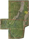
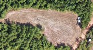
So the situation is that my family has a bit of forest (200hectars/500acres) and we would like to have a better understanding of the damage that is caused to the forest (storms and insects mainly) and would therefor like to map it out somehow. So what I have found out so far is that I have two ways of doing this, manually flying it and making sure to get GPS locations in a SRT file which I can later use to identify where exactly I saw the bad trees or get a drone with SDK support.
Unfortunately this seems to mean I cannot get a mavic 3 pro, air 3 etc but have to stick to either mini 3/pro or mavic 2 pro or air 2s. What I prefer (as someone into open source and coding) is a system that is as open as possible so that I'm not locked down (I know this doesn't go well with the DJI philosophy exactly unfortunately but it is what it is) and with a budget of up to 25000SEK/2300$/€ (but we'd prefer to keep it lower since we don't know know if this will be worth it for us). As for the forest is quite hilly with some mountains and ponds and there are other obstacles as well (powerlines).
Someone offered to sell their mavic 2 pro with extra batteries for about 600$/€ which seems like a good deal but it has no zoom (although I'm not sure if this is something we should care to look for).
Any advice would be really really appreciated.


