I have no actual experience with photogrammetry.
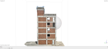
At lunch with a friend yesterday, who owns a concrete contracting business (built the foundation for the Tesla factory in Fremont in 7 days!), I mentioned that drones can map a site and then software can process the images and produce a 3D model that can be used in CAD programs. He was very intrigued.
Is there a low-cost (free is best ) I could get a waypoint mission together to fly on the A3, then something on line that can turn the images into the 3D model?
Some way to demo this at one of his job sites? This could turn into something, in which case I'll dive in and learn, purchase, and do it right.
Any pointers to on-line resources would be great. I recall someone offering a free tool that will create the grid mission, then use Wes' tools to convert to a DJI Fly waypoint mission, then I need a solution to processing the data that's not a $10,000/yr subscription.
TIA, friends... I did some searching on the forum, but couldn't find what I think I remember seeing posted.
At lunch with a friend yesterday, who owns a concrete contracting business (built the foundation for the Tesla factory in Fremont in 7 days!), I mentioned that drones can map a site and then software can process the images and produce a 3D model that can be used in CAD programs. He was very intrigued.
Is there a low-cost (free is best
Some way to demo this at one of his job sites? This could turn into something, in which case I'll dive in and learn, purchase, and do it right.
Any pointers to on-line resources would be great. I recall someone offering a free tool that will create the grid mission, then use Wes' tools to convert to a DJI Fly waypoint mission, then I need a solution to processing the data that's not a $10,000/yr subscription.
TIA, friends... I did some searching on the forum, but couldn't find what I think I remember seeing posted.


