Hi all.
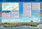
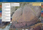
I'm writing a climbing guidebook that covers much of the UK. I'm using a Mini 2, both for close up topo shots of cliffs and also wide angle views of the approaches. I have been absolutely knocked out by the quality it's providing.
Across much of the UK it's been really very straightforward, but I'm having problems in two specific areas. There are some really good cliffs on the South Pembrokeshire coast, in the MoD Castlemartin Range East. I didn't fancy getting shot (!) so I've approached the MoD for permission. They are saying yes... for a £600 access fee. I'm trying to negotiate this down. But I have another concern. Castlemartin is in a Danger Area - EG D113. So even if I did obtain permission to fly, would my Mini 2 actually work there? I have some idea that it might not operate if the GPS says it's in a Danger Area. I don't want to spend lots of money (or indeed any money at all) for access and then find that the drone is geo-locked out of flying there anyway! Can anyone advise?
Secondly, there are bylaws covering the Dartmoor National Park. I've done my best to photograph the climbing on the Tors there - this has involved, at times, an 8' stepladder and a lot of stitching photos together! But that's no good at all for the wide approach shot. So I wonder - does anyone have wide angle shots of the approach walk in to Hound Tor, Haytor, Sheepstor, or The Dewerstone, taken before the bylaws were introduced, that they would consider licencing to me? Ideally these would be taken from maximum altitude and quite a distance, and they will need to be printable at a minimum of A5 (portrait orientation, but I can always paste false sky in to make them higher) and 300dpi. But honestly anything will be an improvement over what I can legally obtain.
Thanks, in advance, for any help.


