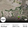
There are other possibilities that could have it deviate from that line, but the most probable is that it is within those designated areas.
If it lost GPS signal and resorted to ATTI mode, it could have drifted with the wind - but ATTI mode rarely lasts more than a few seconds/minutes. And once GPS is restored, it would have attempted the RTH again. Granted, it would have attempted RTH from a different point, thereby creating a different vector and landing location if the new path intersected the hill.
My guess is small dark gray item is just very difficult to spot in the environment in which you're searching. Maybe another set of eyes to help thoroughly comb the area?