DJI Mavic, Air and Mini Drones
Friendly, Helpful & Knowledgeable Community
Join Us Now

So confused about RTK

To elaborate on this Rock RTK network in line with this thread,

Rock RTK is an RTK subscription network. They are new and are kind of a disruptor in the segment. Typically RTK subscription services are expensive and were used by surveyors and engineers amongst other professionals who needed and could afford their service.
Drone mapping when needing absolute accuracy has added a large number of potential customers and has driven a need to lower priced RTK options both in hardware and software.
At least in my area this need has been noticed and a small regional service opened a lower cost RTK service. Rock RTK is taking this need and have expanded it to a growing low cost national RTK subscription service that is fusing their own low cost Bases along with more traditional bases into a new national low cost RTK network.

If you buy, install and host a Rock RTK Base you can use it for free to send and receive corrections to your own rovers.
They also have a subscription without hosting a base at $40 per month or $480 annually which is far less than the quotes I got from both the small regional RTK service I currently use as well as Keynet and Smartnet. Polaris and Point One are another option and have a much lower cost than traditional services.

If you buy any service be sure to see what datum they use and send corrections in. Nothing is worse than collecting your data and then possibly having to transform it, adding another step in workflows.

Rock RTK sends corrections in NAD83(2011) with ellipsoid heights per their webpage.
 
THAT IS A TOUCH OF RELIEF DO YOU KNOW WHERE i CAN PICK UP A LIST WITH THE MEANINGS FOR ALL THE RTH ,PPK,S IN THE WORLD
The gentleman who who started this conversation and all that have contributed to this educational thread Thanks I,m eating this up like candy Although being 68 don,t know how far I can get into this but i started a drone repair business only about a year now and that had turned into sales and at least I know a little about this much talked about subject ,there was a mention of the litchi program that some one was working on i assume more for a 3D model I,ve been using litchi mission hub a waypoints in searching in the southwest ,do you think i could be able to use it some Thank you very much fellows
 
I needed access to a network and was lucky to get access to:
This is the network offered in Arizona. I needed to get RTK for my M3T to keep it in position accurately for long duration overlays of time lapse imagining as part of my geology research project. I managed to get a free account with them, which was very kind of them. It did take poking through about 6 offices from NOAA to AZDOT to find who at Leica/Hexagon could give me access. Overall the process took about 6 weeks. It works quite well, but the actual stations on the NTRIP network are kind of sparse in Northern Arizona. It usually takes around 1-5 minutes to get it to converge and give usable RTK data.

Ultimately, I will have to get an RTK base station. Mainly since I do pop from state to state and there is no way I can do this with multiple states different networks. So I am probably going to bit the bullet and get the DJI D-RTK-2, mainly for ease of setup, not because it is the best by any measure. They do go for about half price used and resale well. So you can get rid of it easily when your done with it.
 
The DJI base will still need a NTRIP connection unless you will have known points to set it up on.
Most folks go with the Emlid RS2 or RS2+ rather than the DRTK-2 because it is less expensive and provides much more functionality. (They just released the RS3, so used RS2’s may drop in price).
The DRTK-2 is simple to use, but only works with a DJI drone, and can’t be used to set GCPs or control points.

Ultimately, I will have to get an RTK base station. Mainly since I do pop from state to state and there is no way I can do this with multiple states different networks. So I am probably going to bit the bullet and get the DJI D-RTK-2, mainly for ease of setup, not because it is the best by any measure. They do go for about half price used and resale well. So you can get rid of it easily when your done with it.
 
Last edited:
All of what you said is true and I totally agree. I would be working from known precision benchmarks. I am using the "Craigslist Rental" theory. Buy it, use it for a few months and resell it. Which works for any of the stations in the long run, but the DJI unit has the easier, wider audience of professional and institutional drone users. It is a group more likely to be interested in it than more capable units that come from the professional survey world. So ultimately, in my case, the unit ends up as only a few hundred out of pocket cost.

Same goes for the drones themselves. The evolution of the camera systems has lagged behind the drones. Just from my perspective. The thermal cameras: The resolution is identical across the entire lineup from Mavic 3T out through the Matrice 350 using the H20T. Then there is the issue that in my case, again, not the norm. Many mines are not allowing DJI drones for work in their environment due to a perceived security threat and some base deficiencies in imaging for geological work. Mainly the forcing of their professional drones to use auto white balance. It makes the images somewhat unusable for us. At the moment we have to go walk the area to ground certify what the image shows. Kind of defeating using the drone in the first place.
 
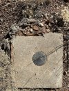
I ended up getting a research account with Lieca/Hexagon turned out free to me, as a geologist. Unfortunately the Arizona network is a little sparse in the north country. So to that end I went ahead and bought a DJI D-RTK-2 at a super discounted price overseas. Shop around and you can approach the cost of a Sparkfun or other lower priced units. Now I know it is not as capable as many other units, but does offer the advantage of being monkey stupid easy to use. I end up placing it on high precision benchmarks, which tend to be plentiful along the railroads and Interstates. I can usually find one within 5-10 kilometers of my study area. The NGS database has just upgraded this month.
NGS Benchmark Database

I would love to take a class that went over all the map making procedures for the Mavic Enterprise series, alas there are none even remotely close. So if anybody has found one online that is worth the price, I would love a referral. Meanwhile I muddle along working it out as I can. Meanwhile I found a couple of online simple setup web explanations of setting up and using the RTK units and planning a map as a starting point.
Planning a mapping project
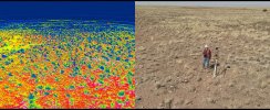
Sitting up and using RTK with NTRIP & CORS & D-RTK-2survey.jpgbenchmark.jpeg

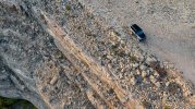
The canyon in study about 7 kilometers away:

Defender Diablo Canyon2.1.jpeg
 
Last edited:
Lycus Tech Mavic Air 3 Case

DJI Drone Deals

New Threads

Forum statistics

Threads
131,140
Messages
1,560,288
Members
160,109
Latest member
brokerman