AMann's latest activity
-
 AMann reacted to Meta4's post in the thread Consensus on Mapping Software for Mavic 2 Pro with
 Like.
Dronedeploy is very good and there are other well-regarded products too. Most are free to use for planning, flying and acquiring images. You only have to pay if you use them to create orthophotos etc.
 -
 AMann reacted to Coconut Island Drones's post in the thread Air 3 Scotland's abandoned shopping village with
 Like.
There's a lot of windows missing so yes other animals would get in pretty easily. Most of central Scotland was littered with shale bings in the past 100 years due to coal mining. There was a huge one in the village next to me and it was just...
 -
 AMann replied to the thread Consensus on Mapping Software for Mavic 2 Pro.WebODM works great for mapping and can handle a lot of images. It is also free. I use it a lot for my projects (see my recent post about it). As you have a Mavic 2 drone, it works with Litchi, which is a perfect low-cost drone flight package for...
 -
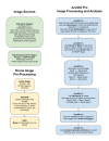
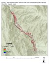
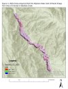
 AMann posted the thread Using a Mavic 2 Pro for habitat analysis - it's still a workhorse! in Mavic 2 Pro.I have been using my IR-modified Mavic 2 Pro to do vegetation monitoring on a local National Forest (US). I did the IR conversion myself using Kolarivision directions, which was very easy! I used their IR Chrome filter to produce false color...


