Recent content by TravelingMan67
-
T
Best speed for videos
Hi, I have been experimenting with shooting litchi missions using terrain following and speeds of the drone. At 30kph close to the ground the motion blur doesn't look good. At 5kph the videos are too long and boring. Is there a sweet spot for speed and good video results?- TravelingMan67
- Thread
- Replies: 1
- Forum: General Discussions
-
T
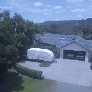
Comment by 'TravelingMan67' in media 'Dulong Qld Australia'
I think I may have not understood how to upload and then comment on a video I shot. Maybe this will work. I am getting used to litchi missions. Trying to find a good speed to fly at, so the total flight is not too long. This was shot at 30km hr but was too fast. I slowed the footage down to...- TravelingMan67
- Gallery comment
-

Around Australia
Various short films of areas we travel too and do house & farm sits. Our life on the road.- TravelingMan67
- Album
- Comments: 0
-
Dulong Qld Australia
a short film of our latest house sit.- TravelingMan67
- Media item
- Comments: 1
- Album: Around Australia
-
T
2 Pro Now We Are Free
Love it. So much better than long lingering high landscapes. You tell a story and give it perspective. At 4 mins I thought I would get bored, but I didn't, you retained my interest and gave me some ideas. Loved the music too. Thanks.- TravelingMan67
- Post #7
- Forum: Photo and Video Showcase
-
T
Old satellite maps?
Just been watching an in-depth tutorial on litchi waypoints. To set up the mission, the guy was using satellite maps. When I open the satellite map (presumably supplied via Google maps?) It shows a very old image, at least 3 yrs old. Given that trees grow, and buildings are built, how can you...- TravelingMan67
- Thread
- Replies: 1
- Forum: Control Apps - DJI, Litchi, Autopilot, etc...
-
T
Android won't connect
DJI Go 4, I also have DJI Go on there for my osmo 2, but thinking that might be a problem, I deleted it. But still no luck. I thought I would have to have a different account to run 4 but apparently no. I was contemplating downloading litchi, but don't want to do that until I can try it with...- TravelingMan67
- Post #3
- Forum: Control Apps - DJI, Litchi, Autopilot, etc...
-
T
Android won't connect
Hi, I am having one of those technology challenging days. First I got locked out of my iPad which is solely for drone use. Then I decided to use my android phone, but it won't connect. I think because it's Oppo the version might be incorrect. It is version 6.0.1 Can someone confirm this is the...- TravelingMan67
- Thread
- Replies: 3
- Forum: Control Apps - DJI, Litchi, Autopilot, etc...
-
T
Is litchi a safe app to use
Ok, thanks. Guess I will give it a go. Cheers.- TravelingMan67
- Post #7
- Forum: Control Apps - DJI, Litchi, Autopilot, etc...
-
T
Is litchi a safe app to use
Thanks everyone. If litchi is set to return home on signal loss, then I assume that if something untoward did happen, turning the controller off and back on should trigger the RTH. Does that sound like a viable action to take?- TravelingMan67
- Post #5
- Forum: Control Apps - DJI, Litchi, Autopilot, etc...
-
T
Is litchi a safe app to use
Hi, I am new to the forum, and have been reading about litchi. I would like to have a better waypoint planner than Go4. However there seems to be a lot of posts both here and on the app download page relating to sudden disconnections, loss of control, or flyaways. Also one post said support was...- TravelingMan67
- Thread
- Replies: 10
- Forum: Control Apps - DJI, Litchi, Autopilot, etc...


