DJI Mavic, Air and Mini Drones
Friendly, Helpful & Knowledgeable Community
Join Us Now

Air 3 went rogue and flew on it's own into a building.....what would cause this?

Julie_Jules

Member
Joined
Sep 5, 2023
Messages
14
Reactions
5
Age
44
Location
Chicago
Let me preface and say I'm not expert, this is an upgrade from the original mavic I bought years ago and upgraded to the air 3 when it came out. Today I drove to the city knowing it'll be very empty with the holidays. Flew it in a few locations and the last one was by the river and bridges. Flew it for a few and landed. Next walked about 1/4 mile down and took off, it was hovering and I looked up and before i could spot it I heard it and then caught it in the corner of my eye and saw it go at full speed into a building. My fingers were off the toggle so I was not controlling it so I'm wonder how in the heck would make it go nuts and just go full speed in one direction when I did not ask it to do that? One of the arms is completely damaged and the camera has now now fallen out from the space it needs to be in, its basically out of commission, which is sad. I do did not by the DJI Care, which I now regret, but prob should see what it would cost for repairs.

I'm trying to see how I can download my flight records to see what went wrong, but still trying to figure it out. Any advice or input would help in order for me to avoid something like this again, losing a drone after investing thousands into it at no fault of my own stings a bit.

TIA!
 
  • Wow
Reactions: Wild Drone Pilot
Post the flight logs but before you do anything else switch off syning and the phone's or controller's
wifi.

Go to the webpage
have a read of the instructions and see if you can find the .txt. flight log.
If so either post it as an attachment here or upload it to that site and post the resulting URL here.
Also if you found the .txt flight log have a look in the folder named MCDatFlightRecords and see if there are any .DAT flightlog in there, if so copy those DATs to your computer.
The DATs may not be readable but we wont know until some one tries to read one. If you find DATs the date and time stamp of the correct DAT should be similar to that of the .txt flight log.
Why switch off syncing? Synching deletes the DATs.

The DAT on the actual drone is possibly encrypted and useless.
 
Last edited:
  • Like
Reactions: Sunny Coast Mini 2
Oh, forgot to say, if you get stuck tell us the controller or phone and your type of computer.
 
I'm definitely stuck as I'm trying to youtube this without much success. Iphone 13 max pro and RC controller, lenovo slim 7i ProX. I think i found the logs but can't be sure what I'm looking at and tried to copy over to an SD card to phone, but didnt seem to work.
 
This sounds like a classic yaw error crash. Did you verify that the compass reading at the lower left corner of the screen was correct before taking off?

The logs should tell the real story.
 
This sounds like a classic yaw error crash. Did you verify that the compass reading at the lower left corner of the screen was correct before taking off?

The logs should tell the real story.
Honestly i cant say for sure, not even sure if it matters at this point of trying to get log (which im still trying to figure out). For future reference, how do I make sure the compass is reading correctly?

Now it's a matter of trying to get this fixed through DJI.
 
I have these book marked
To view this content we will need your consent to set third party cookies.
For more detailed information, see our cookies page.
Can anyone help me retrieve my flight logs? ---------------------------------- post no7


The txt flightlogs have a name that looks like DJIFlightRecord_YYYY-MM-DD_[hh-mm-ss].txt
the DAT will have a name that will look like "YY" or "YYYY" -MM-DD "-" or "_" hh-mm-ss_FLYxyz.DAT, remove the quotation marks and gaps.

With regards to checking the compass there is, from memory, an arrow head in the map or 'radar-scope' that indicates the drone's direction, I think the idea is to check that it indicates the correct direction when the drone is on the ground etc..
 
Last edited:
  • Like
Reactions: Phantomrain.org
I'm definitely stuck as I'm trying to youtube this without much success. Iphone 13 max pro and RC controller
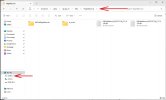
Connect the remote controller to a computer with a USB cable and navigate to this location:

RC2-Flight-Log-Transfer.jpg
 
  • Like
Reactions: SC_Richard
I have these book marked
To view this content we will need your consent to set third party cookies.
For more detailed information, see our cookies page.
Can anyone help me retrieve my flight logs? ---------------------------------- post no7


The txt flightlogs have a name that looks like DJIFlightRecord_YYYY-MM-DD_[hh-mm-ss].txt
the DAT will have a name that will look like "YY" or "YYYY" -MM-DD "-" or "_" hh-mm-ss_FLYxyz.DAT, remove the quotation marks and gaps.

With regards to checking the compass there is, from memory, an arrow head in the map or 'radar-scope' that indicates the drone's direction, I think the idea is to check that it indicates the correct direction when the drone is on the ground etc..
this is the the video it tried and couldnt figure it out, may have to go the PC route. appreciate you finding this.
 
...For future reference, how do I make sure the compass is reading correctly?
OK... if you get frustrated looking for the logs, or contacting DJI & takes a short break from that, you can read below linked post I wrote to another member here today. It thoroughly explains:

-How your drone keeps position even though it's affected by winds
-What happens if the navigation system haven't the correct info
-When & why a "Yaw error" is created
-And what you as a pilot needs to do to avoid all this

LINK--> A lot about yaw errors

Once you share the logs from the incident flight we can pretty easy tell If this really was a yaw error or something else, but by knowing what a yaw error is & how you can avoid it will save you in the future.
 
It crashed into a high-rise building?

Oh I see the OP's location is Chicago. Hmm the logs should be interesting.
 
Are you sure that's the correct flight?
It lasts 30 seconds and the drone never exceeds 9 mph, but that was fully under control.
that's the only file i saw for today, but had 3 separate flights and only saw that one for 1/1/24 so i assumed the day was all clumped up. As I'm looking at the location it's not right. will have to go back in and see what else is there.
 
Okay I believe i got it...
Nope... that doesn't seem to be the correct one, no crash is detected in it.

But never the less, this was also a sketchy flight, no HP recorded until 22sec into the flight when the GPS quality shortly reached a 4 (out of 5)... but it was just shortly, the rest of the flight it was mainly between 0 & 2 which means a very unsecure GPS assistance. And you were flying out of VPS sensor reach mid flight. All this would have made your drone very prone to drifting with whatever affecting it... just luck you didn't crash in this flight also I'm afraid.
 
Honestly i cant say for sure, not even sure if it matters at this point of trying to get log (which im still trying to figure out). For future reference, how do I make sure the compass is reading correctly?

Now it's a matter of trying to get this fixed through DJI.
The drone's compass can be biased if the drone is started near ferrous metal or a magnetic field.

It's straightforward to check the compass. Just open the map view from the lower left corner and check the orientation of the drone shown on the map with reality. If the drone is pointed north, the drone symbol on the map should also be pointed north. If there's a significant difference, turn the drone off and restart it in a different location. One member here suggests starting the drone while holding it about waist level and then placing it on the ground afterwards.
 
  • Like
Reactions: Julie_Jules
Nope... that doesn't seem to be the correct one, no crash is detected in it.

But never the less, this was also a sketchy flight, no HP recorded until 22sec into the flight when the GPS quality shortly reached a 4 (out of 5)... but it was just shortly, the rest of the flight it was mainly between 0 & 2 which means a very unsecure GPS assistance. And you were flying out of VPS sensor reach mid flight. All this would have made your drone very prone to drifting with whatever affecting it... just luck you didn't crash in this flight also I'm afraid.
Okay i see 3 files i can make out the other two and this was my last one, but it's strange it's not showing it, but also the coordinates are incorrect (gps wise) as I was on the other side of the river and it's about 2 blocks off from where i actually was and find it strange that it doesnt provide what actually happened.

here are the other 2 from today plus the original one

1st flight DJI Flight Log Viewer - PhantomHelp.com

2nd flight DJI Flight Log Viewer - PhantomHelp.com

3rd and last flight where it crashed but the location is off according to this. DJI Flight Log Viewer - PhantomHelp.com


I find this strange, there are a ton of drone pilots in Chicago that fly downtown all around and closer to buildings than I get to, how is this not happening to them and how are their drones not crashing?

So based on that flight log how do I avoid future issues, what to avoid? basically flying near tall buildings? or in the thick of it, is the outskirts better to fly from afar? what to check before take off, what warnings to look for?
 

DJI Drone Deals

New Threads

Forum statistics

Threads
134,485
Messages
1,595,523
Members
163,013
Latest member
GLobus55
Want to Remove this Ad? Simply login or create a free account