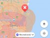
Not according to the DJI flysafe map
Then the DJI map is wrong. Check the official map OpenSky that used CASA supplied data. Also banned by Sydney Harbour Authority and the By-Laws of each of the councils that border the harbour.
The Harbour is a permanently active controlled flight zone with low flying aircraft including helicopters and seaplanes in addition to the approach for commercial aircraft entering and departing Sydney International and Domestic Airports. And then there is the Naval Base, the ferries, cruise ships...