DJI Mavic, Air and Mini Drones
Friendly, Helpful & Knowledgeable Community
Join Us Now

DJI No-Fly Zone Blocking My Own Property – Anyone Else Dealing with This?

Joined
Jan 2, 2025
Messages
8
Reactions
2
Age
56
Location
Yogyakarta
Hi everyone,

I’m dealing with a frustrating issue with DJI’s no-fly zone restrictions and wanted to see if anyone else has experienced something similar.

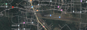
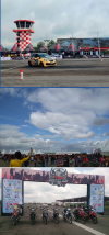
I live near an abandoned airfield that has been out of operation for over 15 years, and I simply want to fly my drone on my own property. The official aviation registry confirms it’s not an active airport, and the area is used for public activities like jogging, motor races, and events.

Despite providing this proof, DJI insists the area is in the "development consideration stage" based on input from a website manager—someone with no authority in aviation matters. They’ve even asked me to get an authorization letter for a location that doesn’t function as an airport.

What’s more frustrating is that talks about rebuilding the airfield have been going on for nearly the same amount of time it’s been abandoned—with no progress at all.

I understand that DJI’s no-fly zone system can be a helpful tool to improve safety and guide responsible flying, and I fully support that. However, it should be a helping tool, not a dictating tool. I can’t understand why DJI believes they have the authority to dictate where I can and cannot fly, especially when no actual regulatory body has declared the area restricted.

Drone operators know it’s our responsibility to follow local regulations, but how can DJI justify blocking an area based on vague speculation instead of actual facts?

Has anyone else faced similar issues with DJI’s no-fly zones? How did you handle it?

Thanks in advance for any advice or feedback!
 
My guess is someone likes the airport field being there to give them "space". And someone keeps renewing the restriction by updating a permit or something.
I don't know the laws in your country but there's also a possibility that DJI has no authority to release the wall until someone fails to renew a lease or something.
The problem doesn't lie within DJI. The problem lies within some part of your government process.
 
This is a surprisingly common problem, more noticeable in small countries (like Britain) where there are still derelict airfields and ordnance storage facilities that last saw use in the late 1940's which are arbitrarily DJI geofenced because someone unqualified to judge read a description printed on a map.

There is the option to use the 'unlock geozone' request built into the app, and there are also solutions to flying in officially unregulated airspaces, but this depends on the drone model.

I think what you need to check is whether the locked zone you want to fly in is within a larger officially restricted area: in which case, the only option I would advise is that you contact the relevant authority and request permission to fly.
 
Last edited:
I would suggest Drone Hacks, depending on your drone.

I had a somewhat similar 'problem' a few years ago. There is a fine viaduct that lies more or less under the flight path to the local airport, and I could not even start the motors. But when the airport closed down completely for several months for runway improvements, still no joy, so I installed DH on my Air2 and off I went, complete freedom. I certainly wouldn't fly there now even though I would be well below any passing aircraft.

I deeply resent some desk dude in China telling me where and when I can fly in my own country. I go by the local and common sense rules, not DJI ones. Is it only DJI that has these drone restrictions?
 
I live on the edge of an active airfield in AZ. I use the DJI FlySafe app to unlock the area around my home for 365 days at a time DJI FlySafe
 
I have a never used heliport behind my house that is agrivating, most times I can get by without having to unlock before flight. Frustrating for sure.
 
My guess is someone likes the airport field being there to give them "space". And someone keeps renewing the restriction by updating a permit or something.
I don't know the laws in your country but there's also a possibility that DJI has no authority to release the wall until someone fails to renew a lease or something.
The problem doesn't lie within DJI. The problem lies within some part of your government process.
Thanks for your response!

I see what you mean, but in this case, the airfield is not listed as active in the official aviation registry. There’s no current permit or lease keeping it restricted—it’s classified as inactive.

The only thing DJI is basing their restriction on is a claim from a webmaster that the area is in a "consideration stage." But "consideration" doesn’t mean anything official—it just means they’re speculating it might become an airport again at some point in the future, which may never happen.

This is why it’s so frustrating. The facts don’t support any actual restriction, yet DJI is still enforcing a no-fly zone based on speculation.

Thanks again for your input—if you have any suggestions for dealing with something like this, I’d really appreciate it!
 
This is a surprisingly common problem, more noticeable in small countries (like Britain) where there are still derelict airfields and ordnance storage facilities that last saw use in the late 1940's which are arbitrarily DJI geofenced because someone unqualified to judge read a description printed on a map.

There is the option to use the 'unlock geozone' request built into the app, and there are also solutions to flying in officially unregulated airspaces, but this depends on the drone model.

I think what you need to check is whether the locked zone you want to fly in is within a larger officially restricted area: in which case, the only option I would advise is that you contact the relevant authority and request permission to fly.
You’re absolutely right—this does seem to be a common problem, especially when outdated or misunderstood information is used to create geofenced areas.

In this case, I’ve already checked, and the location isn’t part of a larger officially restricted zone. The official aviation registry shows that it’s not active or restricted—it’s completely unregulated for UAV flights.

I’ve tried using the unlock geozone request through DJI’s app, but they’re still insisting that I need permission because a “webmaster” said the site is in the "consideration stage." That’s what makes this so frustrating—it’s not based on real regulations but vague speculation.
 
I would suggest Drone Hacks, depending on your drone.

I had a somewhat similar 'problem' a few years ago. There is a fine viaduct that lies more or less under the flight path to the local airport, and I could not even start the motors. But when the airport closed down completely for several months for runway improvements, still no joy, so I installed DH on my Air2 and off I went, complete freedom. I certainly wouldn't fly there now even though I would be well below any passing aircraft.

I deeply resent some desk dude in China telling me where and when I can fly in my own country. I go by the local and common sense rules, not DJI ones. Is it only DJI that has these drone restrictions?
I can completely relate to your frustration—especially the feeling of being grounded when you know you’re flying responsibly and within the rules set by local authorities.

I’ve looked into Drone Hacks and other options before, but I really didn’t want to go down that route unless absolutely necessary. I’ve always believed that the drone’s built-in safety features should be a helpful guide, not something that dictates what I can or can’t do on my own property.

To answer your question—yes, it seems like DJI is one of the few manufacturers that enforces these types of no-fly zones so aggressively. Most other brands don’t have the same level of restrictions.
 
I live on the edge of an active airfield in AZ. I use the DJI FlySafe app to unlock the area around my home for 365 days at a time DJI FlySafe
It’s helpful to know that you’ve been able to unlock the area near your home using the DJI FlySafe app. However, the situation here is quite different. The airfield near my home isn’t active—it’s been abandoned for over 15 years and is used for public activities like jogging, motor races, and community events.

Despite this, my home is inside the red no-fly zone, even though the official aviation registry doesn’t list the airfield as an active airport. DJI still treats it as restricted based on claims that it’s in the "consideration stage" for future use.

Have you ever encountered a case where the FlySafe app wouldn’t allow you to unlock an area that isn’t restricted by actual regulations? I’d really appreciate any tips on how you managed the process.
 
I have a never used heliport behind my house that is agrivating, most times I can get by without having to unlock before flight. Frustrating for sure.
I can totally relate—it’s frustrating when outdated or unused areas are still geofenced. It sounds like you’ve at least been able to fly sometimes without needing to unlock. Unfortunately, in my case, DJI’s system is completely blocking me from flying, even though the airfield has been abandoned for over 15 years. My home is also inside the red no-fly zone, so I can’t even take off without dealing with the unlock process, which they’ve denied multiple times.

It’s wild how places that haven’t seen any aviation activity in years can still cause so many issues for responsible drone operators. Thanks again for sharing—it’s good to know I’m not the only one dealing with this.
 
You've said "My own property" a few times.
DJI couldn't possibly justify geofencing "Your own property".

I think you should chase this "webmaster".

Again, I don't know the laws in your country so it's not easy for any of us to give a more helpful answer.

The map still shows it as an airport. Contact whoever owns the map. If it's Google, they like to fix erroneous info but it doesn't look like it's out of service. It looks like it's still an emergency landing area at the very least.
 
Here in Tennessee, I sometimes have to get permission to fly from my own home. There's an uncontrolled airport, Class G airspace, a few miles away. And unlocking is not always simple.
 
You've said "My own property" a few times.
DJI couldn't possibly justify geofencing "Your own property".

I think you should chase this "webmaster".

Again, I don't know the laws in your country so it's not easy for any of us to give a more helpful answer.

The map still shows it as an airport. Contact whoever owns the map. If it's Google, they like to fix erroneous info but it doesn't look like it's out of service. It looks like it's still an emergency landing area at the very least.
Just to clarify, the airfield isn’t my property—my home is very close to it, only a few hundred meters away, but still inside the red no-fly zone.

The official aviation registry shows the airfield is not active, even though some maps still label it that way. In reality, it’s used for things like motor races and public events. At the end of the runway, there’s a house and a public road, and there are already homes built right next to the runway as well.
If you look at the google maps there are planty of videos and pictures

The main issue is that DJI is enforcing restrictions based on speculation about possible future use rather than actual facts.
 

Attachments

  • gading-airfield.png
    gading-airfield.png
    1.9 MB · Views: 4
Just to clarify, the airfield isn’t my property—my home is very close to it, only a few hundred meters away, but still inside the red no-fly zone.

The official aviation registry shows the airfield is not active, even though some maps still label it that way. In reality, it’s used for things like motor races and public events. At the end of the runway, there’s a house and a public road, and there are already homes built right next to the runway as well.
If you look at the google maps there are planty of videos and pictures

The main issue is that DJI is enforcing restrictions based on speculation about possible future use rather than actual facts.
"...Gading Airfield cannot be used for commercial flights. However, in the future, along with the increasing number of commercial and training flights, Gading Airfield will continue to be developed to help smooth flights in DI Yogyakarta. Thus some flight guidelines for civil aviation must be made..."

We have something similar close to where I live with an international airport that was developed about 10 miles away from a second world war airfield which was originally the main regional airport - then it was downgraded and used as an overspill to take stress away from the new main airport - being tasked with handling prop and turboprop cargo haulers as well as private light aircraft.

It looks like in your case - it is the other way round - with the main Adisucipto International Airport being developed to full potential first, before Gading gets upgraded to handle smaller aircraft and cargo flights... it's been temporarily mothballed - but keeps the continued active status.

Sad to say: it looks like DJI FlySafe actually got it right this time.
 
Last edited:

DJI Drone Deals

New Threads

Members online

Forum statistics

Threads
135,297
Messages
1,604,654
Members
163,759
Latest member
huhun
Want to Remove this Ad? Simply login or create a free account