DJI Mavic, Air and Mini Drones
Friendly, Helpful & Knowledgeable Community
Join Us Now

Drone with autonomous flight in grid pattern with timed 48 Mpixel photos (minimum)

walterr446

New Member
Joined
Jul 29, 2024
Messages
2
Reactions
0
Age
61
Location
Ohio
I own forestland that is prone to an infection called "oak wilt". It is initially carried by beetles but then spreads from tree-to-tree underground. If you catch it early you can contain it by killing the infected tree. I've experimented with a dji Mini 3 taking timed photos (2 second intervals) with the camera pointed straight down while flying in Cine mode. I examine the photos after the flight and then transfer the GPS coordinate of each photo showing a suspicious tree to my handheld GPS. I then visit each tree to determine if it's infected.

The main limitation with this process is that the dji Mini 3 only will take 12 Mpixel photo in Timed mode. It can take 48 Mpixel photos in manual mode. There is a huge difference in my ability to identify tree species and zoom in on the leaf detail when looking at a 48 Mpixel vs. 12 Mpixel photo so I'd really like timed photos at 48 Mpixel (or greater) detail.

Oak wilt kills a tree within 3 weeks after infection so, ideally, I need to be flying the property every 3 weeks from mid-June to mid-September. I believe what would significantly improve my productivity is:
A drone with autonomous flight capability that can be programmed to fly a lawnmower grid pattern over a rectangular area while taking timed photos (ideally once every 2 seconds) at a minimum of 48 Mpixel resolution. If the flying conditions warrant it, it would be ideal if the drone would hover briefly for each photo for maximum image clarity. In an utterly ideal world there would be software to stitch together all of the overlapping photos into one giant scrollable photo that I can zoom in on and know the GPS location of wherever my mouse is pointing. The latter is icing on the cake, though; I'm certainly willing to look through individual photos.

I contacted dji customer sales with this and they said that the Mini Pro 4, Air 3 and Mavic 3 all have the ability to do the steps in the first sentence of the above paragraph (shown in bold). When I opened the specs on the Mavic 3, though, it looks like it only does 20 Mpixels in timed shooting so that made me question all the advice from dji and I have turned to this forum for your insight. This forum showed up in my Google search on Mavic 3 specs.

Thanks, in advance, for the insights I'm sure you'll provide!
 
I believe what would significantly improve my productivity is:
A drone with autonomous flight capability that can be programmed to fly a lawnmower grid pattern over a rectangular area while taking timed photos (ideally once every 2 seconds) at a minimum of 48 Mpixel resolution. If the flying conditions warrant it, it would be ideal if the drone would hover briefly for each photo for maximum image clarity. In an utterly ideal world there would be software to stitch together all of the overlapping photos into one giant scrollable photo that I can zoom in on and know the GPS location of wherever my mouse is pointing. The latter is icing on the cake, though; I'm certainly willing to look through individual photos.
What you are wanting is to to mapping missions.
Rather than timed shooting, you need the drone to fly a precise, planned grid and capture images with precise overlaps to use to create an orthophoto mosaic.
It's not necessary for the drone to stop and hover for shooting.
You use a mapping app like DroneDeploy to plan the mission, fly the mission and acquire the images.

Here's an example of DroneDeploy flying a mission over a 32 acre construction site:
i-QW8n2js-L.png


This shows where the images were taken to give a precise 70% front and side overlap.
i-Kn43TxZ-L.jpg


A large orthophoto mosaic is created from the resulting images.
This is very large and has huge detail.
i-MCZFF55-XL.jpg


You can overlay the orthophoto in Google earth and use Google Earth for viewing, measuring and obtaining position
data for individual trees, like I did here in these examples of a 120 acre forested site.
i-47RSt4N-L.jpg

i-rLDPVFb-L.jpg


This used to be possible with earlier DJI drones like the Phantom 4 pro and Mavic 2 pro, but more recent DJI drones don't have this functionality (unless you buy their overpriced Mavic 3 Enterprise model).

A lightly used Mavic 2 pro or Phantom 4 pro would be ideal for what you are asking about.
The detail from their 20 MP cameras would equal or exceed the detail from the 48MP cameras (with smaller sensors) that you asked about.
 
This is great! Thanks for understanding what I NEED vs. what I ASKED for! This sounds like exactly what I need. If I can acquire either a used Mavic 2 Pro or Phantom 4 Pro will I have to get one with old software/firmware or can it have the newest updates? (In other words do the latest software/firmware versions deactivate the functionality you've described?) Maybe I'm not even asking a valid question; do older drones even receive software updates? Is there a point at which it's not safe (or even permitted) to fly an older drone because the software is no longer supported? If you feel that these questions are going off-topic from my original post I'll research them separately on this forum and create a new thread if they haven't already been answered. Thanks.
 
(In other words do the latest software/firmware versions deactivate the functionality you've described?)
Don't worry .. it's just a policy decision by DJI not to release an SDK for current drone models.
SDK = Software Development Kit
The SDK enables 3rd party software developers to craft their software to work with the features of a particular drone.
DJI seem to prefer selling their Enterprise models for significantly more than consumer models these days.
Is there a point at which it's not safe (or even permitted) to fly an older drone because the software is no longer supported?
That shouldn't be a problem for a lightly used example of the two models I mentioned.
 
If I can acquire either a used Mavic 2 Pro or Phantom 4 Pro will I have to get one with old software/firmware or can it have the newest updates?

My old Phantom 3 Pro does mapping as well. DJI has long since stopped providing any support or updates for the P3P, but it still works great. The most recent apps and firmware update for the P3P are still available on DJI's website.

The Phantom 3 Pro is also able to continue a mapping mission beyond control signal range, which is useful when flying over a forested area where the signal reception is blocked by the trees. But, be very careful if thinking of doing that...

There are many apps that can be used for mapping like DroneDeploy to automate the mapping flight. I use the free app from Pix4D, and then WebODM to generate the orthomap and 3D renders.

The top down orthomap image stitched together from all the individual photos is remarkably detailed.

I'm certainly no expert or doing anything commercial with this stuff, just fooling around and experimenting. But it's pretty cool.

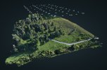
Here's a recent shot showing camera locations over a generated 3D model.
Nakkertok-Camera-Locations.jpg

With the 3D model you can measure distances and volumes etc, or fly through the model. The fly-through is pretty silly when you could just as easily fly your drone through the real thing to get actual footage, but it's still fun.

To view this content we will need your consent to set third party cookies.
For more detailed information, see our cookies page.
 
What you are wanting is to to mapping missions.
Rather than timed shooting, you need the drone to fly a precise, planned grid and capture images with precise overlaps to use to create an orthophoto mosaic.
It's not necessary for the drone to stop and hover for shooting.
You use a mapping app like DroneDeploy to plan the mission, fly the mission and acquire the images.

Here's an example of DroneDeploy flying a mission over a 32 acre construction site:
i-QW8n2js-L.png


This shows where the images were taken to give a precise 70% front and side overlap.
i-Kn43TxZ-L.jpg


A large orthophoto mosaic is created from the resulting images.
This is very large and has huge detail.
i-MCZFF55-XL.jpg


You can overlay the orthophoto in Google earth and use Google Earth for viewing, measuring and obtaining position
data for individual trees, like I did here in these examples of a 120 acre forested site.
i-47RSt4N-L.jpg

i-rLDPVFb-L.jpg


This used to be possible with earlier DJI drones like the Phantom 4 pro and Mavic 2 pro, but more recent DJI drones don't have this functionality (unless you buy their overpriced Mavic 3 Enterprise model).

A lightly used Mavic 2 pro or Phantom 4 pro would be ideal for what you are asking about.
The detail from their 20 MP cameras would equal or exceed the detail from the 48MP cameras (with smaller sensors) that you asked about.
I mapped a warehouse property using a Mini 3. The sdk is out there for the Mini 3 to do orthomorphic mapping, and he seems to have a Mini 3.

The only drawback was, at least in Pix4D Capture, it will only do grid missions. I haven't tried DroneDeploy or Litchi for mapping.
 
  • Like
Reactions: mavictk
I have an Air 2S as well, if DD works with that then I may have a better ortho mapping solution.
 
Lycus Tech Mavic Air 3 Case

DJI Drone Deals

New Threads

Members online

Forum statistics

Threads
133,130
Messages
1,580,407
Members
161,780
Latest member
GeoffreyBH