DJI Mavic, Air and Mini Drones
Friendly, Helpful & Knowledgeable Community
Join Us Now

Dronelink Mini 2 and Mapping?

cmiranda

Member
Joined
Feb 11, 2022
Messages
5
Reactions
24
Age
47
Location
Saint Constant, Quebec
Hello guys!!
I have a new beautiful Mini 2.
So, I start to fly, but I want to map! Start reading (tons of info), and I end with a lot of questions but I have to start somewhere. So, I was looking into Dronelink to do the flight plan. I was about to buy the basic Hobbyist plan and then I realize that the check ✅ next to MAP is not on this plan...!!!! I need to get the Elite plan for $99.99!!!
Question: IS IT WORTH IT?
 
I've been using my Mini 2 to produce orthophotos and 3d models which I use in mapping for OpenStreetMap. I use OpenDroneMap to generate the orthophotos and 3d models. Up until recently I had been flying the capture flights completely manually. Since the release of the SDK for the Mini 2 I've bought a DroneLink Elite licence.

Using DroneLink certainly makes the flights easier but it is also quite nerve racking leaving control to the program. For the relatively small areas I capture DroneLink seems to be marginally faster but produces equivalent results to manually flying.

You can see the sort of orthophotos I've managed to produce at OpenAerialMap, those before March 2022 were manually flown and those afterwards used DroneLink.
 
Drone mapping software is expensive, but I found that Litchi (approx. $20 / platform) just works for me.
Litchi itself doesn't have any mapping capabilities, however you can do waypoints with it.
So what I did, is I made a little script, that translates Mission Planner Missions, to Litchi Missions.
Then I use WebODM to process the images.

Read more about it on the Litchi Forum: Mapping/survey grid tool
A thread on the topic here on this forum: Mission Planner Surveys to Litchi
GitHub page of the project (with instructions): GitHub - YarostheLaunchpadder/MissionPlanner-to-Litchi: Convert Mission Planner (ArduCopter) Waypoint Missions to Litchi CSV Format to execute on DJI Drones
 
DroneDeploy and other dedicated mapping apps are free.
You only pay if you use their image processing.
I don't know about that. When I tried Dronelink and drone deploy I needed to pay after registering.
 
I don't know about that. When I tried Dronelink and drone deploy I needed to pay after registering.
Like you said ... you don't know
I haven't tried Dronelink, to comment on what they do.
 
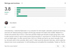
Drone deploy doesn't have good reviews on google play...
1650443382004.png

And I bought litchi so I use it for that.
 
Drone deploy doesn't have good reviews on google play...

And I bought litchi so I use it for that.
DroneDeploy is the Industry standard mapping app.
It's an excellent program.
Google reviews mean nothing and you can use it for free.
 
DroneDeploy and other dedicated mapping apps are free.
You only pay if you use their image processing.
I think that is if you are using the Android version. With ios you have to pay once the trial runs out.
 
I am using dronelink & maven for different purposes. Maven works without a glitch, but dronelink gives me difficulty, which I hope to solve tomorrow. Both I have had to pay for. 😫
 
Drone mapping software is expensive, but I found that Litchi (approx. $20 / platform) just works for me.
Litchi itself doesn't have any mapping capabilities, however you can do waypoints with it.
So what I did, is I made a little script, that translates Mission Planner Missions, to Litchi Missions.
Then I use WebODM to process the images.

Read more about it on the Litchi Forum: Mapping/survey grid tool
A thread on the topic here on this forum: Mission Planner Surveys to Litchi
GitHub page of the project (with instructions): GitHub - YarostheLaunchpadder/MissionPlanner-to-Litchi: Convert Mission Planner (ArduCopter) Waypoint Missions to Litchi CSV Format to execute on DJI Drones
This is probably the best option for most users who just want to do a few simple maps.

At $99, it's hard to recommend Dronelink just for mapping, but if you think you might like to do more complex programmed missions, Dronelink is quite a bit more powerful than Litchi. For what it does, I don't think it's overpriced, but it's not for everyone. BTW, the Mission Planner mapping missions can be imported into Dronelink, so another option is to get the $49 Premium plan Dronelink (which doesn't include mapping but does include the most useful stuff) and then use Mission Planner to create mapping missions. (I can't recommend the $24.99 Basic plan at all; it's missing too many features.)
 
and then use Mission Planner to create mapping missions
But it's going to be the same as Litchi with Mission Planner, basically.
 
You could use the Pix4D Capture app for capture, that us free for capturing data, then use the Images for whichever processing platform you prefer. I have done this with M2P but guess Mini 2 would also work??
 
DroneDeploy and other dedicated mapping apps are free.
You only pay if you use their image processing.
Hello, Can you tell me of other apps that can be used for free just to fly the missions?

About litchi, im testing the virtual litchi mission but it shows an error when tryin to make a big area saying it max at 90 waypoints, if i do the mission on mission planner and export to litchi is it still limited to 90 waypoints?
 
Lycus Tech Mavic Air 3 Case

DJI Drone Deals

New Threads

Forum statistics

Threads
131,336
Messages
1,562,093
Members
160,272
Latest member
JuiceThe6One