Hi,
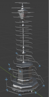
I have a scan of a lamppost and I want to use it to trace a flight plan around it to get perfect overlaps of photos and distance from the lamppost. Is it possible to import a model into drone harmony or litchi or dronelink or dronedeploy?
I use blender, so i could trace the object in there and copy and paste the positions into one of those programs if that's possible. I believe droneblocks can possibly achieve that?

Anyway that anyone knows of to bring these points into a flight path app?
I have a scan of a lamppost and I want to use it to trace a flight plan around it to get perfect overlaps of photos and distance from the lamppost. Is it possible to import a model into drone harmony or litchi or dronelink or dronedeploy?
I use blender, so i could trace the object in there and copy and paste the positions into one of those programs if that's possible. I believe droneblocks can possibly achieve that?

Anyway that anyone knows of to bring these points into a flight path app?


