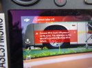
I am 6 miles from an airport and only wish to go up about 200' to get some video of my RV campground. Is there an override?
You are using an out of date browser. It may not display this or other websites correctly.
You should upgrade or use an alternative browser.
You should upgrade or use an alternative browser.
Geo fencing over ride?
- Thread starter RVtraveler48
- Start date
Are you stopped from flying? Airport zones other than TO and landing paths are usually just a 5 mile radius circle. AirMap may help clarify.I am 6 miles from an airport and only wish to go up about 200' to get some video of my RV campground. Is there an override?
Have you tried 150’ or 175’?
I am 6 miles from an airport and only wish to go up about 200' to get some video of my RV campground. Is there an override?
Welcome to the forum and to the hobby.
In addition to DJI GeoFencing you also need consider FAA Regulations in regards to Airspace. You should be aware of and able to determine the Airspace you're looking to fly in. Actual "distance" from the airport isn't a matter any longer it's the actual AIRSPACE you're flying in. If you're near an airport it's possible you are looking to fly in CONTROLLED airspace. In order to fly (even 2' off the ground) in CONTROLLED airspace you must have FAA Approval. Depending on the type of flying and the airspace will determine which of the 2 methods you use.
LAANC is the easy one and almost instaneous approval/denial. Is the facility is not "participating" in LAANC you'll need to go to FAADroneZone, create a FREE account and submit an Airspace request.
Here is a link to go and see if you are indeed operating in CONTROLLED airspace
ArcGIS Web Application
 faa.maps.arcgis.com
Those altitudes are not "APPROVED" altitudes but they are an indicator of what altitude you might get approved for. In other words if it states 100' and you request 300' you will get an immediate denial.
I am miles from the take off and landing pattern - absolutely no issue for what I want to do. But the controller says Can't Fly." This happened to me once before, 8 miles north of Naval Station Mayport Florida on Little Talbot Island. I was aware of low flying helicopters along the shore line and wasn't going anywhere near it, but after takeoff inside the picnic pavilion I was in the drone hovered and would not budge in any direction but down. Candidly, I am not a good reader of instruction manuals, just as DJI is not a good writer of instruction manuals, so I tend to poke around to try and solve problems LOL.Are you stopped from flying? Airport zones other than TO and landing paths are usually just a 5 mile radius circle. AirMap may help clarify.
Have you tried 150’ or 175’?
Attachments
The thing to do is compare the FAA facilities map for the area you wish to fly (quite a few controlled airspace/airports in Jacksonville) to what the geofencing map shows. I've found that DJI does pretty much follow the facilities map. Sometimes the grey altitude zones along runway approach paths extend a bit beyond the controlled airspace borders, but the altitude limit in the zone is usually 400ft or more anyway, and we're limited to 400ft.
Dave Maine
Well-Known Member
- Joined
- Jan 27, 2018
- Messages
- 1,547
- Reactions
- 1,123
- Age
- 82
There are no overrides other than those provided on request to part 107 pilots from the governing agency.
NDWildBill
Well-Known Member
I would suggest downloading and using either the Kittyhawk app or the Airmap app for requesting LAANC approval. both have maps to tell you restricted zones and flight altitude limitations. Also B4UFLY is a good app for checking airspace.
Similar threads
- Replies
- 28
- Views
- 3K
- Replies
- 4
- Views
- 1K
DJI Drone Deals
New Threads
-
-
Mini 5 Pro Flying DJI Mini 5 Pro at −24 °C - real winter test from Canada
- Started by trisen1981
- Replies: 0
-
-
-


