- Joined
- Mar 29, 2019
- Messages
- 40
- Reactions
- 14
Handy Flight Map.
Drone Map Format.
Make a Shapes Transparent in Microsoft Word:
1. Select Insert > Shapes.
2. Select a Shape from the drop-down gallery and then draw it the size that you want.
3. Right-click the shape and choose Format Shape.
4. In the dialog box, in the Fill section, select the Transparency slider and drag rightward to set the degree of transparency you want (100%).
5. Footpaths made with 'Shapes' (Curve) Format AutoShape for colour etc.
------------------------
Google Earth Location.
Crop Map to 6X4, and Brighten.
Microsoft Word Paper size 12.2cm x 23cm.
All Margins 2.54cm.
Page Border 3pt.
Text White Size 10 Arial Bold.
Shapes Red 1.5pt.
Print and cut on dotted line.
Cut Photo Paper (to stiffen Zippy Bag) 12.2cm x 23cm.
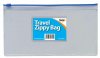
DL/Travel Zippy Bag (301602) ebay fit small split ring in corner under zip for Lanyard/Loop for Belt Clip if needed.
Drone Map Format.
Make a Shapes Transparent in Microsoft Word:
1. Select Insert > Shapes.
2. Select a Shape from the drop-down gallery and then draw it the size that you want.
3. Right-click the shape and choose Format Shape.
4. In the dialog box, in the Fill section, select the Transparency slider and drag rightward to set the degree of transparency you want (100%).
5. Footpaths made with 'Shapes' (Curve) Format AutoShape for colour etc.
------------------------
Google Earth Location.
Crop Map to 6X4, and Brighten.
Microsoft Word Paper size 12.2cm x 23cm.
All Margins 2.54cm.
Page Border 3pt.
Text White Size 10 Arial Bold.
Shapes Red 1.5pt.
Print and cut on dotted line.
Cut Photo Paper (to stiffen Zippy Bag) 12.2cm x 23cm.
DL/Travel Zippy Bag (301602) ebay fit small split ring in corner under zip for Lanyard/Loop for Belt Clip if needed.