DJI Mavic, Air and Mini Drones
Friendly, Helpful & Knowledgeable Community
Join Us Now

Litchi: waypoint missions and more

gonuts

Member
Joined
Jan 4, 2019
Messages
12
Reactions
2
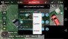
I've been trying to use Litchi to check specific objects at numerous locations. It technically can perform this function but have some questions. Drone is the Mavic 2 Zoom.

1. If I set it to fly at an altitude of 100m, does this follow the lay of the land? will it stay 100m above the ground even if it passes over a hill? or will it just crash into the hill.

2. What happens if it hits an obstacle? will it attempt to fly over it, hover in place? will it return home if battery gets low?

3. Is there a way of saving the drone location and perspective like in the DJI app? (hover in place over the target and save it, so that it keeps the correct framing) I've been testing it and relying on the GPS location always results in it being a few meters off when attempting to inspect an object a metre large. It would be amazing if it used a "precision landing" like image to know where to point the camera.

4. Does the auto gimble control POI focus work if it becomes disconnected from the controller? (I read something that gave me doubts about this).

I will say the app does have a very annoying habit of focusing on the grass on takeoff and being out of focus throughout the whole flight, auto focus doesn't seem to work. I have to take off then tap the screen to focus.
 
1. If you have Litchi set to place the way-points relative to ground level, then yes. If not, then 100m is relative to the take-off point. There is a check box in the Mission Hub for using AGL (Google Earth elevations). This will be true for each way-point, and elevation will be interpolated between them, so a hill or obstacle that lies in between two way-points will not be recognized.
2. Obstacle avoidance depends on the aircraft and associated settings. OA works on whatever settings you are using in Go4. It can be turned on or off in Litchi. RTH functions as usual, except on a mission, where low-battery RTH will function normally, but signal loss RTH will not be used.
3. I don't think this is possible. Consumer grade GPS is just not good for more than a couple of meters.
4. No, the gimbal cannot be controlled by the information that is uploaded to the aircraft, nor can speed. These adjustments come from the RC, so if signal is lost the gimbal pitch and speed will remain constant.
5. You are best to lift off first, adjust your camera settings, then start recording and begin the mission, perhaps setting focus manually to infinity.
 
  • Like
Reactions: Grumpy Digger
Much appreciated mate, very helpful.

1. I cant find any setting for using AGL, can you point me to it please?

3. Yeh that's why I had hoped the official waypoint function used the camera in combination with the GPS (well I think that's whats used in "precision landing"), but I guess that's for another drone down the track.

4. So what is uploaded to the mavic 2, is it only coords, altitude and orientation? is the "hold" time saved as well?
 
capture_001_14012019_100420.jpg

Note the "Above Ground" check box under altitude. As far as what is uploaded to the AC you are correct. Actions such as "stay for" and "take photo", etc. are NOT uploaded. Coords, elevations, yaw, ARE uploaded. It is a limitation of the DJI SDK. You should try to remain in contact with the AC if you are using "straight line" missions with actions associated to way-points.
 
Appreciate the picture, as it doesn't look like mine, mine doesn't have that above ground checkbox nor coords. What have you installed Litchi on? Mines on an iPhone 5s.
 
Appreciate the picture, as it doesn't look like mine, mine doesn't have that above ground checkbox nor coords. What have you installed Litchi on? Mines on an iPhone 5s.
It's the Mission Hub - on a desktop PC. However, the function is also available in the app.
 

Attachments

  • Screenshot_2019-01-14-10-42-39.jpg
    Screenshot_2019-01-14-10-42-39.jpg
    87.9 KB · Views: 18
View attachment 58798

Note the "Above Ground" check box under altitude. As far as what is uploaded to the AC you are correct. Actions such as "stay for" and "take photo", etc. are NOT uploaded. Coords, elevations, yaw, ARE uploaded. It is a limitation of the DJI SDK. You should try to remain in contact with the AC if you are using "straight line" missions with actions associated to way-points.

One important caveat - it holds that height above ground level at the waypoints, but it flies linearly between waypoints without any knowledge of the ground elevation between them. As a result - if you have two adjacent waypoints set 30 m AGL, but there is a hill between them that is 50 m higher than the ground elevation at the waypoints, then it will not clear the hill. So it is important to include additional waypoints at the high points on a flight profile in order to maintain ground clearance.
 
One important caveat - it holds that height above ground level at the waypoints, but it flies linearly between waypoints without any knowledge of the ground elevation between them. As a result - if you have two adjacent waypoints set 30 m AGL, but there is a hill between them that is 50 m higher than the ground elevation at the waypoints, then it will not clear the hill. So it is important to include additional waypoints at the high points on a flight profile in order to maintain ground clearance.
Mentioned this in post #2 but it is an important point to remember. This is why I prefer missions designed in the online Mission Hub, then exported to Google Earth for verification with terrain.
 
  • Like
Reactions: sar104
Mentioned this in post #2 but it is an important point to remember. This is why I prefer missions designed in the online Mission Hub, then exported to Google Earth for verification with terrain.

So you did - apologies. I should have read more carefully.

That's exactly how I set up missions too.
 
I still cant find the "above ground" setting in the app, the only thing that looked like it was "show vps height when used" but that doesn't seem to do it. Within the hub I had to click "use online elevation" for it to work, is there something similar within the app? *EDIT: found the solution thanks to your pic, click the rectangle box and select all, then edit, the change home to ground. It made me log in to do it.

I did some tests, if obstacle avoidance is triggered during a mission it just hovers in place, presumably until the battery drains and go home is triggered. Mildly annoying, is there any way to force it to look for a way around? to get around the test obstacle all it had to do was go up a metre or two.

I also tested the "waypoint at aircraft" placed on the C2 key (saving waypoints as you fly), but that doesn't save gimbal position so it mostly useless for more precise positioning. Autonomous gimbal control aside, it seems insane that DJI haven't put proper gimbal control on the mavic (manually doing it by holding and dragging the screen is a piss poor solution). You should have been able to map the 5D button to do it.
 
Last edited:
Lycus Tech Mavic Air 3 Case

DJI Drone Deals

New Threads

Forum statistics

Threads
131,096
Messages
1,559,795
Members
160,077
Latest member
svdroneshots