DJI Mavic, Air and Mini Drones
Friendly, Helpful & Knowledgeable Community
Join Us Now

Lucky escape from singal lost

Eagle430

Well-Known Member
Joined
Oct 24, 2020
Messages
142
Reactions
29
Location
Cy
I had a very scary incident yesterday with my mavic 3. In my country there are lots of incidents lately of gps jam and signal lost, when there is a situation of gps jam the home point is updated to Lebanon and when the return to home is initiated (due to signal lost), the drone heads to Libanon and it is running out of battery and either crashing or getting lost somewhere in the sea.
It happened to me as well yesterday, I was flying very cautions before taking off was making sure home point was correct and satellites more than 16-20.
I had two flights with no problem at all, but during my last flight (again double checked homepoint/satellites before taking off) the scary "gps lost " issue hit me.
The drone was not too far from me and luckily it was heading towards me.all of a sudden I had the message "gps lost" atti mode initiated fly with caution", low battery (my battery was 50%) and another error code appeared which I don't remember .
What I did was to push the forward stick all the way and hoping for the best. I was taking off from a cliff about 3meters above the sea , then when I was above the sea the altitude was correcting to 16-17 meters. When the lost gps incident happened the drone took a dive almost landing in the sea, it came to around only 25-30cm above see, my controller was showing height -2meters, lucky for me I could see it and push the left stick up, drone then was drifting left towards the rocks, then made a slight turn right and came back to me and manage to land it. Wind was blowing towards the see not towards the rocks. I was focused watching the drone, I don't know if it regain the gps signal and autocorrected it self. What I don't understand is the dive from 17 meters height to go to almost 0 meters . Is this because I was flying above sea and atti mode kicked in?
Scary incident but I was very lucky to bring it back. I don't know if there was something else I could do?
 
Scary indeed ! Glad you saved her and that the craft was within VLOS so you had that opportunity !

I don't know why it dropped so much when it lost GPS, but I can hazard a guess that even though it is not certified as a pressure-altitude source, the altitude can still be derived from triangulated GPS data from multiple satellites, so might be used as 1 of several sensor inputs to manage altitude. So if it is doing that, and relying, partially or otherwise, on that info to hold you vertically in place, when that info disappears it will have to fall back to other methods, presumably obs avoidance, and whatever downward sensors are going on at the time, and the 'averaging value' they are using could change quite considerably. And if that surface is constantly changing sea I can imagine how that might cause it to do something like what you saw. Just a guess tho ! :)
 
Last edited:
I had a similar incident befall my Mavic Pro Platinum a few weeks ago when that massive solar flare occurred. I should have known better than to fly a drone when the Gods were angry and throwing tantrums.

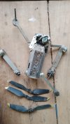
I launched the drone vertically up to the usual 150-foot altitude I set for all waypoint missions but before I could hit the "play" button on my Litchi waypoint screen, the drone abruptly departed like a bat out of hell on a westerly heading, never to be seen again, until a few days ago when the drone's mangled carcass was handed over to me by a farmer who saw my phone number on the drone, but sadly did not see the drone until he had run the plow over it and pulverized it beyond any hope of salvage.

I still wonder whether that bizarre flyaway should be attributed to the solar flare or like your Mavic 3, was the result of GPS jamming which is a distinct possibility given that a low-level insurgency is brewing just one hour's flight time from where I type these words. Regardless, I will replace that Mavic Pro Platinum with an identical model even though mainstream drone owners largely regard the MPP as an antique and obsolete curiosity.


1718188774275.jpeg
 
Last edited:
still wonder whether that bizarre flyaway should be attributed to the solar flare or like your Mavic 3, was the result of GPS jamming which is a distinct possibility given that a low-level insurgency is brewing just one hour's flight time from where I type these words.
I have lost at least 2 (VERY legacy) DJI drones to what happens when GPS goes mental, and have returned to them now, 7 years later, in the hope there might be some sort of redundancy going on that might prevent that sort of thing, so it's disturbing to read that these sort of things still go on and haven't been ironed out through general iteration.

What is slightly more disturbing is that on the latest generations of all our favourite flyers we don't seem to be instantly force ATTI mode anymore - it is simply not there as a mode any more, which pretty much leaves us at the mercy of whatever GPS madness is going on at the time. Are there any ways around that we know about ?
 
The drone was not too far from me and luckily it was heading towards me.all of a sudden I had the message "gps lost" atti mode initiated fly with caution", low battery (my battery was 50%) and another error code appeared which I don't remember .
What I did was to push the forward stick all the way and hoping for the best. I was taking off from a cliff about 3meters above the sea , then when I was above the sea the altitude was correcting to 16-17 meters. When the lost gps incident happened the drone took a dive almost landing in the sea, it came to around only 25-30cm above see, my controller was showing height -2meters,
You might find posting the .txt flight log to be useful and you would find out if it regained GPS etc.
In ATTI mode the drone should not exhibit a tendency to fly to a place of its own choosing but it will not automatically fight wind.
It will fly as you instruct it with the control sticks, meaning, for example, that in a side wind you would have to give it roll to counter the side wind.
With regards to height over water in ATTI mode, I am not certain how it should behave, it would seem odd to me that it would dive. Page 73, or there abouts, of the manual says that
1} The height limit is 30m when GPS is unavailable but the lighting is sufficient for VPS
2} The height limit is 3m when GPS is unavailable and the lighting is INsufficient.

The latter raises the possibility that, even though the lighting was presumably sufficient, the drone 'did not like' the water as a reference point for VPS as thus considered VPS inoperable and reduced the height limit to 3m in some semblance of 2) above.
Note that this is speculation on my part and probably wrong but the logs might tell us or you.
 
Last edited:
  • Like
Reactions: GadgetGuy and AeroJ
I had a very scary incident yesterday with my mavic 3.
Just a point.

I got sucked in by your text and forgot about the title.
"Signal" would, I think, generally be taken as meaning the control signal.
I have a vague recollection that if GPS and control signal are simultaneously lost then the drone will land where every it is.
You might want to check if my memory is correct and fly accordingly, if I am correct and that happens over the sea you are going to lose the drone.
 
Last edited:
I had a very scary incident yesterday with my mavic 3. In my country there are lots of incidents lately of gps jam and signal lost, when there is a situation of gps jam the home point is updated to Lebanon and when the return to home is initiated (due to signal lost), the drone heads to Libanon and it is running out of battery and either crashing or getting lost somewhere in the sea.
It happened to me as well yesterday, I was flying very cautions before taking off was making sure home point was correct and satellites more than 16-20.
I had two flights with no problem at all, but during my last flight (again double checked homepoint/satellites before taking off) the scary "gps lost " issue hit me.
The drone was not too far from me and luckily it was heading towards me.all of a sudden I had the message "gps lost" atti mode initiated fly with caution", low battery (my battery was 50%) and another error code appeared which I don't remember .
What I did was to push the forward stick all the way and hoping for the best. I was taking off from a cliff about 3meters above the sea , then when I was above the sea the altitude was correcting to 16-17 meters. When the lost gps incident happened the drone took a dive almost landing in the sea, it came to around only 25-30cm above see, my controller was showing height -2meters, lucky for me I could see it and push the left stick up, drone then was drifting left towards the rocks, then made a slight turn right and came back to me and manage to land it. Wind was blowing towards the see not towards the rocks. I was focused watching the drone, I don't know if it regain the gps signal and autocorrected it self. What I don't understand is the dive from 17 meters height to go to almost 0 meters . Is this because I was flying above sea and atti mode kicked in?
Scary incident but I was very lucky to bring it back. I don't know if there was something else I could do?
Just a thought, but it might be interesting to mark the location on Google Earth, make a note of the coordinates and then head back to the location and run a GPS positioning app on your phone, just to see if there's a significant disparity between the northing and westing coordinates you got from WGS84 Google Earth and what the phone app settles down to display.
 
Loosing GPS signal may also be caused by a bad compass calibration. The error messages are not really reliable then. In former times with Phantoms there was a possibility to do an emmergency calibration while in air, by several 360° turns around the yaw axis. Would be worth trying same with actual models in case of GPS loss.
 
I can hazard a guess that even though it is not certified as a pressure-altitude source, the altitude can still be derived from triangulated GPS data from multiple satellites, so might be used as 1 of several sensor inputs to manage altitude. So if it is doing that, and relying, partially or otherwise, on that info to hold you vertically in place, when that info disappears it will have to fall back to other methods

Nope. DJI drones use a barometric pressure sensor to measure changes in altitude. GPS data is only used for horizontal position, not used for vertical measurement.
 
  • Like
Reactions: AeroJ
1} The height limit is 30m when GPS is unavailable but the lighting is sufficient for VPS
2} The height limit is 3m when GPS is unavailable and the lighting is INsufficient.

I think both of those only apply from the point of takeoff. The idea being that people don't know how to deal with ATTI mode. So, without GPS, the drone will still manage to brake to a halt and hold horizontal position when sticks are centred as long as it has sufficient lighting for VPS and stays within the 30m operating height range of VPS.

If there is no GPS, and no VPS due to insufficient lighting, then limiting the height to 3m prevents the drone from climbing to a height above which ATTI mode might become more difficult to cope with.

But if the drone is already operating higher than either of those limits when GPS and/or VPS were to suddenly become unavailable, I don't think it makes any sense that the drone should then automatically force itself to descend down to below those 30m or 3m limits. Yes, the drone would revert to ATTI mode at that point, but it would still react to stick inputs (including height control via throttle inputs), and it would continue to be perfectly capable of holding altitude based on its barometric sensor.
 
  • Like
Reactions: GadgetGuy and AeroJ
I have a vague recollection that if GPS and control signal are simultaneously lost then the drone will land where every it is.

That is true. Losing one or the other isn't cause for panic. But losing both at the same time means the drone will land where it's currently at.

Losing control signal, the drone will respond with its chosen and configured failsafe mode (RTH, Hover, or Land).

Losing GPS, the drone will rely on its VPS sensor (when within range and lighting conditions) for horizontal position hold. Losing both GPS and VPS, the drone reverts to ATTI mode, which is perfectly controllable as long as you realize it's not going to brake to a halt and hold a fixed position whenever the control sticks are centred. You are in control with stick inputs. But with sticks centred the drone will be free to drift with the wind.

Losing both control signal and GPS, the drone is not being controlled by you and it doesn't know where it's at. So for safety, the default reaction is to autoland.
 
  • Like
Reactions: Yorkshire_Pud
I think both of those only apply from the point of takeoff. The idea being that people don't know how to deal with ATTI mode. So, without GPS, the drone will still manage to brake to a halt and hold horizontal position when sticks are centred as long as it has sufficient lighting for VPS and stays within the 30m operating height range of VPS.

If there is no GPS, and no VPS due to insufficient lighting, then limiting the height to 3m prevents the drone from climbing to a height above which ATTI mode might become more difficult to cope with.

But if the drone is already operating higher than either of those limits when GPS and/or VPS were to suddenly become unavailable, I don't think it makes any sense that the drone should then automatically force itself to descend down to below those 30m or 3m limits. Yes, the drone would revert to ATTI mode at that point, but it would still react to stick inputs (including height control via throttle inputs), and it would continue to be perfectly capable of holding altitude based on its barometric sensor.
You may well be correct that these limits will not force a descent but it is still the only thing I can come up with to explain the descent the OP mentioned.
That said, I think VPS height can, in the absence of GPS, come into play during a flight, e.g. a drone being flown down into a canyon, losing GPS and then going low enough for the canyon floor to come within VPS range, that has resulted in drone being prevented from climbing out of the canyon.


There is one other point, which is why I think the log would be useful.
What does the log see/show as the maximum permissible height when GPS is lost ?
I am on the wrong device to check my own logs for GPS-less flights but I have reduced the maximum permissible height whilst the drone was flying and above the new set height limit. In every instance the drone descended autonomously to comply with the new ceiling.
I have also seen a log where the floor of an air corridor reduced the localised maximum permissible height recorded in that log. The drone subsequently got stuck, over water, when it RTH'ed into the side wall of that corridor. It only escaped when a low battery forced landing commenced and the pilot was able to get it over land after it was below the corridor.

Seeing the log would probably clear up the speculation, let's hope the OP posts it.
 
Last edited:
  • Like
Reactions: Zbip57
I have also seen a log where the floor of an air corridor reduced the localised maximum permissible height recorded in that log. The drone subsequently got stuck, over water, when it RTH'ed into the side wall of that corridor.
You make lots of good points.

I have only an ancient Phantom-1, a Phantom 3 Pro, and an original Mini. So I'm limited to running experiments only with them. But I have read that some newer models now can recognize bumping into an Altitude Zone restriction during a RTH, and know enough to automatically descend to allow returning beneath that altitude restriction.

Seeing the log would probably clear up the speculation, let's hope the OP posts it.
That's certainly always the best way to figure out what's going on in any case. It's rarely reliable to trust a pilot's recollection of circumstances when an unexpected crisis occurs. One should always be skeptical of what they believe happened and what they say their response was. The data in the flight log is the only reliable source of interpreting the exact circumstances.

It's bizarre that the FAA requires the use of safety equipment like black box flight data recorders and cockpit voice recorders for this exact purpose (factual analysis of aviation mishaps), yet when similar technology is made available on DJI drones it's somehow considered espionage and a threat to US national security. Go figure. Sheesh.
 
But I have read that some newer models now can recognize bumping into an Altitude Zone restriction during a RTH
Suren posted in the thread I mention that his mavic 3 x? will, during an RTH, descend and fly under a corridor if necessary. Us stick-in-the-muds on older drones will have to do it manually.

yet when similar technology is made available on DJI drones it's somehow considered espionage and a threat to US national security. Go figure. Sheesh.
I suspect the concern is more along the lines of "What will someone do with the data when the data is uploaded to a foreign computer".
 
I suspect the concern is more along the lines of "What will someone do with the data when the data is uploaded to a foreign computer".
Yes, that's exactly what I'm asking. What actually could any foreigner do with that data?

What exactly in those flight logs could in any way be of espionage value???

You have yourself studied and analyzed flight logs. How are recorded battery voltages, airspeed data, or any other recorded flight data (even GPS co-ords) considered to be such a vital risk to US National Security???

Google, and Garmin, are American companies, no? They make their Google Earth and Google Map and Garmin software available to everyone. With that, you put your cursor over any feature on the entire globe and it tells you the precise GPS coordinates.

How is it any more dangerous if GPS coordinates are recorded by DJI's flight data recorder?

If someone could explain to us precisely HOW these drones present an enormous risk warranting such a ban, that would go a long way to generating public support for the ban. It's not sufficient justification to merely say they're a Chinese company, and nothing Chinese can be trusted.

What makes a DJI drone more dangerous than a Skydio drone?
 
  • Like
Reactions: Meta4
Yes, that's exactly what I'm asking. What actually could any foreigner do with that data?

What exactly in those flight logs could in any way be of espionage value???

You have yourself studied and analyzed flight logs. How are recorded battery voltages, airspeed data, or any other recorded flight data (even GPS co-ords) considered to be such a vital risk to US National Security???

Google, and Garmin, are American companies, no? They make their Google Earth and Google Map and Garmin software available to everyone. With that, you put your cursor over any feature on the entire globe and it tells you the precise GPS coordinates.

How is it any more dangerous if GPS coordinates are recorded by DJI's flight data recorder?

If someone could explain to us precisely HOW these drones present an enormous risk warranting such a ban, that would go a long way to generating public support for the ban. It's not sufficient justification to merely say they're a Chinese company, and nothing Chinese can be trusted.

What makes a DJI drone more dangerous than a Skydio drone?
The cynic in me says because DJI currently has the monopoly on a multi-billion dollar industry that Skydio wants. First rule of policing: FTM. Follow The Money.
 
The cynic in me says because DJI currently has the monopoly on a multi-billion dollar industry that Skydio wants. First rule of policing: FTM. Follow The Money.
If they were honest about that and admitted that's the goal, then fine. That I could understand.

If it's all about protecting your country's existing industry against some artificially low-priced offshore competition, then slap a tariff on 'em like you do with your steel industry, automotive industry, lumber industry, dairy and beef industry, whatever.

But there is no viable US drone manufacturer currently able to compete with, let alone replace, the enormous market share currently held by DJI. Banning DJI altogether from the market, and grounding their existing drones, would totally crash the entire drone economy of the USA.

It's not merely hobbyists that will suffer. There are businesses and vital government services, police and fire departments, search and rescue, etc. It's completely nuts!
 
What actually could any foreigner do with that data?
I suspect not a great deal.
BUT, in truth and donning an aluminium foil hat, do we know all that the logs record ? We certainly can not see all the data they record?
Why start encrypting the phone and drone DATs ? P3 drone DATs are readable and I have made use of them. Post P3? they started to encrypt the DATs on the drone and finally the screen device DATs. I thought they had seen the light when the Mini 3 Pro had readable screen devices DATs but they have gone back to encrypting them.
The app can recognise the flights flown under the current login, it displays ONLY those logs.
It does not display logs flown under other logins, and nothing in any of the CSVs I have looked at gives any indication of which login was used.
The .txt flight log includes low resolution copies of the photos that we shoot. Airdata and FlightReader can, from memory, show them.
 
Last edited:
Why start encrypting the phone and drone DATs ?
There are probably many reasons why it's a good idea to encrypt the log files, such as to prevent competitors from studying and learning from them

Another good reason would be to guarantee the integrity of the log file, preventing anyone else from editing the contents. The logs are recorded primarily for DJI's own benefit as a factual record of all the various flight parameters. In case of any legal dispute over liability, DJI can point to the actual data to verify the facts of the case.

The .txt flight log includes low resolution copies of the photos that we shoot.

All of the photos?? Or just the single representative thumbnail image that's displayed next to each flight summary in the app?

Either way, how are these low resolution thumbnails deemed to be so much worse of a security threat than the bazillion hi-res photos, including full metadata, posted every day by millions of people on FaceBook? Or the 4k and soon (or already?) 8k full resolution videos uploaded every day to YouTube?
 
Lycus Tech Mavic Air 3 Case

DJI Drone Deals

New Threads

Forum statistics

Threads
132,302
Messages
1,571,779
Members
161,019
Latest member
dugan