DJI Mavic, Air and Mini Drones
Friendly, Helpful & Knowledgeable Community
Join Us Now

Mavic 2 Enterprise Advanced Thermal Map in Pix4D

I finally had time to go out and obtain the images to make a thermal map with the Enterprise Advanced.

Pix4D wanted 90 front and 90 side overlap per the directions and I found this to make the aircraft fly at only 2-3 mph. I do think that DJI Pilot does not have the correct information about the camera settings for mapping as it could of flew much lower and faster as there was such a long period between images.

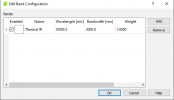
When processing in Pix4D the software recommended using the settings for a FLIR Tau 2 sensor with 640 resolution.
When I tried using the Mavic Enterprise Advanced 620x512 setting the images would not stitch. I am going to try to make my own camera setting using the settings from the FLIR, but tweaking them a bit.

Overall I am very happy with the output though as when I compare it to regular images, it stitched this low sloped roof extremely well.
I chose this building as it is known to have leaks all over and I know where they are. It is basically a perfect place to train on qualitative thermography dealing with low slope roof moisture in the insulation.

Roof Specs:
Built-up Roof Covering (Not Modified Bitumen as far as I can tell due to the spacing between layers)
Unknown insulation under the covering
Corrugated metal decking for sheathing

Today's environmental factors made it an okay day for this.
Temperature got over 45* F
The sun was out and thermally loaded the roof
The wind was 10mph, but had gusting over 20mph at times.

View attachment 138236

Orthomap of thermal images.
Take note that until DJI releases and SDK that Pix4D can use, you can only make a thermal map without the radiometric data embedded in it. The above map is more like an RGB ortho.

Compare the above with this image of the building and you can see that the stitching was very good.
View attachment 138237

For those who want to try on solar panels, keep in mind that due to the angle of the panels you must get the drone to line up the same way or you will run into problems. Raptor Maps explains this well in their article on how to use this new drone for solar mapping.

I did not have this problem as my target has only the slightest of an angle.
Excellent post and info! All well informed!
Also enjoyed the Deer in corn thermal too!

Side bar questions: has there been any new FW that has improved the M2EA RGB camera use & settings; any new features overall that improved the platform.

After having M2EA, Anafi and EVO2 Dual... can't recall if you picked up a EVO2 Ent Thermal too? How are you leaning now... if you peeled it back to 1 small thermo... what would be your direction now?

I may have hastily mis-judged that EVO2 Ent... after flying the M3. Reconsidering M2EA or EVO2 Ent...
Side bar questions: has there been any new FW that has improved the M2EA RGB camera use & settings; any new features overall that improved the platform.
No, not at this time. There are always rumors that a big update is coming. The camera needs more settings as only Auto is available and there are no panoramas like the Mavic 2 Enterprise and Enterprise Dual? offered and which I have found to be useful in Public Safety.

After having M2EA, Anafi and EVO2 Dual... can't recall if you picked up a EVO2 Ent Thermal too? How are you leaning now... if you peeled it back to 1 small thermo... what would be your direction now?

If I had to choose only 1 small thermal, it would be the Enterprise Advanced. The free 1 year Enterprise Care with option to purchase a second year makes me able to fly more comfortably that in the event of an accident I can be up and flying again in a week or so and not totally out almost $7000. The thermal sensor works well and as an aircraft it has the same polished feeling of all the Mavic 2's.

We just got our Matrice 300 RTK in a few weeks ago. When viewing the Thermal/RGB Side by Side setting, it has the same exact feel as the Enterprise Advanced, except in a sub menu you get Isotherms, and may have more but we have yet to fly our new bird.

As we expand our fleet and pilots at work, I am pushing for either 3 Enterprise Advanced or 3 Evo 2 Enterprise 640T's, as the Boson Sensored Evos are both at the $10,000 mark.

One of the Blue sUAS stated they will have a 640 Boson soon, it may have been Teal, but with their prices high to begin with, I do not see them being under 10K most likely.
 
How to I correct the values for the temps on the reflectance map?

1682820456171.png

Photos taken with the M2EA, Thermoconverter to convert the jpeg's to tiff, and the following camera parameters from @Faquaral 's post: Mavic 2 Enterprise Advanced Thermal Map in Pix4D

1682820597708.png

1682820685420.png

Here are the Thermoconverter export settings. I didn't edit any of them:
1682820757795.png
 

Attachments

  • 1682820723744.png
    1682820723744.png
    39.4 KB · Views: 2
  • Like
Reactions: jaja6009
Lycus Tech Mavic Air 3 Case

DJI Drone Deals

Forum statistics

Threads
130,931
Messages
1,558,023
Members
159,936
Latest member
adsjr