DJI Mavic, Air and Mini Drones
Friendly, Helpful & Knowledgeable Community
Join Us Now

Mavic 3T Blury Thermal Image and different size now

NorthEastJohn

Well-Known Member
Joined
Oct 21, 2016
Messages
92
Reactions
32
Age
59
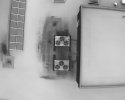
I was out collecting some re-occuring roof thermal data and noticed that the images I captured last night were blurry when compared to previous pics. Images were taken of same subject. Thermogram was FFC correct before capturing the image. I noticed that the new data properties lists the thermal image size of 1280x1024 where is should be 640x512 like the older one. Not sure why the new image is displaying and not sure if that is even related to the blurry image or if I am having another issue with the thermal sensor. Also, older image that is clear is 1MB in size and the newly collected image with larger format size is 1.2MB.
 
Things to check.

The current or older images were in IR Super Res or maybe they were shot in High or Low Gain.
 
@jaja6009 Double checked the blurry images taken last night and they were in High-gain. Also, not sure what IR Super Res. Is that a setting on the Mavic 3T?
 
Super Res was added in an update.

I think you get to it in Camera Settings. It basically makes the hotter and colder part of the image standout more.
 
Oh, I will look for it. Never purposely touched it. Do you know if enabling Super Res will make the pictures blurry?
Trying to attach a comparison of two of the thermograms, but they just don't load with I select attach file.

Map created in 2023 DroneDeploy

Map created last night
 

Attachments

  • DJI_20231024181335_0011_T.JPG
    DJI_20231024181335_0011_T.JPG
    78.2 KB · Views: 3
Can't get the second one from last night to load. weird. I did just upgrade to the newest version of firmware yesterday before flying?
 
I just found UHF Res. It is on. I think that it's been there for awhile. No difference in the image when turned on/off
 
I am just trying to brainstorm with you.

Super Res should not be used for radiometric work. I am not sure if Drone Deploy is processing as a radiometric map or visual. Super Res should not make the image blurry, it should make the hottest thing and the coldest thing in the image standout more. If using Super Res images, I do not think Drone Deploy will make a radiometric map where you can get temperature values from each pixel.


You should be using High Gain, as low gain definitely gives a less defined image and also less accuracy in temps.

Maybe take an image from each dataset and view it in DJI Thermal Analysis Tool. Maybe that will give you some insight.

When looking at both maps, some areas are better in each map. What was the ambient temperature for both maps? Temperature will affect contrast between things.
 

DJI Drone Deals

New Threads

Forum statistics

Threads
136,496
Messages
1,618,242
Members
165,125
Latest member
ZEMUSHKA
Want to Remove this Ad? Simply login or create a free account