I was in western Colorado, driving north on an unpaved road in the Book Cliffs leading toward Baxter Pass. I'd just left Mesa County and entered Garfield County. My intent was to capture some still photos of the local topography in furtherance of my photography hobby. I am strictly a recreational flyer.
It's a pretty remote area, and the road is not maintained by the county. The only signs of development in the immediate vicinity were some aerial transmission lines paralleling the right-of-way, a couple of seemingly derelict corrals, and a gas compressor facility. There are no military or other sensitive sites in the area.
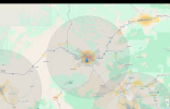
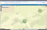
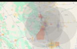
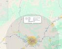
A cold front was approaching, and partly cloudy skies had given way to a general overcast and plummeting temperatures. Not a great day for photography. Even so, I pulled onto a dirt track a mile or so beyond the compressor station and made preparations to launch my Air 3. I was in a narrow valley, and the surrounding terrain was several hundreds of feet higher all around. When I powered up the drone and controller, a warning message immediately popped up on the controller screen. The gist of the message was that I was in a restricted airspace, that I was not to exceed 500 AGL flight (100 feet higher than is permissible), and that any operation of the drone could result in a loss of control (I regret not having taken a picture of the screen and don't recall the exact wording).
Restricted area? I was probably 20 or 25 miles from the Grand Junction Regional Airport and more than 10 miles from the nearest private airstrip on Mack Mesa. I heard no aircraft and received no ADS-B warning.
When I returned home, I consulted my Denver Sectional map. There was no indication on the map of restricted airspace in the area where I had stopped. I noted, however, that the location where I chose to fly lay under the direct airway between the Grand Junction VOR/DME and the Vernal, UT airport (the latter is a supposition, because I don't have the adjoining Salt Lake City Sectional, but it's the nearest town in that general direction with an airport). Direct airways are denoted on the map by straight, light blue lines connecting navigation aids. The Grand Junction VOR/DME is not located at the airport but is situated instead on the uplands in Glade Park, CO, about 16 miles west.
And so, after this lengthy narrative, a couple of questions: 1) Are direct airways, by definition, restricted airspace? 2) Was this warning typical of something I might expect from DJI's geofencing function?
I can find no mention of such restricted status in any of my reference materials, including the "Pilot's Handbook of Aeronautical Knowledge," online, or on the Sectional map's legend.


