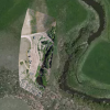
I used 125 still images from a Hyperlapse video with a trial version of PIX4D and was able to create this point cloud. It looks like it could be useful with the exception of one thing. The whole point cloud is tilted. The water in the slow moving parts of the river should be flat but isn't.
I also found that the geo-location is off in the flat/ortho view. It's almost as if the point cloud is rotated around an axis and if "un-rotated" it might align with the background satellite image.

The DJI software asked me to re-calibrate the compass at the beginning of the session. Maybe there was enough magnetic interference to shift geo-location??
Maybe my whole workflow was faulty. I don't really know because it was my first attempt at creating a photogrammetry point cloud? Any advice would be welcome.
PS: I'm using a Mavic 2 Zoom flying at 300 ft agl with zoom set at widest angle.


