DJI Mavic, Air and Mini Drones
Friendly, Helpful & Knowledgeable Community
Join Us Now

Planning Drone Missions in Google Earth

I'm a Safari user so looking forward to that update in the future.
Congratulations on creating this Chrome Google Earth plug-in that allows a UAS pilot to pre-plan a flight with such prevision, including the angle of camera views from the drone. I've never used Litchi but plan to get it. I wonder if you have considered a mapping function. Drone looking straight down with 50% overlap for creation of simple maps. This would be useful in my own entomological research where I map out native ground-nesting bee nesting sites and plot the occurrences of their food host plants.

A Point of Interest orbit feature would also be cool. :cool:

Thanks again for all that you have done. An amazing flight tool.
Best,
Steve

Stephen Buchmann
Dept. of Ecology and Evolutionary Biology,
The University of Arizona,
Tucson, AZ
Thank you for the feedback Stephen. I have not yet considered a mapping product, but I would love to make something that people would use (All of the development tools I make will be free and open-source).
Before I started this project, I actually wrote machine learning algorithms for a research project I started to autonomously map aquatic invasive species (Eurasian Milfoil) using a drone. Milfoil is a huge threat to the Finger Lake region, where I am from. I believe one of the biggest potentials of drone technology is the environmental impact it can make. I appreciate hearing about you could use something like this for your bee work!
 
  • Like
Reactions: BigAl07
Hi Tolly, this Flight Planner actually goes a step beyond what Dronelink offers in its 3D visualization of mission planning. The DroneHub Flight Planner lets you create the missions in Google Earth, whereas in Dronelink you can only export a mission to view in Google Earth
Well ok thx. I'll have a look :)
 
  • Like
Reactions: seccode5
Neat, is it feasible for the plugin to work in the external Google Earth Pro application? Much more powerful than the web based variant.

A tool for mapping would be nice, Dronedeploy does it well enough but it semi requires an internet connection where litchi doesnt.
 
Neat, is it feasible for the plugin to work in the external Google Earth Pro application? Much more powerful than the web based variant.

A tool for mapping would be nice, Dronedeploy does it well enough but it semi requires an internet connection where litchi doesnt.
I would have to take a look at Google Earth Pro, as I have not yet used it. Making a Flight Planner for an offline version becomes complicated to support, whereas Chrome Extensions will auto-update so that you will always be using the most up to date version. I can look into porting this tool to Pro in the future.

Could you elaborate on what features you are looking for in a mapping product? And what use cases would the tool apply to? Thanks!
 
Could you elaborate on what features you are looking for in a mapping product? And what use cases would the tool apply to? Thanks!

Complete offline capability is a function a lot of modern day app developers just don't comprehend because they live in cities. Dronedeploy DOES work offline but occasionally it will ask for a username and password at the login screen which locks me out of the app until I have some sort of service, it's infuriating.

For those of us who adventure in what most would consider "extreme remote areas" I need an app that allows full functionality with no connection.

Here's a list:

  1. All of litchis capabilities working on the app
  2. All of dronedeploys capabilities on the app
  3. Downloading of maps (topo, satellite, etc)
  4. Ability to import maps and display on app (kmz, geotiff, sqlitedb)
  5. Ability to import waypoints from external apps (GEP)
  6. Ability to import GPX icons/boundries as an overlay
  7. Never seen this done but if the boundries and icons could be displayed as an overlay on the real time video feed from the UAS that would be extremely useful and dope. Very difficult to create, lol.
  8. 100% working offline
Essentially I'm asking for an app that mixes what litchi, Dronedeploy and OsmAnd can do into one that pulls from each apps best features.

Screenshot_20201003-081609_OsmAnd.jpg
Being able to see overlays and important markers is essential while flying, no flying app does this yet.


Screenshot_20201003-081920_DroneDeploy.jpg
Dronedeploy does a lot right but it's clunky on mobile and has hiccups when offline.

20201003_082836.jpg
Litchi gets a lot right but has no good way to cache maps for offline use. It's also lacking any advanced features found in Dronedeploy for mapping.


My wants are a tall order but if someone developed an app that was a combo of the three above, they'd be a big hit very quickly. Oh and avoid forcing a RC connection during Waypoint missions, like a few other Waypoint apps do, completely defeats the purpose.
 
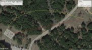
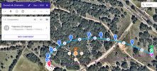
I would like to use your innovative method to import a csv file (waypoints along a log-spiral curve) into Google Earth to create a curved drone flight path as the entry scene for a more dramatic video sequence (perhaps add an orbit around the target point). DroneLink was gracious enough to do this for me as a demo. The attached images illustrate a) the set of original log-spiral waypoints imported into DroneLink to create the b) DroneLink flight path [blue waypoints]. If I can do this all at once using your method, that would be great.
Would you explain how to do this using your method?
 

Attachments

  • DroneLink Demo Flight Trajectory 113020.jpg
    DroneLink Demo Flight Trajectory 113020.jpg
    1 MB · Views: 13
  • DroneLink Imported Curved Flight Path (1).jpg
    DroneLink Imported Curved Flight Path (1).jpg
    57.5 KB · Views: 13
ChrisOutdoors, sounds like you got a lot of development to do. Let us know how it works out for you. ;)o_OThumbswayup

seccode5, Great work! :D
 
can someone provide the Chrome browser .crx extension file for DroneHub Flight Planner. The developer stated it will be free forever on this bbs
 
Last edited:
Will this automatically set the gimbal pitch or does this have to be done manually at each waypoint in Litchi ?
 
Will this automatically set the gimbal pitch or does this have to be done manually at each waypoint in Litchi ?
To view this content we will need your consent to set third party cookies.
For more detailed information, see our cookies page.
Visual Mission Planning with Google Earth
 

DJI Drone Deals

New Threads

Forum statistics

Threads
134,565
Messages
1,596,305
Members
163,065
Latest member
kyle465
Want to Remove this Ad? Simply login or create a free account