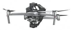
I'm about to order a M2P and I'd like to make sure it will meet my needs for a specific project. I would like to be able to hover and take a single photo, then change elevation by a very specific (and relatively small amount, probably 5-6cm) and then take another photo. I'd like to be able to fine tune the vertical change, as accurately as possible, ideally down to about a millimeter. If I calibrate my system and decide that 5.6cm is the right amount of vertical change between photos, I'd like to be able to repeat that, quickly and easily - take a photo, drop or rise 5.6cm and then take another photo.
Can I do this with waypoints? Or is there another way to accurately change elevation by a specific and small amount?
Thanks
Can I do this with waypoints? Or is there another way to accurately change elevation by a specific and small amount?
Thanks


