My DJI software is preventing me from taking off with no explanation other than Restricted Area. It is a location I have flown many times before, and B4UFLY and AirData both say I should be able to launch. The coordinates are 34.167613, -78.048899. I am aware of the RR tracks owned by the D.O.D. which I am unable to fly over, as well as the Military Ocean Terminal Sunny Point to the Northwest. I would appreciate any help.
You are using an out of date browser. It may not display this or other websites correctly.
You should upgrade or use an alternative browser.
You should upgrade or use an alternative browser.
Restricted Area Question
- Thread starter bg4166
- Start date
I am aware of the RR tracks owned by the D.O.D. which I am unable to fly over, as well as the Military Ocean Terminal Sunny Point to the Northwest. I would appreciate any help.
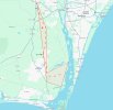
It looks like that DJI nfz extends over those railway tracks which you mentioned.
DJI FlySafe

photoshop67
Well-Known Member
- Joined
- Feb 14, 2017
- Messages
- 73
- Reactions
- 34
- Age
- 75
JanM
New Member
I experienced a similar limitation. The no fly zones around Houston significantly increase when the president or presidential candidates are in the area.
Those are FAA TFRs, Temporary Flight Restrictions, unrelated to DJI authorization zones.I experienced a similar limitation. The no fly zones around Houston significantly increase when the president or presidential candidates are in the area.

How to Check for TFRs for Drone Pilots - Restricted Areas - Pilot Institute
Situational awareness is one of the key skills of a drone pilot. This involves knowing all the potential hazards you should be concerned with, such as obstacles or other flying objects nearby. However, not all hazards are visible – some take the form of flight restrictions. Flight restrictions...
kpjamro
Member
That's a really odd shape. Looks like somebody made a typo in entering the boundary coords. Suggest you contact DJI to see if they made a mistake.My DJI software is preventing me from taking off with no explanation other than Restricted Area. It is a location I have flown many times before, and B4UFLY and AirData both say I should be able to launch. The coordinates are 34.167613, -78.048899. I am aware of the RR tracks owned by the D.O.D. which I am unable to fly over, as well as the Military Ocean Terminal Sunny Point to the Northwest. I would appreciate any help.
That's a really odd shape. Looks like somebody made a typo in entering the boundary coords. Suggest you contact DJI to see if they made a mistake.
It's just another sloppy attempt of DJI to "approximately" cover a NFZ using the minimum number of coordinates.
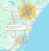
In the image below, the dashed red line marks the path of the railroad track owned by the Dept of Defence, which you're not supposed to fly over. The red X is the location where the original poster wants to fly. As he said, both B4UFLY and AirData say he's allowed to fly there, as it isn't over the railway track. But, unfortunately he's within the red NFZ defined by DJI. So, even though it is "legal" to fly there, DJI prevents from him doing so.
He could legitimately request an unlock code from DJI to fly at his location.
Curiously, the question mark and black arrow shows a spot where the forbidden railway extends outside of DJI's nfz. So, even though it actually is illegal to overfly the same railway at that spot, DJI would not prevent you flying there.
It's always the pilot's responsibility (not DJI's) to determine whether you can or cannot legally fly. Just because DJI permits you to fly or not, does not necessarily make it true.

kpjamro
Member
That depends on what the military is transporting over that section of track. Is anyone familiar with the facilities at each end and what they're moving?Putting a railroad into the FlySafe database seems like a bit of overreach....
kpjamro
Member
Similar threads
- Replies
- 9
- Views
- 3K
- Replies
- 10
- Views
- 3K
- Replies
- 10
- Views
- 2K
- Replies
- 27
- Views
- 6K


