DJI Mavic, Air and Mini Drones
Friendly, Helpful & Knowledgeable Community
Join Us Now

Theodolite like drone camera App

JBrintnell

New Member
Joined
Apr 19, 2021
Messages
3
Reactions
0
Age
55
Location
lancaster ohio
New Drone pilot, and new Mavic Air 2 owner. I'm looking for an app that will put a compass overlay on the photos I take with the drone similar to how Theodolite does. I don't necessarily need angle and such, but GPS coordinates and Camera heading would be helpful. I bought the drone to do survey work for wireless equipment.

Any advice would be helpful.
 
GPS coordinates and Camera heading would be helpful.
That information (and much more) is in the metadata for each image file the camera creates.
Here's just a little of the metadata stored in one image file.
i-jB7sMMN.jpg
 
That information (and much more) is in the metadata for each image file the camera creates.
Here's just a little of the metadata stored in one image file.
i-jB7sMMN.jpg
How did you get this information? When I right click a photo and look at properties I don't see most of this. Also, which setting shows what the heading of the camera is?
 
How did you get this information? When I right click a photo and look at properties I don't see most of this. Also, which setting shows what the heading of the camera is?
That's some of the imformation in the XMP section of the image metadata.
You need a specialised metadata viewer to see it.
Picture Information Extractor is a good one.

Gimbal Yaw Degree is the camera heading
 
  • Like
Reactions: gspell
That's some of the imformation in the XMP section of the image metadata.
You need a specialised metadata viewer to see it.
Picture Information Extractor is a good one.

Gimbal Yaw Degree is the camera heading
So I downloaded and purchased PIE. I need the GPS Coords, time/date and Gimbal Yaw Degree to show on image. Do you know how to get the Gimbal Yaw Degree to show up? I couldn't just pull it up in "Tags"
 
So I downloaded and purchased PIE. I need the GPS Coords, time/date and Gimbal Yaw Degree to show on image. Do you know how to get the Gimbal Yaw Degree to show up? I couldn't just pull it up in "Tags"
I don't know a way to automate that and would have to copy the data and paste it into the image in Photoshop to do that.
 
I have the same need from a client of mine, but they also want angle or orientation relative to true North overlaid over normal photos taken. I'm also a developer, how many would find use in a desktop app that could read the metadata of an image and overlay the values like Theodolite over the image and export the image out as a .JPG?
 
I have the same need from a client of mine, but they also want angle or orientation relative to true North overlaid over normal photos taken. I'm also a developer, how many would find use in a desktop app that could read the metadata of an image and overlay the values like Theodolite over the image and export the image out as a .JPG?
See this related thread:
 
See this related thread:
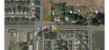
Thanks for showing that thread. It looks like I'll have to do it through Photoshop by reading the metadata manually and doing some trigonometry. My client want images of the positioning of a transmitter on a pole topper for a telecommunications company. They want something like what I attached here. Also, I can take an image directly in front of the transmitter and find the orientation from true North from that and overlay it from Photoshop too.

Guess there is no software to do this out there, unless an enterprise license is purchased for 3D mapping or 2D orthomosaics mapping. That would be idle, but costly for some smaller startups.
 

Attachments

  • Screenshot_20210728-191349.jpg
    Screenshot_20210728-191349.jpg
    2.1 MB · Views: 3
Lycus Tech Mavic Air 3 Case

DJI Drone Deals

New Threads

Forum statistics

Threads
131,742
Messages
1,565,808
Members
160,593
Latest member
Bob@max