DJI Mavic, Air and Mini Drones
Friendly, Helpful & Knowledgeable Community
Join Us Now

Tucson Airplane Graveyard

PeRo

Well-Known Member
Joined
Oct 11, 2018
Messages
72
Reactions
47
Age
61
Location
Bavaria, Germany
I am planning to visit AZ and Tucson in March. Now wondering whether it is possible to find a launch site suitable for spotting the famous Airplane Graveyard - even at distance. Naturally, there are lots of restricted areas / NFZs around the city and the Davis-Monthan Air Force Base. Any recommendations?
Thanks!
 
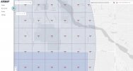
Looking at Google Earth and the FAA SUAS Facility Maps, it appears that the north side of Palo Verde park would give you 200' AGL with a LAANC authorization about 2.8 miles from the nearest airplanes. The controlled area to the east and south around Davis-Montham AFB is all 0' AGL maximums. But the outer edge to the east on S. Irvington Road a little way beyond S. Harrison Road would allow you 400' AGL at a distance of about 2.0 miles from the nearest airplanes, a couple of rows of C-130s with tankers beyond.

Screenshot 2022-02-01 182746.jpg
 
  • Like
Reactions: PeRo
When I visited several years ago, the "Boneyard" is part of Davis-Monthan AFB, therefore you would be flying a drone over an active air force base. Can't see how this could be a good idea under any circumstances.
 
When I visited several years ago, the "Boneyard" is part of Davis-Monthan AFB, therefore you would be flying a drone over an active air force base. Can't see how this could be a good idea under any circumstances.
It's still part of the airbase and tours are no longer available. All but a bit of the southeastern corner of the base and much of the adjacent area is limited to 0' AGL for LAANC authorization. Definitely not a good idea to fly over the base.

Screenshot 2022-02-01 212153.jpg
 
Last edited:
  • Like
Reactions: RMS001 and PeRo
I drive past that field all the time. It’s a pretty large piece of ground and it is connected to the AFB. They have an overpass on Kolb road built years ago to push aircraft over the road.
I do see people quite often on the side of the road with cameras.
If you head this way, you may want to see check the Pima Air Museum also. It’s expanded much more from years ago.
 
  • Like
Reactions: PeRo
Looking at Google Earth and the FAA SUAS Facility Maps, it appears that the north side of Palo Verde park would give you 200' AGL with a LAANC authorization about 2.8 miles from the nearest airplanes. The controlled area to the east and south around Davis-Montham AFB is all 0' AGL maximums. But the outer edge to the east on S. Irvington Road a little way beyond S. Harrison Road would allow you 400' AGL at a distance of about 2.0 miles from the nearest airplanes, a couple of rows of C-130s with tankers beyond.

View attachment 143145

Thanks for your detailed suggestions! I'll give it a try.
 
When I visited several years ago, the "Boneyard" is part of Davis-Monthan AFB, therefore you would be flying a drone over an active air force base. Can't see how this could be a good idea under any circumstances.
I have no plans to fly in NFZs. Looking for spots (if any within viewing range) in compliance with the rules.
 
It's still part of the airbase and tours are no longer available. All but a bit of the southeastern corner of the base and much of the adjacent area is limited to 0' AGL for LAANC authorization. Definitely not a good idea to fly over the base.

View attachment 143147
No plans to fly over the base at all. I am looking for remote spots outside of any restrictions but within viewing distance. I'll check the suggestions in your previous post. It's a pity, that tours are not offered any more.
 
I drive past that field all the time. It’s a pretty large piece of ground and it is connected to the AFB. They have an overpass on Kolb road built years ago to push aircraft over the road.
I do see people quite often on the side of the road with cameras.
If you head this way, you may want to see check the Pima Air Museum also. It’s expanded much more from years ago.
Thanks for the idea of visiting the Pima Air Museum. If not from air, that may be another option to get a good impression of the area and related background.
 
I have no plans to fly in NFZs. Looking for spots (if any within viewing range) in compliance with the rules.
The FAA's B4YOUFLY app is very handy for quickly checking on the official regulations in any location, whether you're on site or selecting the location on the screen map.
 
The FAA's B4YOUFLY app is very handy for quickly checking on the official regulations in any location, whether you're on site or selecting the location on the screen map.
Yes, thanks! I am aware of the App. The idea was, to collect first hand recommendations for locations, complying with the regs and enabling sufficient spotting options. Local experience is unbeatable...
 
  • Like
Reactions: MS Coast
Maybe from Pima community college east campus off Irvington? Call them. It would be a blast to FPV the yard. Irvington Rd at S Pantano, there’s a bike path…All along Irvington as you’ll see on maps you can drive or walk along and get nice ground footage. I hope that helps I’m pretty new here.
 
Last edited:
Lycus Tech Mavic Air 3 Case

DJI Drone Deals

New Threads

Forum statistics

Threads
130,593
Messages
1,554,204
Members
159,598
Latest member
fast54