DJI Mavic, Air and Mini Drones
Friendly, Helpful & Knowledgeable Community
Join Us Now

Mini 2 What causes Natural Water Tanks to be round?

Paleomanjim

Well-Known Member
Joined
May 5, 2020
Messages
549
Reactions
1,251
Age
75
Location
Las Vegas, Nevada
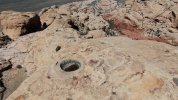
This is a snapshot from video taken with my DJI FPV drone flying over the Calico Tanks above Red Rock Canyon near Las Vegas. I've been flying over this area a lot taking in the natural beauty of the area but keep wonderig what made these water tanks perfectly circular? There are dozens of these on top of the sandstone rocks. The ones in this picture are around 3'-8' in diameter. They look like small Meteor craters that appear on the moon but obviously are not. They also appear to resemble Native American Mortars used to grind food but are far too large for that. I did an internet search to find an answer but nothing turned up. I am curious what natural process would cause such perfectly circular holes in rock? I am guessing freeze/thaw causing some erosion to begin and/or acidic rain continuing the process of enlargement and perhaps wind causing some swirling action after water has been deposited after rains? Big Horn sheep and deer often drink from these water holes but that should have no effect on their round shape. Anyway, maybe there is a geologist out there who can explain the process. Thanks in advance.Water Tanks 1.jpg
 
Last edited:
I guess it's similar to rockpools. You start with a crack or slight depression in the rock within which bits of stone and other debris get swirled around by the wind/tide and gradually erode the rock. Over time, that will remove any sharp corners and edges where higher friction will occur, and smoothes things out. The optimal shape for that is a circle - e.g. no sharp corners or edges with a completely even gradient all the way around the perimeter.

You can kind of simulate this in a graphics package if you create a complex shape then repeatedly add an outer border with some small distance to it; the sharp corners will get rounded out almost immediately, then progressively larger concave depressions will fill in. With enough iterations you'll always end up with a perfect circle or ellipse.
 
Thanks folks, that makes sense and I leanred something new! The Wikipedia definition talks of stream flow causing the eddy currents but these are mostly on top of the rock summits and not in stream beds. But each rainfall would no doubt wash into each pothole not evenly but on one side or the other, creating a slight whirlpool effect. Flew over it again this morning for a closer view and some of them are much deeper than I had assumed. The drone disconnected directly over it but fortunately RTH kicked in and saved it! calico pothole.jpg
 
Remember, what's now at the top was once surrounded by terrain that's been eroded away.

Where I live the dominant kind of terrain is called "upland terrace gravel" (I think) or "inverted terrain". Ridges are often topped with river pebbles — rounded stones of sizes varying from potato to minuscule — deposited when those ridges were creek bottoms. Over the years, the soil around eroded away while places protected by pebbles were more resistant to erosion and remained higher. Now the elevation contours are roughly opposite of what they were however many thousands of years ago. This might be what happened there, but more likely it's just luck that left that patch of rock un-eroded.

We don't have potholes in that terrain, but a short hike down to the James River and you'll see potholes in the Petersburg granite that makes up the Fall Line — where the James and other east-flowing rivers leave the hard-stone Piedmont geologic province and flow onto the more easily eroded quaternary sediments of the Tidewater province, forming waterfalls. Those potholes look just like your photo, though the ones nearest Pony Pasture Park are a bit smaller. Same mechanism at work.

[eta] I should add that much of the granite has been quarried to make buildings and curbstones found up and down the East Coast and elsewhere. There's still enough to find potholes and other interesting erosive features. I'll get some pictures next time I'm able to go flying / photographing.
 
Based on the bedding I see in the left distance, this sandstone was very likely part of a paleo-dune field that has been lithified (cemented). The potholes probably result from differential sand grain cementation around a foreign object.......examples would include burrows, pieces of wood, a pebble, or anything that is out of the ordinary in the dune. The precipitation of inter-grain cements can either result in more intense cementation, or just the opposite. It largely depends on the groundwater chemistry (silica-rich, carbonate rich etc.) which flowed through the dunes as they were slowly turning to resistant sandstone.
 
These are very educative pictures indeed. The most interesting is that the pot holes at the top of this sandstone formation were formed by a huge river flowing many thousand years ago when the hard top of this sandstone was the bottom of that river. We are looking here at an inverted topography. The rest of the more tender geological material has been eroded away leaving nowadays a harder sandstone spot with the print of an ancient river. It is mind blowing.

Formation of a pot (English translation from a French Wikipedia description).

Pots usually form in shields composed of ancient rocks with various erosion resistances. Streams drag the hardest pebbles into vortices, which widens and digs the cavities. These pebbles must be at least as hard as the bottom of the torrent. The rotational movement hollows, from an initial relief irregularity, a gradual erosion of the pot-shaped rock.

Collection of pebbles from pots.

In some pots, pebbles can stay a long time and take ovoid shapes, with a circular section, and sometimes form almost perfect spheres. These pebbles are expelled during exceptional floods and are found downstream in the river bed, easily recognizable among the other pebbles thanks to their regular shapes and polish.

When the stream is very inclined, these pots can be spread along a waterfall, forming sometimes aesthetic basins, overflowing into each other. With the progression of erosion, some pots can finally pierce and empty partially or completely depending on the size of the opening and the flow of water.

A large pot with a concave wall and partially filled with water can be a deadly trap for river or canyon descent enthusiasts.

Giant pots can also be formed by a glacier.

As a geographer flying an old Mavic Air, I really enjoy these photos.
 
I'd like to see a geological map that shows that the beds have been overturned. Betcha can't find one.
 
Thanks everyone. Here is what the Geologist say about this area. I have found several sea shell fossils in these hills, so definetely under water in the past. ......

Geology of Red Rock Canyon
page1image2499743152
Red Rock Canyon NCA is home to a rich and complex geological history.
600 million years ago, the land that is now Red Rock Canyon NCA was at the bottom of a deep ocean and the coast was in present day western Utah. A rich variety of marine life flourished in those waters and left behind deposits of shells and skeletons more than 9,000 feet thick. These were eventually compressed into limestone and similar carbonate rocks.
Starting approximately 225 million years ago, crustal movements caused the sea bed to slowly rise. Streams entering the shallower waters deposited mud and sand which later consolidated into shale and marine sandstone. Changing land and sea levels also trapped large bodies of water. These later evaporated, leaving behind layers of salt and gypsum in some areas.
About 180 million years ago the area was completely arid, much as the Sahara Desert is today. A giant dune field stretched from Red Rock Canyon NCA eastward into Colorado, and windblown sand piled more than a half mile deep in some locations. As the wind shifted the sands back and forth, old dunes were leveled and new ones built up, leaving a record of curving, angled lines in the sand known as crossbeds. These shifting sands were buried by other sediments and eventually cemented into sandstone by iron oxide with some calcium carbonate. This formation, known locally as the Aztec Sandstone, is quite hard and forms the prominent cliffs of the Red Rock escarpment. Exposure to the atmosphere led to the iron minerals in some areas to oxidize, giving the rocks their red and orange colors.
The most significant geological feature of Red Rock Canyon NCA is the Keystone Thrust Fault. The Keystone Thrust is part of a large system of thrust faults that extends north into Canada and began to develop approximately 65 million years ago. A thrust fault is a fracture in the earth’s crust that is the product of compressional forces that drive one crustal plate over the top of another. This results in the oldest rocks on the bottom of the upper plate resting directly above the youngest rocks of the lower plate. At Red Rock Canyon NCA, the gray carbonate rocks of the ancient ocean have been thrust over the tan and red sandstone in one of the most dramatic and easily identified thrust faults found. The Keystone Thrust Fault extends from the Cottonwood Fault north, along State Route 160, for 13 miles along the crest of the Red Rock escarpment. It then curves east along the base of La Madre Mountain before it is obscured by very complex faulting north of the Calico Hills.
 
  • Like
Reactions: BethanyFerrell
I'd like to see a geological map that shows that the beds have been overturned. Betcha can't find one.
If that's in reference to "inverted topography", that's not what the term means. See my earlier post for an explanation of the process, which involves preferential erosion of material not protected by stream-bed stones. No uplift/folding/overturning is involved, just rain and a whole lot of time.

In other words, the materials involved aren't inverted physically, it's the contour itself that becomes "inverted" in a different way.
 
I have a masters degree in geology, with an emphasis in fluvial sedimentology and fluvial geomorphology, along with non-marine processes. Your theory of pots at the base of a river is incorrect. The holes are the result of differential cementation around a foreign object........in this case, the cementation is less complete than in the surrounding host rock.
Again, these are paleo-dunes, and there is no evidence of fluvial erosion into the dunes at this location.
 
@RockyMtns: I'll take your word for it on that location, which I'm not familiar with. Where I live the surface is granite rather than sandstone, and the potholes are definitely erosion features. The inverted topo is well established too; my information comes from official Virginia geological surveys.
 
Great subject for an aerial view.
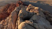
Here is a video from a few weeks ago that shows the whole area in better detail. The first mountain at 1:00 in this video is Kraft Mountain which I think is part of the Keystone Thrust Fault. I have hiked this entire area many times and have also found basalt rocks so there may have been some volcanic activity here as well, but maybe it predated the uplift. The whole area is a favorite place for rock climbers.

 
  • Like
Reactions: BethanyFerrell
@RockyMtns, would you say that @zocalo's graphics-software metaphor/simile is apropos? That is, as the hole is enlarged, it naturally becomes more rounded?

As a thought experiment I'm picturing a more linear feature (though it wouldn't have to begin that way) that wears preferentially on the sides while the ends take less abuse, gradually losing its original form and appearing more and more nearly circular.

Side note — yesterday I went down to Pony Pasture Park but the good potholes were way under water. Not quite flooding but pretty close. One of these I've been measuring since I was about eight years old. It's about 40mm wider now than it was back in the slightly post-medieval times when I was young. Pretty good for hard granite, but of course the exposed surfaces have degraded; some pieces up on land are literally crumbly after so many millennia of weathering.

A good deal of rubble on the river bank has perfectly round holes, all the same size. The mechanism is quite clear: drilling by quarrymen. (Generally prisoners in the late 1800s, possibly slaves before then. Ugh. Virginia has lots of history, some good and some very, very bad.) I and many other river types enjoy climbing on the rocks In Spite Of All the Danger. Speaking of Quarrymen.
 
Lycus Tech Mavic Air 3 Case

DJI Drone Deals

New Threads

Forum statistics

Threads
131,096
Messages
1,559,801
Members
160,079
Latest member
calezu