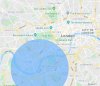
DJI Mavic, Air and Mini Drones
Friendly, Helpful & Knowledgeable Community
Join Us Now

Which one is the correct NFZ map of these two about UK?

This website/map is the definitive NATS map covering UK Flight Restriction Zones

If you need to see more info about 'temporary' restrictions, then it's best to use the NATS Drone Assist app off the Google or Apple sites for your mobile device.
 
For crying out loud, what's the use of a map like the one on dronesafe.uk/restrictions/ if it doesn't show the actual situation. How about parks, then? No buildings there. Surely some people, but away from them?
 
For crying out loud, what's the use of a map like the one on dronesafe.uk/restrictions/ if it doesn't show the actual situation. How about parks, then? No buildings there. Surely some people, but away from them?

Its best to treat central London as a no fly zone.

Edit to add; the drone safe restriction shows air space restrictions. It’s up to the pilot to then ensure they follow the drone code. Don’t forget, you’ll also need to pass the test and register with the CAA.
 
Last edited:
Take no notice of "no-fly-drones" whatsoever as a guide of where to fly.
Its a private website where *anyone* can request their particular area/garden/house/castle/rock listed as a "no fly zone" despite having absolutely no legal validity at all.

Add a Zone to NoFlyDrones
Tired of drones flying over your land, business or home? Our site, which is viewed over 10,000 times a month by prospective drone operators, could help alleviate nuisance drones flying in your area. By adding your own personal "no fly zone" to our map you ensure drone operators using our site think twice before operating.


WHAT WILL MY ZONE LOOK LIKE?
It will look just like the existing zones such as those for airports and airspace.
WHAT WILL HAPPEN WHEN DRONE OPERATORS CLICK ON MY ZONE?
We ask that you provide a name for the "no fly zone" and email address as a minimum. Optionally you can also provide a telephone number. This will display when the zone is clicked and by providing contact details drone operators looking for permission can contact you and arrange a safe and convenient time for flight.


Just ignore the site completely. In fact, if anyone is bored enough feel free to script and spam their site with NFZs covering every square inch of the British Isles just to prove a point...

The *ONLY* authoritative source of airspace restrictions is NATs which is available to drone users via the Drone Assist app.
Be aware this only shows airspace restrictions NOT ground based launch/recovery. And you still need to abide by the drone rules regarding distances etc.

The altitude angel link above *should* be ok - its the same backend data that NATs drone assist user.
 
Last edited:
  • Like
Reactions: Pky
For crying out loud, what's the use of a map like the one on dronesafe.uk/restrictions/ if it doesn't show the actual situation. How about parks, then? No buildings there. Surely some people, but away from them?
Because they, rightly, assume that if you are in the UK you already know how to apply the UK drone legislation of 150m away from buildings and flying over built up areas. That's a given.. The NATS app is designed to tell you about other restrctions within countryside areas which might not be obvious (small airfields etc). Also gives you 'yellow' caution areas where you might want to use some common sense and not piss people off (schools etc).

I live in a rural area on the edge of a small rural town. It's a given for me I shouldn't fly it over the town, but the countryside to the west is fairly clear. NATS app does however show me that not too far away is a microlight club and puts a buffer around it.

EDIT -oh, and regarding the parks comment - that's covered by UK drone regs insofar as you shouldn't be flying closer than 50m to anyone else.
 
Lycus Tech Mavic Air 3 Case

DJI Drone Deals

New Threads

Forum statistics

Threads
130,927
Messages
1,557,941
Members
159,929
Latest member
redcircle