

mobilehomer
Well-Known Member
No, height is from take-off point. The barometer is zeroed at that point.Flying height is measured from the controller.

No, height is from take-off point. The barometer is zeroed at that point.Flying height is measured from the controller.
Would you give me an example of resetting the RTH point pleaseRTH height is relative to the take off point.
So, if you set an RTH height of 70 ft, launched and then descended to -300ft, all WITHOUT LANDING etc. and without any 'canyon problems', and then trigger an RTH, the climb will be 370ft........ to +70ft relative to the launch point.
BUT if you landed at -300ft then the subsequent RTH height would be at 70ft above the NEW launch point i.e. 230ft below the original launch point and it would RTH to the NEW launch point, NOT the original launch point.
However you can reset both the home point and the RTH height at any time with one exception, you can not reset RTH height if the drone is EXECUTING an RTH, been there and done that.
You can however reset the homepoint whilst a drone is executing an RTH and some people have proposed that and possibly used that, as a way of creating a way point flight .
That's cool. But appeared as if the drone was following him all along.Around 1:26 in
I don't think I can run that fast for one.Ya, I'm just not in the habit of walking around when I fly tho. LOL
around 3:20 inThat's cool. But appeared as if the drone was following him all along.
I think what you are referring to was someone that lost GPS in the canyon because it couldn't pick up enough satellites to get a fix which enacted the 90 foot height limit for non-GPS flight. That limited its ability to climb out of the canyon.No, the height will simply show negative, you would have to land to reset the height (I can't remember if it zeros on motor stop or take off but it will be reset by a landing and motor stop and subsequent take off. It's one of the theoretical ways of climbing a tall mountain. And then, as pointed out, you could be in difficulties.
My lowest is -300+ft off the top of a sea cliff and from memory others have gone far lower than that.
You also need to be aware that there can be other problems associated with going way down low, into, say, a canyon.
I can't remember the reasons behind it but something about loss of GPS rings a bell but I could be wrong. At least one member here or on the DJI forum been unable to get their drone to climb out of the canyon where they were and where they had descended, even though the drone never landed.
They ended up having to fly along the canyon to reach a low point of the rim and just clear that rim to land at the roadside.
Thank you. I like this video much better. Very succinct.around 3:20 inIt seems tshows resetting the home point to
a) the drone' position
b) the controllers position
c) somewhere on the map
agreed it did look better.Thank you. I like this video much better. Very succinct.
Ponz
You may well be correct, thanks for the assist.I think what you are referring to was someone that lost GPS in the canyon because it couldn't pick up enough satellites to get a fix which enacted the 90 foot height limit for non-GPS flight. That limited its ability to climb out of the canyon.
Surely flying height is measured from the zero barometer reading of the drone at startup and is unconnected to the controller's elevation.Flying height is measured from the controller.
That was interesting, I thought it was set to zero at takeoff but I have just started the motors at one height and then lowered it 1m and launched from 'down there', the zero point remained 'up high'.Surely flying height is measured from the zero barometer reading of the drone at startup and is unconnected to the controller's elevation.
That might be where my confusion stems from too. I rarely pay attention to what one hand does in relation to the other. HAHAHAThat was interesting, I thought it was set to zero at takeoff but I have just started the motors at one height and then lowered it 1m and launched from 'down there', the zero point remained 'up high'.
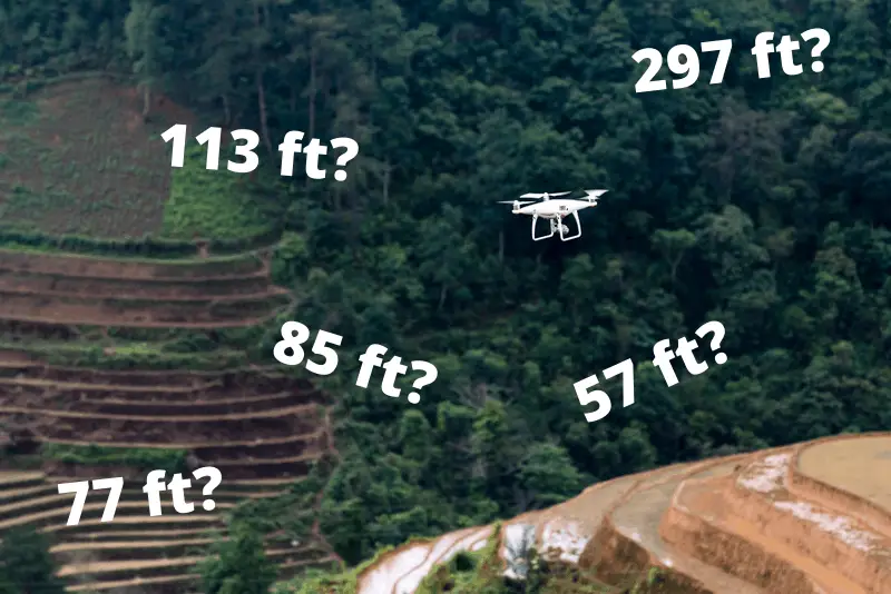
The indicated height ( determined by barometer ) is relative to the launch point, and ONLY the launch point.
So flying at an indicated height of 10ft will produce a horizontal flight and when over the ground beyond you cliff it will STILL indicate a height of 10ft.
When it is above the range of the downward looking sensors ( VPS and or IR sensors on the bottom of the drone ), the mini 2 has no way of knowing its height above the ground ( AGL ).
Even when the ground is within range of those sensors there is NO display of AGL and all you see is the height as determined by the barometer.
The legal height limit is a different matter entirely, if your legal height limit is 400ft then imagine a 400ft long piece of weighted string tied to the bottom of the drone. That string MUST theoretically ALWAYS be in contact with the ground beneath the drine.
I think that under that description the string would simply HAVE to be able to touch the ground somewhere. I am pretty certain that at some point I saw a CAA '400ft layer diagram' that had a 'leaning' 400ft arrow that was perpendicular to the slope of the depicted hill.I’m wondering if the string analogy will tie in with the new CAA CAP 722 guidance for us in the UK anymore though. I think we can now take off on top off the vertical side of a mountain and fly out over it as long as the drone is within 400 feet of the closest point of the surface. If I’m interpreting this correctly anyway (from P26 CAP 722 published 22/12/22)
“Open Category operations are limited to a maximum distance of 400 feet (120 metres) from the closest point of the surface of the earth.
Note:
This is not a ‘vertical height’, but a distance between the UA and the closest point on the surface of the earth. See figure 1 below.”
I think this creates a sphere of 400 feet around the drone and provided this sphere is in contact with the closest point of earth it’s legal to fly there, assuming still within VLOS.
So we could take off from the edge of a 1000 feet vertical cliff, climb 100 feet, fly out 100 feet so now 1100 feet AGL but still well within that 400 feet sphere that the drone is closest to the surface of the earth.
If this is the case then I think its is a pretty decent amendment. Particularly handy for getting shots looking back at yourself on top of the newly bagged Munro for example.
Or is there something really obvious preventing this that I’m totally missing?
Ok, I've been having a problem with this too ... I always assumed the the drones used the triangulated gps signal to calculate height above sealevel, then reset that height to zero at the home point and caluclated flight heights from that. . You are saying that it actually users a barometer to calcualte height? this does not seem to be a very accurate way to calculate height, as air density can vary considerably over short distances, especially if there are some large rain clouds around ...No, height is from take-off point. The barometer is zeroed at that point.
Ok, I've been having a problem with this too ... I always assumed the the drones used the triangulated gps signal to calculate height above sealevel, then reset that height to zero at the home point and caluclated flight heights from that. . You are saying that it actually users a barometer to calcualte height? this does not seem to be a very accurate way to calculate height, as air density can vary considerably over short distances, especially if there are some large rain clouds around ...
 dronejay.com
Most DJI drones measure altitude using a barometric sensor with an AGL (Above Ground Level) reference.
...
While being perfect at determining the horizontal coordinates of a point, the GPS has a pretty bad reputation for measuring altitudes.
The matter is complex, but to put in simple terms, the GPS measures the elevation of a point from the earth’s center based on something’s called an “ellipsoid” model; a mathematical model that represents the earth as an elongated sphere with the North and South poles at the top and bottom points of it.
You can see where the problem is now. Don’t you? The earth’s surface isn’t regular; it has mountains, forests, craters, and oceans. In turn, this requires converting your ellipsoidal data into a practical elevation reference.
...
This translates into that: your Mavic will start with a zero measured height, no matter where you and it are positioned, and it’ll start measuring altitude from there. The direction will be indicated by a plus or a minus sign. Plus is going up, minus is down.


