DJI Mavic, Air and Mini Drones
Friendly, Helpful & Knowledgeable Community
Join Us Now

"DJI Viewer" - new software for DJI drone video playback

Status
Not open for further replies.
Ran Drone Viewer with Spark and Mavic Pro and found it useful. But, just purchased a Mavic 2 Pro, and ran H294 and H295 codecs. The H295 did not work at all. I recorded SRT files with the H294 codecs and 4K video. The video worked fine, but no data was extracted from the SRT files. Just thought you would like to know
 
  • Like
Reactions: drakkor
Yes, it seems DJI took a step backward in their Mavic 2 Pro's SRT file format. The MP2 doesn't record flight trajectory information in the SRT file anymore so it can't be used in DroneViewer.
 
  • Like
Reactions: DanMan32
I think that stinks. How can I correlate where I've been and how high? The other stuff included in the SRT can probably be extracted from the video metadata.
 
If they don't record flight trajectory information in the SRT file then what do they record there and should I still have it turned on?

Couldn't contact you on the DroneViewer web site. Are you still maintaining DroneViewer?
 
Yep, still maintaining DroneViewer. My info is in the Contact page.

There are other ways to extract the trajectory info from a MP2 flight, it's just not nearly as convenient as the SRT method. It's no surprise that if you make something difficult less and less people will actually go through he hoops to use it. Too bad DJI lobotomized SRT on the MP2.
 
I looked at a video I took a couple days after I received my M2. I was curious how high I was. In past times I could look at the SRT. Now I have to find the correlating flight log and play it back.
 
Guys, I just released DroneViewer 1.1.0. Versions 1.0.1, 1.0.2 and 1.1.0 have the following new additions and improvements:

New Features:

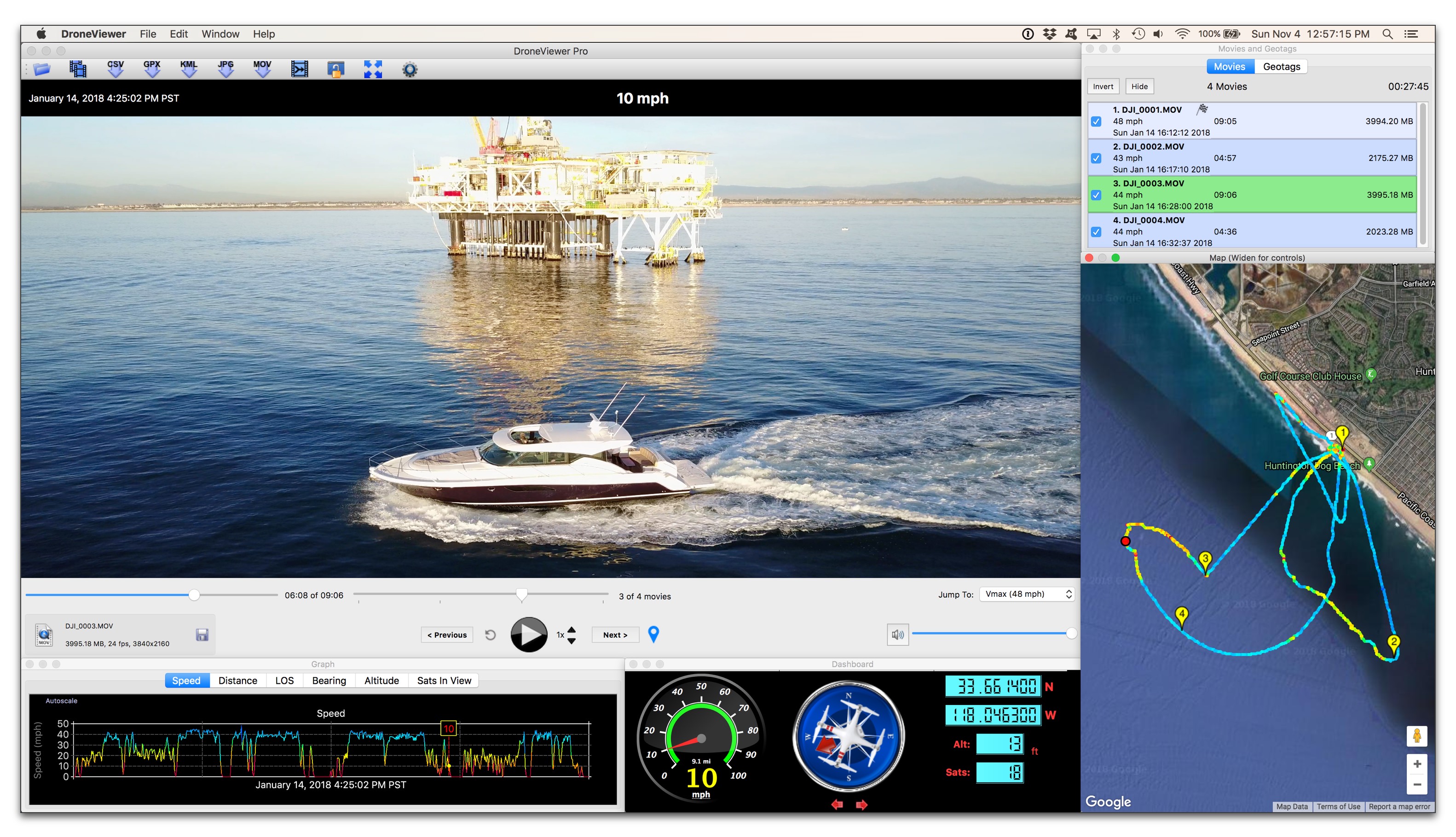
• New user-configurable speedometer!
• Now compatible with GPS-enabled GoPro HERO5 and HERO6 cameras!
• Added new Line-Of-Sight (LOS) graph. This graph shows the distance of the drone from the start point.
• LOS is now exported in the CSV file.
• Added new speed unit: meters/sec. You can switch units via the Preferences or by clicking the units tag in the speedometer.
• Improvements in auto-scaling of graphs
• Improvements to graphs when changing speed units
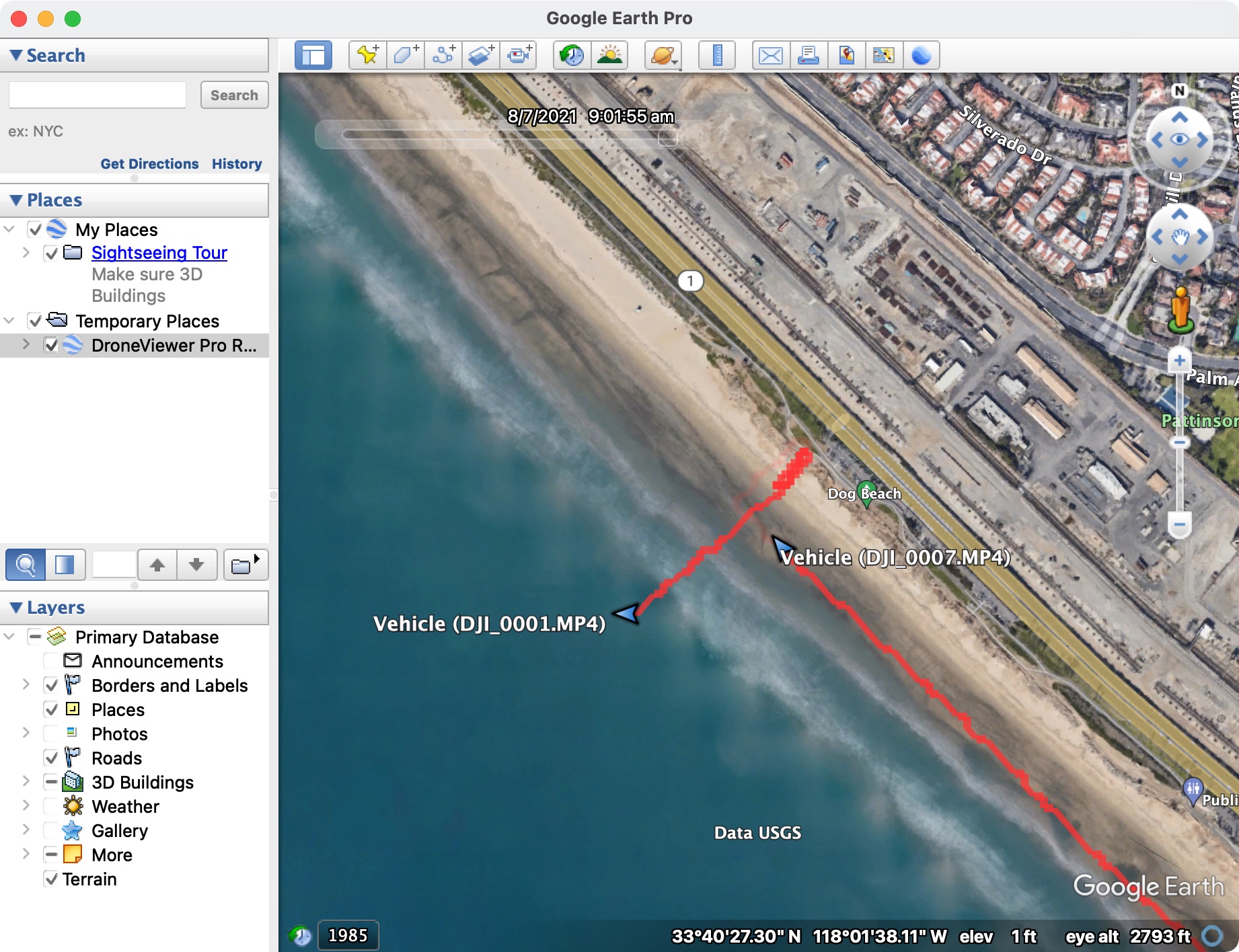
• Added compatibility with Phantom 4 Pro v2, which embeds its GPS data inside the movie file itself. Note that Video Caption must be enabled in the Go App for this to occur. Earlier Phantom 4 Pro drones (and possibly Inspire2 drones), which also store their SRT data in the movies, may work as well although I haven't tested them.
• Updated Users Manual

Bug Fixes:

• Fixed bug in distance readout
• Fixed artifact on main window after startup
• Fixed bug in that would prevent default settings file from being deleted
• Fixed bug in which geotags could have incorrect timestamps
• Fixed bug related to preserving windows sizes between runs
• Fixed bug in which altitude values in GPX files could be ignored
• Fixed bug in which consecutive movies recorded at significantly different times would not update the cursor correctly.
• Fixed bug in which SRT data points stored at greater than 1 Hz were not loaded properly.

Website : https://mydroneviewer.com

drv_v1-1-0.jpg


Thanks,
-wanderer
 
It looks interesting, even if the screen is a bit busier than I like.

It sounds like it won't work with the Mini-2, yes?

Would it work with the DJI FPV?

Thx!

TCS
 
@Reflexeye Yes, you can use the Export to KML button to write a timed-trajectory of your flights to Google Earth! Here's an example from my Mini-2 flights, @Chaosrider :)

BTW, this thread has been superseded by the newer thre ad here.

Thanks
-wanderer

dji_mini2_googleEarth.jpg
Well if it has just continue there. 👍
Continued In the link above.
CLOSED.​
 
Status
Not open for further replies.
Lycus Tech Mavic Air 3 Case

DJI Drone Deals

New Threads

Forum statistics

Threads
131,196
Messages
1,560,795
Members
160,162
Latest member
Keith J