DJI Mavic, Air and Mini Drones
Friendly, Helpful & Knowledgeable Community
Join Us Now

Which map to use for determining NFZ?

camhabib

Member
Joined
Jun 3, 2017
Messages
17
Reactions
2
Age
35
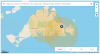
Trying to stay in the confines of the law as much as possible, I'm checking the status of various locations I've been planning on flying before I get there. I've been using a few different sites to do so, and each one has been giving me different information, some varying drastically with one another. For example, the DJI map gives a small area on Martha's Vineyard in MA as a restricted area, but Knowbeforeyoufly lists the entire island as prohibited. Which map should I go by, and why the difference?
 
I'm in the uk and have the same issue,different apps with conflicting information.I use drone assist occasionally (but I think it's only for uk airspace) and UAV forecast.The UAV forecast shows DJI no fly zones so it's a good one.There are plenty of settings to suit your preference and it will inform you if it's good or bad to fly due to certain conditions.

UAV Forecast on the App Store
 
Last edited:
  • Like
Reactions: gavcuk
When in doubt I like to check the FAA Sectional Chart for the area. Having said that, I looked on the knowbeforeyoufly.org website map and I don't see the large restricted area that is mentioned, and it looks to me like both that map and the DJI map are mostly consistent with the FAA sectional.
 
When in doubt I like to check the FAA Sectional Chart for the area. Having said that, I looked on the knowbeforeyoufly.org website map and I don't see the large restricted area that is mentioned, and it looks to me like both that map and the DJI map are mostly consistent with the FAA sectional.

Except where I live :(. The sectional shows the airport that is a mile away as "Closed", and in other FAA info "Permanently Closed".

But of course not DJI...
 
When in doubt I like to check the FAA Sectional Chart for the area. Having said that, I looked on the knowbeforeyoufly.org website map and I don't see the large restricted area that is mentioned, and it looks to me like both that map and the DJI map are mostly consistent with the FAA sectional.
Screen grabs of the two different maps
 

Attachments

  • Screen Shot 2017-06-10 at 10.47.27 AM.png
    Screen Shot 2017-06-10 at 10.47.27 AM.png
    234.2 KB · Views: 20
  • Screen Shot 2017-06-10 at 10.49.06 AM.png
    Screen Shot 2017-06-10 at 10.49.06 AM.png
    583.4 KB · Views: 20
Except where I live :(. The sectional shows the airport that is a mile away as "Closed", and in other FAA info "Permanently Closed".

But of course not DJI...
Sorry to hear that - so does DJI have you in a red zone?
 
Download SkyDemon from the App Store, there is a lite version and a paid version, This gives you access to all the proper charts that show the airspace for any country that submits the charts to them, which is most. You then have acces to all the data that determins operating altitudes of the various airspaces that aircraft are operating in. It doesn't have drone specific restrictions, such as stadiums etc. It does give you access to the proper airspace maps, which is as a pilot the most important stuff!
 
Lycus Tech Mavic Air 3 Case

DJI Drone Deals

New Threads

Forum statistics

Threads
131,407
Messages
1,562,830
Members
160,328
Latest member
volpe