F
FormerMember06292019_2
Guest
I live in flat-land USA these days so I haven't a convenient way to test this.
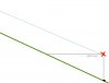
Given I am on top of a hill at least 400' above the surrounding terrain and I lift off straight up... my Mavic 2 will top out just under 400' AGL from my launch point. I then move the drone in any direction. And my AGL will increase in direct relation to the decreasing elevation of the hill.
Does the software/internal GPS firmware take this slope into account and cause the drone to descend or otherwise alert the user the drone is above 400' AGL?

") Oh, and a current check for TFR's in the area. Whats the wind like at those upper elevations? Are there Kabatic winds in effect?
Oh, and a current check for TFR's in the area. Whats the wind like at those upper elevations? Are there Kabatic winds in effect?